Kipu Kai, Finally

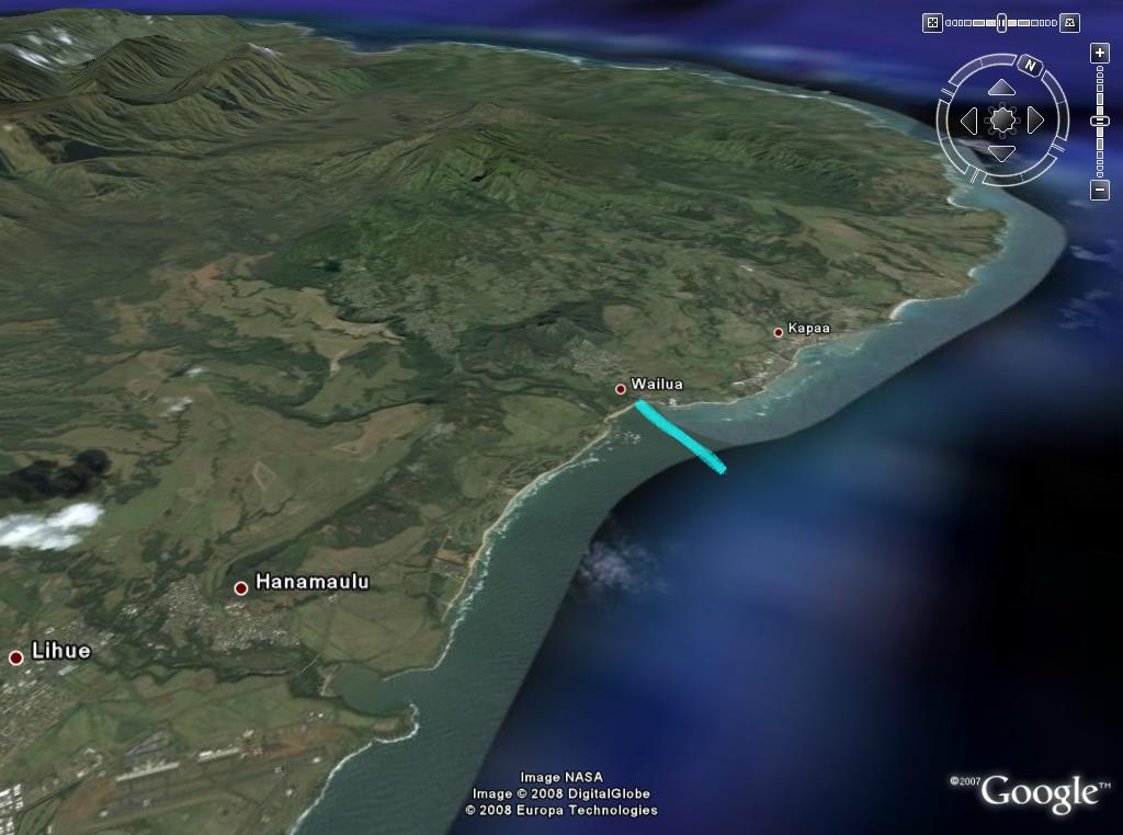
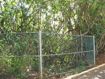
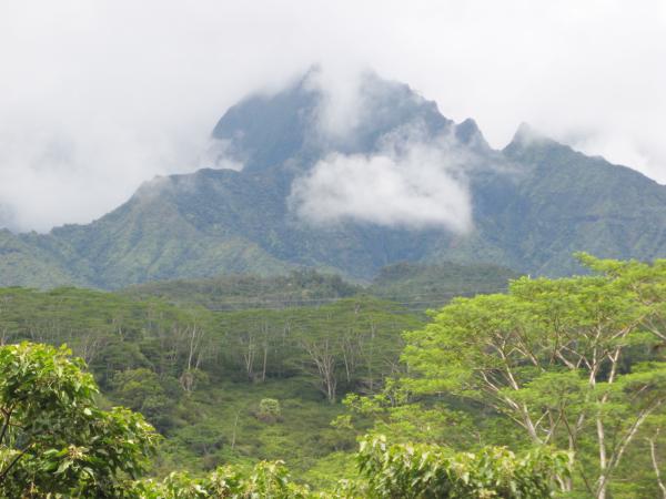
Kipu Kai is a large cove on the south-east coast of Kauai, between Lihue and Poipu. It has about 2 miles of shoreline, more than half of it sandy beach. This area is nearly cut off from land access by two ridges that go down to the ocean at right angles from Mount Haupu. The wedge of land in between the ridges, as well as the only access road over them is private and closely guarded, but the beach up to the high wash of storm waves is public by law.

The combination of remoteness, seclusion, and sandy beach makes it one of those mythic “forbidden” places, coveted by modern-day explorers. Needless to say, I’ve always wanted to go there.

KipuKaiFromAirplane1 Few helicopter tours fly over Kipu Kai, but you sometimes get a glimpse of this coastline from commercial airlines landing or taking off at Lihue airport. This image shows the series of cliffs that reach down to the ocean, making access along the shoreline impossible.
This photo shows how Mount Haupu towers 2300 feet (700m) over Kipu Kai, and how the ridges wall it off from the rest of the island. KipuKaiFromAirplane2

You can also see Kipu Kai from some of the boat tours, as well as one of the ATV rides, but all of them from a distance. Fishing boats must go by here all the time, but to stand on the beach, you have to either jump from a boat or paddle in on a kayak.

With the calm seas we’ve been having recently, fellow adventurers and neighbors Randy and Ronnie proposed we do just that. It was so calm that my wife and I brought along our 2-year old daughter. We had two choices for which route to take, either from Nawiliwili harbor area or from Kawailoa bay at the end of the dirt road in Mahaulepu. It’s about 2 miles of paddling from Mahaulepu and 4 from Nawiliwili, but coming from Kapaa, we figured we’d rather spend the time in the kayak rather than in the car.

That was actually a fortunate decision because we were experiencing Kona weather, with the wind and the swell from the south. That meant that we went against them when they were mild in the morning, and they pushed us along when they both picked up in the afternoon. Here’s the map of our route, which you can download if you have Google Earth.

KipuKaiMap (click for large map)

The easiest place to lauch a kayak at Nawiliwili is at the beach park on Niumalu road, behind the small boat harbor. We had a later start than planned, so to save a bit of time (about half a mile each way) we drove through the Marriott Resort, parked at the bottom and carried the boats onto Kalapaki beach. From there, we had a straight view of our intended route across of the shipping channel, behind the behind the breakwater, and beyond to the farthest point where we turn for Kipu Kai:

KipuKai1

KipuKai2 The ocean was perfect for kayaking and we were soon out of the harbor and going past the first point. High above us was Kalanipuu (780 ft, 240m), which has an aviation beacon because it’s so close to the airport.

From here on, all the ridges and coastline were unseen terrain to us.

Before making the turn around the next point, there is this cove and small valley. The valley is somewhat of an oddity because it is nestled into what looks like a single ridge from either side, splitting it in two. The cove only has a rocky beach, which would make it hard to land and explore the valley. KipuKai3

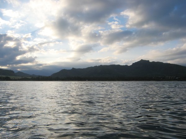
When we rounded the “furthest” point we could finally see towards Kipu Kai. The waves and wind picked up a bit, now that we were more exposed to the southerly pattern. The coastline here consists of steep ridges, with rocky cliffs that face the sea. After passing the point of the next cliff, we caught good views of the beach already, looking like they were just beyond the next point.

KipuKai4

But looks are deceiving from sea level, and we were barely more that half-way there. It took another hour of paddling into the wind and waves to finally reach the small bay at Kipu Kai itself. Mahaulepu is another 2 miles beyond the furthest point in the photo above.

KipuKai5 The swells going into the little bay were almost surfable size, which is way too big for a kayak. You can see on the map we got pushed in and had to turn around to avoid getting swept up. Waiting for a lull between sets of waves, we then paddled straight through to the lee of the rocks in this photo.
As we paddled in, we got a good view of Mt Haupu looming over the private residence. I was a bit disappointed to paddle so far and have such and “intrusion” on my adventure, but I told myself it meant this was the more sheltered and more scenic of the three main beaches. KipuKai6

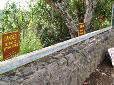
We land at last, after 2h15 of paddling it felt good to stretch our legs and rest our arms. We had a picnic lunch in the shade of the rocks of the picture above, since it’s forbidden to walk off the beach into the trees above. There is also a sign that says not to climb on the rocks—I don’t think steep rocky coasts have a public right-of-way like beaches. I have heard they keep a keen eye on visitors to make sure no one is tempted. We did see someone leave the house on an ATV, but I never saw whether they came to watch us or some other ranch business.

Speaking of ATVs, the private dirt road to Kipu Kai goes through the low notch in the ridge above the house. One of the ATV tours goes up to that col, but not down into Kipu Kai, click for the view from up there, and then tell me where you’d rather be.

KipuKai7

Then we went to expolre all the beaches we could walk to from here, which included the main beach above, and some smaller ones we saw on the way in. You can see where we went in the yellow path on the map above. The people on the beach above retreated to the house after we landed, so we had the place to ourselves. They must have been members or guests of the family who own the land, but I’m not sure if anyone lives in the house permanently or wether it’s just a weekend retreat.

At the end of the first beach is a wide expanse of extremely shallow reef. It is very flat and had less than an inch of water, none in places so we walked carefully on it. In little pools that were deeper, there were intact pink coral, sea cucumbers, and in one, juvenile pennant butterflyfish.

PinkCoral KipuKai8
LoloSeaCucumber
GreenSand GreenSandCloseup
RustedChain TangledNet

After the shallow reef, we climbed through some short rocky stretches to access the further beaches. Here were some nice stretches of sand without footprints, at least until we arrived. These beaches are at the foot of steep slopes reaching up to the high ridges. In places where runoff usually flows down from theses slopes, it has carried the green olivine crystals from the volcanic rock down to color the beach. The reef still continues here, so there is no swimming, just laying on the warm sand and staring up at the cliffs, in a way that reminded me more of Kalalau than any other place.

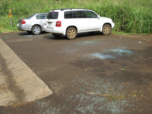
On the way back to the kayaks, we stayed in the rocky areas instead of the reef and found the two large pieces of maritime trash—yet both very artistic in their own way. My first impulse was to want to take them home, then I realized that I could never carry them on a kayak, and secondly it was their contrast with the relatively pristine surroundings that gave them their character.

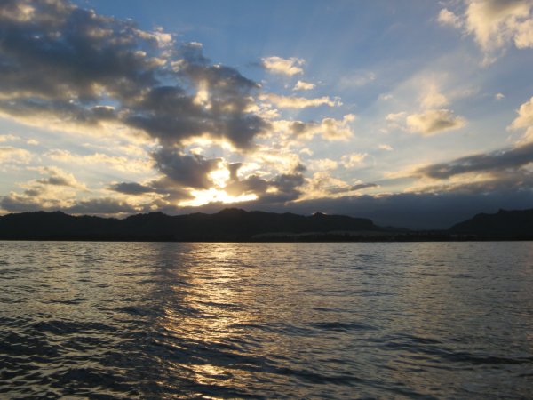
Back on the main beach, we could look back and see the other beaches we had walked to. We could also see that the waves were getting larger, so we had better not linger:

KipuKai9

With over 4 miles of paddling ahead of us, we never even considered going to the two other main beaches to the south. Those would have to wait for another flat ocean day, and probably be wiser to attempt from Mahaulepu. The swells were noticebly larger than in the morning, perhaps the largest I’ve done in our little kayak. We pitched and rolled a little, but no waves were breaking on us and we were never in any danger of tipping over.

On the first leg of the return, the waves were coming mostly from behind, but at angle. The caused the kayak to turn, and since have a rudderless kayak that the rear paddler steers by changing the stroke, I was working extra hard. Now I understand why ocean kayaks usually have little rudders that can adjust for this. Still, the wind was at our backs and really helping us along the whole way. Plus, once we turned past the big point to head for the harbor, the waves were straight behind us and we could surf a little down each wave. In the end, it only took us 1h30 to paddle back, 1/3 less time than going.

But just because I’ve gotten into the habit of finishing with the bad news, here are two views of the development going on at the Marriott Lagoons, between the port and the airport. You can see the little detour we made on the return paddle in green on the map above.

LagoonsWaterfall What a pretty little waterfall I had never seen before, splashing down under the palm trees onto the rocks. Then I realized there is no stream here, and it must either be golf-course runoff or overflow from the artificial lagoons. Our friends thought they might be working on the Lagoons and draining them.
Manmade, yet nowhere near as pretty nor as ephemeral, we could also see one of the developments under construction. This used to be practically a blighted area. In the excess of the 80’s, there had been an ocean-front luxury shopping center for the resort guests. Later it was boarded up and the parking lot overgrown with weeds, only the brewpub survived but they no longer brewed their own beer. LagoonsConstruction

So it was little surprise it was being redeveloped. And from one of their ads, it seemed they were offering low-rise condos, from an aestethic viewpoint better than 4-story boxes or spread-out luxury homes. But on the picture above, you can clearly see that they’ve created a huge artificial hill, to create more valuable real-estate overlooking the ocean. In my mind, that should not be permitted because it destroys the natural topography, crowds the shoreline, and runs the risk of eroding faster. I’ve never been to Ninini (running waters), the little beach you can see below the development, but I’d be willing to bet that many more buildings will now be visible from that beach. And now those visions of Kipu Kai seem even more precious.

Whales Offshore

We’ve had several periods of very calm seas recently, and some friends borrowed our kayak one weekend to go offshore at Kealia beach. They paddled out over two miles and had an incredible encounter with the whales. It is illegal to approach whales in any boat, and a friend on Maui was cited by a federal ranger for swimming out next to some whales. But if you paddle out and wait, they sometimes approach you.

Our friends saw them surface less than 100 feet (30 m) away, could hear them breathe, and even saw the eye of one that seemed to be looking at them. They also saw the whales wave their flippers and flukes (tails) out of the water, but not so close-up thankfully. Remember that a baby humpback whale is the size of a car, and an adult is the size of a school bus.

Hearing that, my wife and I wanted to go too. So late one afternoon, with ocean still increadibly flat, we put the kayak in the water at Wailua Beach, and then we paddled straight out to sea:


We got some nice views of the coast that we land-lubbers aren’t so used to seeing. Here is Nonou, the Sleeping Giant profile:


And then we saw the whales! First there were several blows, and then one of them was breaching several times in a row. They get far out of the water and come down with a huge splash—it looked like fun to me. I wonder if it was a male trying to impress a female or just someone with an itch. They were still a mile or more away, this is the best photograph I took of them:


Much as we wanted to go nearer, the sun was going down behind Kalepa Ridge, so we had to head back in:


According to the GPS, we were only 1.3 miles (2km) offshore, and whales probably don’t come that close. You can see in the map above that we never went beyond the imaginary line connecting the outermost points of the island.

Back on the beach, we met some other friends who had the same idea and had just landed their kayak as well. Except they had started earlier, went further out, and were approached by the whales, maybe the same ones we saw. They said they were close enough to hear their whalesong above the water.

For the rest of us unlucky whale watchers, we’ll have to be happy with the live broadcast of whalesongs from Maui by whalesong.net. You’ll need the RealPlayer plugin to hear it, but it’s worth installing if you don’t already have it.

Wailua Falls Fenced Off

Every now and then, I like to visit the tourist spots on Kauai, the places locals almost never go anymore. So back in January when I had an hour in Lihue between appointments, I drove to the famous Wailua Falls overlook. The falls were as pretty as ever, with plenty of runoff from the winter rains:

Not Yours!

I also discovered the secret to catching the rainbow in the spray below. You have to go when the sun is near the point directly behind your head as you look at the falls. In early January, this happens around noon. In late fall and early winter, the rainbow should still be visible in the morning, but during spring and summer, the sun is in the wrong place.
This time, I knew something was different even before I arrived because much of the road to the falls had been repaved. There is still a small section with potholes, and the rest is still narrow and curvy, but it makes the driving much easier. But I wasn’t aware that the State Parks department had entirely rebuilt the lookout area. The parking lot beyond and viewing area haven’t changed that much, but the addition of the rock wall and striping on the road give more security to pedestrians.

One thing that hasn’t changed is that to see the pool below the waterfall, as in the photo above, you need to stand on the wall. I suppose it’s easier to stand on the wall than the old fence, but it would be better if they trimmed the vegetation back instead.

Come to think of it, if the State went to all this trouble of fixing the lookout, they should’ve acquired another acre of land nearby and created a small loop with more parking and a physical barrier between the road and the walking area.

Another noticeable difference is the proliferation of warning signs. From the wording on them, they just left the old ones that mention the fence, and added new ones that mention the wall.

You can see in the photo above that there is a fence that begins just to the right of the wall. This fence existed before, and it blocks off an impossibly steep gully that you’d have to be crazy to think you can get down it to the base of the falls.

So far so good, there’s no harm in having more signs, and it may even do some good. But then I started exploring around, as I’m prone to do, and was quickly thwarted.

To the right of the chain link fence is one of the very steep trails down to the waterfall. This is not an official trail, but scores of people have made their way down using directions from the guidebooks. Now, there is a low, temporary-looking fence that runs along the whole area.

It doesn’t really keep people out, and indeed the fence is flattened in one spot giving easy access. But it really sends the message that the State Park administration doesn’t want people going to the pool at the base of the falls.

No problem, I think to myself, I prefer the other trail down anyways, it’s more scenic. A 1/4-mile back on the road is a large turnout, now nicely paved with a shiny new guardrail.

But the State Parks fenced this whole area off as well, and put up some new signs for good measure. Again, the barrier is more psychological then physical, but it does make the conscientious hiker pause and reconsider.

Just for fun, I went to see the top of the falls instead. I really must emphasize that standing at the top of waterfalls is dangerous, the top of the cliff can be slippery, and trying to cross the river there has deadly consequences if you fall in. But the hole in the old fence was still open, so I went to check it out.

This area is more secluded and less interesting than the pool, and there is no real trail. But sure enough, there was a new fence going all the way down to the river and more than enough signs for the State to cover its liability.

Update: A reader wrote to say that the little fences were not present last November when he hiked down to the falls from the turnout. He also makes it sound as if the wall was not built yet either, so all the work was probably done in December 2007.

Kuilau Ridge Trail Update

After yesterday’s blog update, today I have news that the Kuilau trail has been “updated.” In my first post about the trail, I focused on the nice views near the picnic shelter at the end. I walked the trail a week ago and some maintenance has made it even better.

The most evident work that has been done is a thinning of trees by the side of the trail, opening up many more views than existed before. This is in the first half of the trail that used to be very shaded, so now it is a little more exposed to the afternoon sun. As much as I’m opposed to “improving” natural areas for aesthetic reasons, I have have to admit I was enjoying the many sights. In the photo below, you can see the trunks and branches that have been trimmed, making a nice view of the green valley and Makaleha mountains beyond.


One advantage to having more light on the trail is that it should dry out quicker and be less muddy. When I looked at the trail again, I noticed that it was very flat and even all the way up. While this trail was never very rutted, it had some places where it wasn’t very flat. Now it’s been graded and some gravel added to make it almost passable by a wheelchair (I did say “almost”).


Similar to what was done on the Moalepe trail further along, I think all this work was done because it is a popular horseback ride from the stables nearby. And since I find it hard to believe that the State did all this maintenance on a trail, I would guess that the stable owners contributed to the effort.

We’ve been having Kona weather recently, where the tradewinds are replaced with Kona winds (from the south or west). This gives different views of the mountains on the east side because now the clouds are being blown over from the other side. I got another picture of Pohakupele, although you can’t really see the distinctive rounded summit in the clouds. This is the peak to the right of the Blue Hole over which it is said the ancient Hawaiians hiked up to Wai’ale’ale. The clouds reveal the deep notch in the north-eastern ridge, and so they probably followed the south-eastern ridge, with appears directly in front of the mountain in this picture:


Because the Kona winds create and push the clouds up from the south, it is clearer over the south shore. In this view looking south, the low point is the Knudsen gap, near the tunnel of trees, and the first major peak to the right is Kahili Mountain.


It’s not that great a picture, and I didn’t really manage to improve it with Photoshop, but I want to include it because it made me realize what is so incredible about the views from the Kuilau ridge: you can probably see 20% of the surface of Kauai from here, and except for the powerline and a few distant antennas, there are no man-made structures visible.

After the good news, the bad news: there was a lot of broken car window glass at the parking lot right at the trailhead. Upon seeing that, we parked 150 feet (50m) further in the larger parking before the river crossing. There is no glass there.


I don’t know if this glass is the result of theft, drug-induced rage or teenage pranks, because this is a popular hangout, and there are jest as many rental cars in each parking. Still, do not leave anything valuable in your car whenever you park at any trailhead or beach, and do not leave anything visible other than worthless items such as towels. You should also hide your guidebook under your seat if you don’t hike with it.

Update: Just to end on a happier note, local reader Erik Burton sent me these photos of hoi, a native wild yam, that can be found along the Kuilau Ridge trail. I’ve seen them before, but never took pictures of them. Hoi (pronounced ho-ee) was a famine food, gathered only when necessary, probably because it is also known as the bitter yam.

The tubers come in all sizes, from golf-ball to large potoato. I think they grow aerially and so you often see them having fallen off the vine and rolled onto the trail. Erik says the vine grows from a large tuber underground, but I’ve never dug one up.
The vine is easily recognizable, with simple dark green, heart-shaped leaves.

More Kalalau Trip Reports

I didn’t have much time to write today, so I did what every good blogger does: link to somebody else’s writing.

I updated my page of Kalalau trip reports with 3 new ones that are worth checking out. It’s like 3 blog posts for the price of none.