Kalalau Trip Report

Several months ago, my wife and daughter were staying with my in-laws, and I had the chance to do some backpacking. Because of my day job with computers, I only had one weekend to hike in and out of Kalalau by myself. So while I never recommend it, I hiked to Kalalau and back in what I call “2.2 days.” In fact, it was really only 48 hours, from Friday afternoon to Sunday afternoon. The only advantage to such a short trip is that I was able to go as light as possible. I managed to fit my bedroll, hammock, cold food, water filter, a change of clothes and other small essentials in a large day pack, so I was only carrying about 20 lbs (10 kg). See my other post about the food and equipment logistics for this trip.

Day 0.2

I didn’t even get an early start Friday afternoon, leaving Kapaa around 4 pm and reaching the trailhead at Kee Beach after 5 pm—at least I found parking.

It was no longer hot in the late afternoon, and I hiked the first two miles to Hanakapiai in exactly one hour. With the weather being so dry this spring, the trail was almost mud-free, which is actually a testament to how muddy this first section can be. The streams were all very low, too, making it easy and quick (and safe) to cross with shoes on dry rocks. I made it to Hanakapiai by sunset, learned to put up my hammock and got a nice photo of the hala (pandanus) silhouettes at sunset.
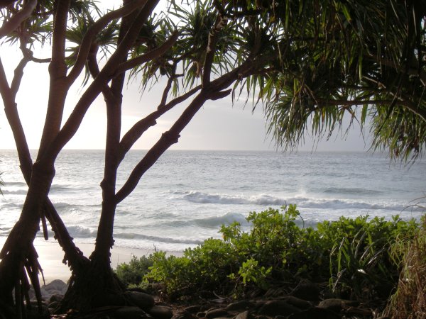
HalaTreeSilhouette
Hala tree at Hanakapiai

Day 1

I was up by 5 am the next morning before first light, due to jet-lag from a European trip—my schedule was working perfectly. I hit the trail by 5:30am and hiked several miles before the sun rose above the Pali. The trail climbs over 800 feet in 1.25 miles from the lowest point at Hanakapiai Beach to the highest point at the “Gate,” a distinctive rock overhanging the ocean below and welcoming you into the mystic valleys of the Na Pali coast. First is Ho’olulu, my favorite for the gentle downhill gradient through a hala forest and multiple sub-valleys, all wild and unexplored.
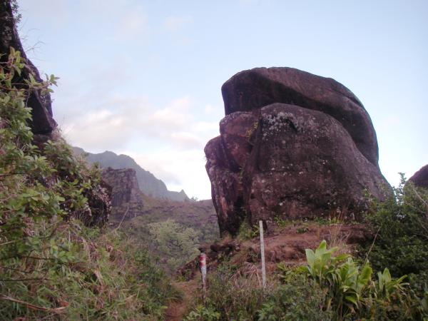
TheGate
The Gate or Space Rock

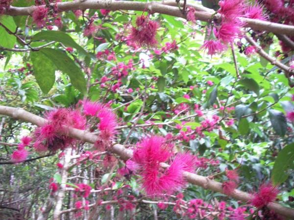
MountainAppleBlossoms
Mountain apple (syzygium malaccense) in bloom–poor photo quality due to low light

The next small valley is Waiahuakua, which has wild mountain apple trees that bloom in puffs of pink and lay a pink carpet on the trail. Sadly, I have never seen their fruit here so I don’t know if I missed the fruiting or if there’s a lack of polinators. With the dry weather, Waiahuakua has no drinkable water, but I didn’t need much in the cool morning, and the four miles to Hanakoa went quickly.

Looking at the times on my GPS track, I covered 4 miles (6 km) in 3 hours, including stops and side trails. It seemed like the miles went quickly, but that’s not very fast, so I must’ve been still asleep and just don’t remember the time going by.

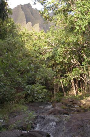
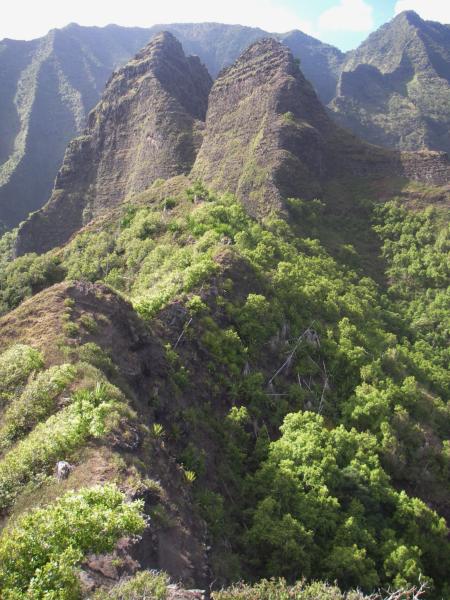
In Hanakoa, I took some time to explore the two terminal ridges that I mentioned in another post. I went as far as safely possible on these narrow ridges, getting nice views into the valley and down to the ocean from both. The first photo is from the north ridge, and you can see the taller Hanakoa falls to the left in the shade (not the short falls in the sun). The second photo is from the south ridge, looking up at two distinctive peaks where only goats dare to go.
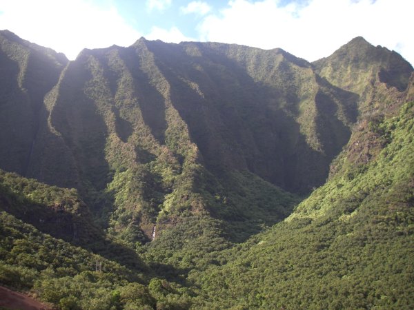
FromHanakoaNorthRidge
Looking into Hanakoa valley from the north ridge
FromHanakoaSouthRidge
Looking up the south ridge of Hanakoa valley

I spent another hour in Hanakoa resting, filtering water and taking pictures of the exposed sections of the trail that come next (I’ll post them in a separate article). Back on the trail again, I caught up with and passed some other hikers going into Kalalau who had slept in Hanakoa. They had big packs and looked like what I call “REI campers,” identifiable by the bright orange shovel (burying human waste is discouraged and composting toilets are provided). I think certain mainland styles are less adapted to the climate and terrain of the tropics–then again, they were probably carrying food for a week and I would be hiking back out tomorrow.

An important note: camping restrictions have since changed, and permits are now given for Hanakoa instead of Hanakapiai. See the update to my previous post on the subject.

The balcony trail just after Hanakoa is the lowest point on the trail between Hanakapiai and Kalalau, at about 100 feet (30 m) above the ocean. The trail then dips in and out of several small valleys and then climbs steadily to the second highest point of the trail at the top of “Red Hill,” the entrance to Kalalau valley at around 600 feet (200 m). On this part of the trail, everyone is dreaming of being at the beach already, but the little valleys with their babling brooks and the higher vertical valleys with their groves of kukui nut trees are pretty in their own right—remember to take note of them on the hike out.
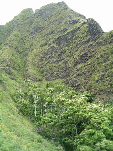
VerticalValley
Looking up at the back side of Puu Ki before reaching the top of Red Hill

I was motivated to get to the beach before it got too hot and covered the 4 miles to the Kalalau stream in 2:15 (1.75 mph or 2.8 km/h), stopping only once to filter water for my bottles. But I was starving by then and took the time to eat lunch in the cool shade by the stream, leaning back against the 10 mile-marker. I reached the beach and the end of the trail a half mile further, for an overall time of 7 hours (6am-1pm) to cover the 8.5 miles (13.5 km) plus side trails.

I was happy to have the whole afternoon in Kalalau, so I started with a dip in the ocean to cool off and relaxed a bit at the beach. But I wanted to go exploring up in the valley and ultimately find a campsite to sleep up there. First, I followed some of the side trails up into the valley and into one of the side gullies. When that trail grew too faint, I was at the foot of a small ridge and I scrambled up to get a view. It was steeper than it looked, and the thick grasses made it hard to pass, but I eventually reached the crest.

I’m being intentionally vague about access to this ridge, not because it is any sort of secret place, but because I can’t encourage anyone to go off-trail. I do not want to be responsible for getting anyone into a dangerous situation–please be careful and realize you are hiking at your own risk. If you do go exploring, please tread lightly, avoid destroying vegetation on slopes, avoid causing erosion and rock-falls, and never, ever free-climb on the crumbly rock.

I followed the ridge upward until it became very narrow. It seemed like there was a trail on this ridge, but the number of goat droppings tells me it was just a game trail. I climbed about 1000 feet (300 m) altogether, and it seemed like I must be deep in the heart of the valley. In truth, I was only on the 3rd ridge from Red Hill and the view into the valley wasn’t much different. Looking up, however, was a fairly impressive perspective on a point that I believe is called Puu Ki. I had to stop at the foot of the tower seen in the foreground of the photo on the left.
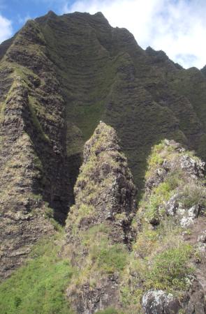
ClimbingRidge
Looking up at the other side of Puu Ki
KalalauStreamCascades
Same ridge seen from the Kalalau stream

Backtracking down the ridge, I found some other trails that led down to the Kalalau stream, at a point where I caught a glimpse of the ridge I had just climbed (photo on the right above). From there, you can follow stream up past some very pretty cascades and pools, keeping to the south bank and weaving in and out of a bamboo grove on that side. I followed the stream for about a quarter-mile (0.5 km) before turning around. I did see a campsite, but it was already claimed by someone more or less permanantly. I also saw some of the resident “hippies” (I don’t mean that negatively, it’s just the best term I’ve heard for the free-spirited and optionally-clothed people you meet in the valley), they were sitting by a pool talking and playing a flute. I took a dip in a delightfully refreshing swimming hole, quite possibly the one I’ve heard called “Ginger Pool:”
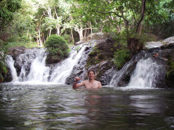
CoolingOffInGingerPool
Me cooling off in Ginger Pool

Climbing the steep bank above the stream, I found the ideal site to hang my hammock. Technically, camping in the valley is illegal, but being alone and practicing zero-impact camping, I felt I wasn’t violating the intent of the law. Again, I would be a hypocrite to condemn illegal camping, but if you follow my example, please leave absolutely no trace either: no campfire, no buried waste, and preferrably no tent on the vegetation–anyways it’s easier to hang a hammock between trees than to find a flat campsite. I have to say that falling asleep to the sound of the stream and the view of the stars over Kalalau was idyllic.

However, I had not counted on how cold it could be in the valley at night. I had a single fleece sleeping sack, which is usually sufficient on Kauai. I had forgotten that a hammock doesn’t block the wind like a tent, and the steady breeze down the valley kept me chilled. It’s possible that the cold air slides down from the Kokee forest, which lies above the valley rim at 4000′ (1200 m). Even though I estimate the temperature was in the low 60’s (15-17 C), I didn’t have any insulation in the hammock against the breeze. I put on my second shirt and huddled in my bag and managed to sleep, but I was still cold. Moral of the story: fleece sleeping sacks only work inside tents or out of the wind. Even on the beach, it’s best to have some sort of wind shell or bivy bag–though often a plastic tarp will do.

Day 2

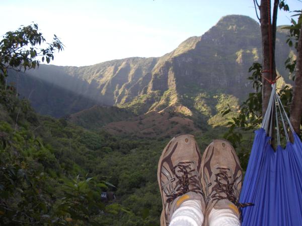
Because of the cold, I didn’t sleep well and stayed huddled in my hammock far past the sunrise. When I did peek out finally, the view made up for any discomfort:
DefinitionOfAGoodMorning
Can it get any better than this?

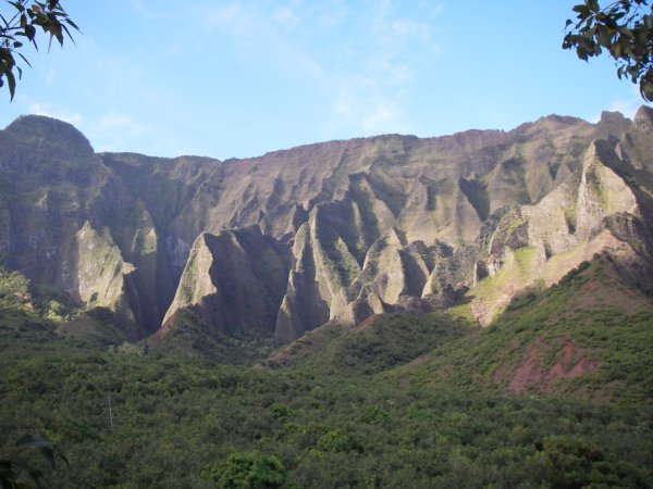
As you can see, I kept my shoes on at night in the hammock in case I fell out or needed to get out. I still need some practice to use the hammock gracefully. As the sun came up a bit more, it lit up the south wall of the valley, an area I sometimes call the “Cathedral” for its soaring pillars of rock that seem to curve in ribbons and mimic graceful arches:
RibbonsOfRock
The south wall of the lower valley lit by the early morning sun

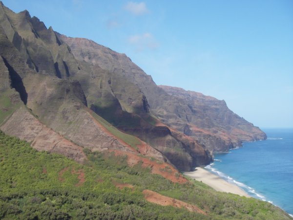
By the time I got up, had breakfast, took down my hammock, repacked my bag, and hiked back to the main trail, it was already 8:30am. If you’re easily tired by the heat like I am, this is really much too late to start the long hike back. The sun was already beating down on Red Hill, making the steep climb even hotter—and it was only 9 am. However, the views were spectacular, with the morning sun lighting up the Na Pali coast. Here’s my new desktop image:
LateStartButGreatView
View back towards Kalalau from Red Hill

Fortunately, the trail after Red Hill is mostly in the shade as you traverse some near-vertical walls and valleys (remember to look at the groves of oddly branching kukui trees). I had used up most of my water on Red Hill, so I was also thankful for the many streams that were not dry—they must be fed by springs in these short valleys (but I always filter and purify the water anyway). I was really feeling the effects of my jet-lag, and after the previous day’s hiking and exploring, every uphill was a struggle.

It took me two hours to hike the remaining 3 miles back to Hanakoa Valley, where I was happy that it was raining. It was too early for lunch, but I did stop to pick coffee in Hanakoa (more on that in another post). I usually like to stop for lunch at a view point overlooking the ocean, but I could find none in the shade after Hanakoa. I eventually found some shade under an overhanging cliff just around the corner into Ho’olulu Valley, but my leftover food wasn’t very appetizing. Then I made it back up to the Gate and the long downhill into Hanakapiai, averaging only about 1 mph (1.5 km/h) overall.

I always find the return to Hanakapiai to be really jarring, even after just 2 days. There are lots of people milling around, mostly day-hikers whose perspective of the trail is completely the opposite of mine at that point. Many think that they have hiked the Na Pali coast, all 2 miles of it, and no matter how out of shape they are, after 5 minutes of rest they look and feel better than those of us hiking back from Kalalau. If I had the energy, I would want to share with them how grandiose and beautiful that experience was, but from the way they seem annoyed at our slowness, our large packs, and likely our smell, I doubt these tourists would understand.

On that particular day, I was especially tired and dreading the last big hill. I sat down on a rock near the stream, and a woman practically scowled at me because I was in her picture. Mostly, I felt like I had absolutely no energy left. Even after resting and drinking, I didn’t feel like hiking anymore. Fortunately, I found a small bag of salted almonds at the bottom of my pack. I must’ve been low on sugar or maybe electrolytes (probably both), because those almonds practically revived me, or at least gave me a kick to get going up and over the hill. I finished around 4 pm, so about 7.5 hours to hike the full 10.5 miles (17 km) going out.

Unless it is pouring down rain, do not miss the swim at Ke’e Beach after hiking back. How good it feels just to float in the cool water after the long hike. Compared to Hanakapiai, the return to the crowds and traffic at Ke’e is more anonymous—everyone is enjoying the beach no matter how far they hiked or what they saw. After the swim, I rinsed off at the showers, and changed into my spare set of clothes from the car (I once forgot to leave a set of clean clothes in the car and regretted it).

Driving again felt strange, I always drive extra slow after a backpacking trip–it just feels unnatural to go fast. Fortunately, nobody can drive fast with the curves and one-lane bridges on historic route 560, and Hanalei is not far with plenty of good restaurants. Being alone this time, I just stopped in Papaya’s Natural Foods and bought some carry-out deli items which I ate outside, looking up at the mountains.

In Conclusion

While I don’t usually hike alone, I was glad I had the opportunity this trip. Besides the freedom to go exploring, I also had the time and mental space to reflect on the experience. What I found myself thinking over and over was how lucky I was to be in such an awesome and unique place. At other times, I have also enjoyed meeting other campers, both visitors and residents, and learning about their perspectives on the valley.

The isolation reduces the world to the space between the cliffs and the ocean, and so your focus is concentrated on the trail. After the satisfaction of reaching Kalalau, you are rewarded with a miniature garden of Eden affording either exploration or total relaxation in a grandiose setting. Except for the helicopters, the world beyond might not exist at all, and I for one never miss it. Unlike other trails that I do for the views or the sense of accomplishment, Kalalau is a hike and destination that I would do over and over for that feeling of living close to nature in a simpler, more beautiful world.

Kalalau Logistics

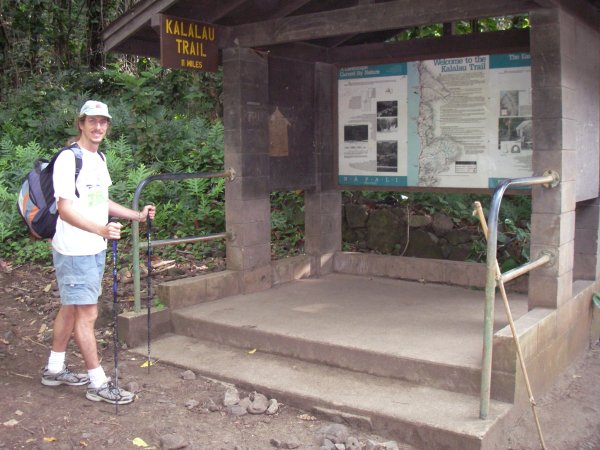
I wanted to give some details about the food and equipment I took on my recent 2.2-day hike on the Kalalau trail. While a 2-day hike is different from a 5-day outing, this can give an idea of the minimum needed. Here I am all ready to go at the trailhead:

KalalauTrailhead
Trailhead signs at Ke’e beach for the Kalalau Trail

Food for 48 Hours

The advantage of going for only the weekend is that I didn’t need to carry much food. To reduce weight, I decided to eat cold so I could leave the campstove. I mixed some peanut butter and jelly into a plastic container, and I took 1 large tortilla for each big meal (4 in all). I couldn’t stand PB&J by the last day and didn’t finish it—next time I’ll take humus. For breakfasts I took granola bars and dried fruit, and for the rest of the day some trail snacks (salty nuts and crackers, dark chocolate, and hard candy). One of my favorite trail snacks are Iso Peanuts, sometimes called Mochi Balls: they’re Japanese and made of a peanut coated with rice-cracker and various flavorings–carbs, protein, fat, and salt in a convenient package.

For drinking, I took only one 1.5L bottle of water and the water filter with purifier drops. Seeing how I probably sufferend from low electrolytes, next time I will try to take some powdered sport drinks (PDF and others).

Minimal Equipment

On this trip, I tried out a light-weight travel hammock which I cover with a plastic tarp against the rain (I hear there are all-in-one hammock “tubes” that would be perfect). My bedroll is a fleece sleeping-bag, light-weight but sufficient (almost, as seen above). I hike in shorts and a shirt that are not cotton, because they dry faster and carry moisture away. The shorts are actually a bathing suit, so I don’t have to deal with underwear and so I can jump in the water anytime. I wore one change of clothes and carried another for sleeping and for the hike out. Only take clothes that you don’t mind getting dirty, the mud or dust can stain even synthetic fabrics.

Along with the minimum saftety equipement (hat, sunscreen, knife, whistle, lighter, and emergency mylar blanket) and some accessories (camera and GPS), I could fit all this in a day pack, which probably weighed around 20 lbs (10 kg). Even without the hip support of a full pack, this was by far the most comfortable pack I’ve carried into Kalalau. Because of the heat, I really recommend carrying as little as you possibly can, it only adds up to extra strain, effort, and fatigue.

For shoes, I usually go with full height hiking boots when I have a full pack. I have weak ankles and need the extra support. With the lighter pack, I was comfortable with the running/trail shoes I have. Trail shoes have the advantage of being lighter and breathing better, but make sure they have plenty of big tread, anything else will slip too much. I do not recommend hiking sandals (Tevas or Keen) unless you’ve hiked extensively in them before–same goes for flip-flops that the Kalalau “hippies” wear on the trail.

Finally, you can see in the first picture that I hike with poles. I always take them for backpacking and almost never for day-hiking. Since they mainly help me balance a heavy pack and take some strain off my knees, I considered not taking them. They can get in the way in the overgrown sections, and they do cause a bit more erosion. But they also allow me use my arm strength for walking faster, and they are useful for stream crossings, so I took them. If you have poles and are used to them, I recommend you use them on the Kalalau trail.

More on Parking

Hikers can understandably be worried about leaving their car several days unattended at the trailhead parking at Kee Beach. I have an old island car that I’ve left parked there up to 5 day without incident. I do lock it (on principle), but mostly I leave nothing valuable in the car, even out of sight. I do leave a towel, a change of clothes, some water, and other worthless car junk, but always in the open, not in a closed bag. Obviously, rental cars are more conspicuous, so never leave anything you can’t loose, even if you are just going to the beach. That way the worst thing that happens is that you have to deal with insurance, should anything happen.

I actually haven’t heard of break-ins at Kee Beach, but I’m sure they occur, it’s one of the most remote places and there are no people around at night. There is a ranger stationed there as part of the Haena State Park, but I don’t know if they patrol at night. Leaving your car at the campground at Haena beach should be safer because there are people around, but that’s no guarantee, and you then have to walk or get a ride 1 mile (1.6 km) to and from the trailhead. The surest thing is to be dropped off if you can arrange it, though you need to set a pick-up time and ask your driver to be willing to wait an hour or two for you, in case you’re late hiking out. Needless to say that catching a plane the same day you hike out of Kalalau is tempting fate.

Updated Feb 18, 2008: I gave some more details in a comment reply on another post. Also, I have heard that you can sometimes park your car at the YMCA Camp Naue in Haena. They will charge a fee, but it’s probably the option that is most safe. Depending on who else is using the camp, you may also be able to camp or bunk there before and after hiking the Kalalau trail. Their phone number is (808) 246-9090, and I found more information at the Frommer’s travel site (even the official YMCA website links there). Thanks to Mary Jo in the comment below for finding out that the YMCA camp is not an option. I had heard about the camp from several sources, including the link above, but I failed to confirm my information directly with the YMCA poeple.

Total Lunar Eclipse Tonight

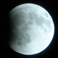
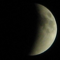
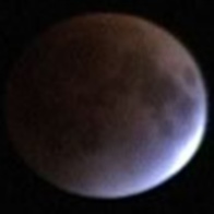
Update: Here are some photos I took with a point-and-shoot Canon PowerShot A710 IS at 6x zoom with digital image stabilization. The photos are full-size, only cropped from the 7.1 MP originals.

The beginning of the eclipse is impressive, it really does look like there’s a bite taken out of the moon. During the partial eclipse, the curvature of the shadow just makes it look like a crescent moon. The prettiest was right before full eclipse, when most of the moon was reddish-orange, except for a white spot on the edge. The last one is a still from a video camera— the moon was too dark and I didn’t have a tripod.

Full moon with a black shadow on the edge
22:46 HST       f/4.8       1/500 s
Crescent moon, only dimmer because of the penumbra
23:16 HST       f/4.8       1/200 s
Nearly total eclipse showing the reddish color
video still

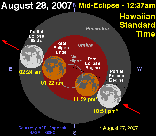
Lunar eclipses are perhaps the most common of celestial eclipses, but they still don’t happen every year in a given place. Tonight, one will be visible from Hawaii (Australia, N & S America as well), beginning just before midnight local time and lasting 1.5 hours. During the eclipse, the moon appears reddish because sunlight reflects through the earth’s atmosphere where blue light is absorbed, much like a sunset or sunrise. Before and after, the moon will be shaded by the penumbra and then partially eclipsed. Here is a link with more details about lunar eclipses.

Graphic showing the phases and exact times of the lunar eclipse

Source: NASA

Sorry for the late notice…

Foraging in Kalalau

Mitch emailed me to ask:

I have a quick question i was hoping you could answer. My girl and I are visiting kalalau for 5 nights in mid sept. (After the crowds). And I was wondering if there was still alot of taro left in the valley that time of the year. And if its abundant by the streams. I was hoping to find fruits and make poi rather than carry in a ton o’ food. whattaya reckon?

As I like to do, I’m sharing my reply with everyone:

Sorry to dissapoint you, but for all intents and purposes, there is no taro in Kalalau. Taro requires maintenance of the lo’i (irrigated paddies), and though you can find rock walls that held the terraces where taro once grew, the forest overtook them long ago. I once saw a restored lo’i, but even if it still exists, you shouldn’t pick someone else’s crop. The only place I saw what might be wild taro (I’m no foraging expert) is in the last stream before reaching Kalalau valley. There are a few plants growing in the mud nearby that may be taro or a relative plant. I advise against picking them because:

  • They are pretty plants and this is a state park after all.
  • They are probably very woody, not fleshy like cultivated taro.
  • Even real taro must be boiled for half an hour to remove oxalic acid that can irritate the mouth (or worse).

Additionally, there is almost no foraging of any kind in Kalalau. You can find a mango here or there during mango season (late spring into early summer), maybe a lilikoi (passion fruit) and sometimes you’ll find what looks like an orange and turns out to be a lemon. The only edible plants I’ve seen in the Kalalau stream are ginger and watercress, but you won’t get much of a meal out of those. Even if you did catch peak mango season, you have to get them before the fruit flies do. If you go off trail, you can find some papayas, bananas, other trees cultivated by the resident hippies. When the state enforcement officers raid the valley, they chop down any productive trees they find, so they are quite rare in the first place. The ones I did see were not producing fruit abundantly, so again, why take from someone else.

Here’s a true story: I was once exploring one of the side-streams in Kalalau valley with a friend. We climbed out of the stream-bed to examine a low rock wall, and beyond it was a grassy area with fruit trees. There was an orange tree, some unripe egg fruit and some rather scrawny papayas. We saw a ripe orange and picked it with a stick–it was a real orange and not a sour lemon. Not long thereafter, a hippy walked in and when asked, he said it was OK to pick the orange, the fruit was for everyone. He told us it was an old orchard that was planted in the heydays of the 60’s and 70’s. He said he came down to pick a lime that afternoon, and even though he was never threatening in any way, I wonder if he hadn’t heard us and came by to inspect and/or protect the spot. After a few minutes, a lime fell off the tree and hit the ground with a rustle of leaves, and he sauntered off to get it saying “that must be the lime I was waiting for.”

So even if you tried, I don’t think you’ll ever find enough food in Kalalau valley (or fishing from the beach) to live comfortably for 5 days. Nor can I even recommend you try, because if all hikers did the same, the valley and fish stock would be depleted quickly. Maybe if you befriended some of the hippies, you could eat with them, but then again, they either have to pick from their limited resources or carry it in, so it’s unlikely.

Having done several week-long backpacking trips, both in Kalalau and on the mainland, I recommend taking calorie-dense foods that require little or no cooking (to save fuel or avoid carrying it altogether–no wood gathering in the valley either, burn only driftwood from the beach, but it is usually gone by the fall). I’ve mentioned these before:

  • powdered humus mix
  • powdered refried beans
  • dried taboulĂ© mix
  • tortillas
  • powdered soup
  • ramen noodles
  • peanut butter
  • oil (in a small sealable bottle)
  • chocolate
  • powdered milk (soy or cow’s)
  • powdered coconut milk
  • energy bars/protein bars

You can always eat the freeze-dried meal packages, but I find those to be expensive and too salty (good for hiking days, though). The other advantage of these alternate foods is they can all be found on Kauai (except for the powdered soy and coconut milk), mostly at Papaya’s Natural Foods in Kapaa (their Hanalei store might also carry the mixes, but I haven’t looked for them).

Hurricane Flossie

Everyone on Kauai is anxiously hoping that hurricane Flossy will spare the island. Memories and stories of hurricane Iniki’s direct hit on Sept 11, 1992, are still vivid. Today, everyone says the weather is strange: there’s lots of wind and the dark clouds at all altitudes with sunshine in between. It just doesn’t feel like the usual patterns—no wonder animals can tell when storms are coming.

Update 12 hours later: the storm is down to category 2 and skirting the Big Island, where they have a hurricane watch, closing schools and opening shelters. The storm is about 65 miles (100 km) from the island, which is a fortunate distance because hurricane strength winds are felt about 40 miles ( 65 km) from the center. They are expecting 5-10 inches (12-25 cm) of rain and 25-foot (8-meter) waves. What they did not expect was the 5.3 magnitude earthquate last night. State Parks on the Big Island are closed, and hikers on other islands should probably avoid trails as the storm approaches.

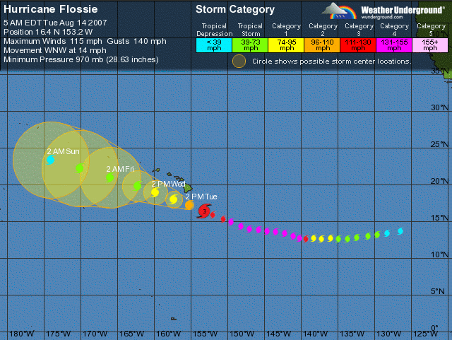
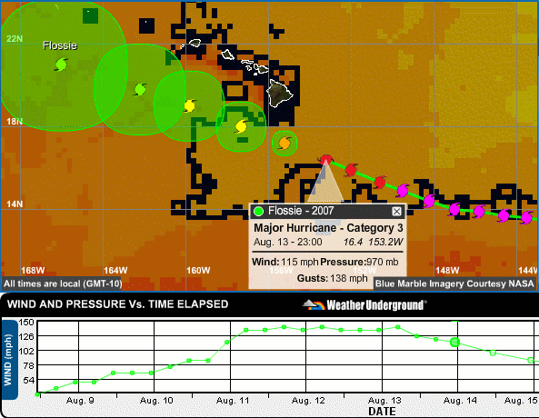
For a while, Flossie was a category 4 hurricane (on the Saffir-Simpson hurricane scale) and the Hawaiian islands were within the range of predicted paths. Over the last twelve hours, the storm has weakened and is predicted to stay to the south of the islands, though it could brush close enough for Kauai to experience severe winds:

Predicted path of hurricane Flossie, just south of the Hawaiian islands

Source: wunderground.com

The NOAA has lots of real-time maps that track hurricane Flossie, but I found the ones at wundergound.com to be slightly more readable. Among them is the following, found under Flash Tracker, an interactive map that shows the sea surface temperature (SST):

Predicted path of hurricane Flossie, back in hot water

Source: wunderground.com

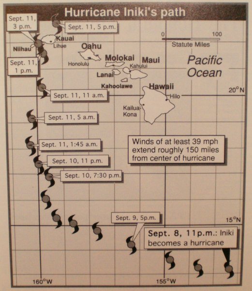
I find it interesting because the hurricane is predicted to weaken now that it has entered cooler water. This seems to be the case on the map above, but what happens when it reenters the warmer waters south of Kauai? The story I’ve heard several times about hurricane Iniki (other than it broke the anemometer at a wind speed of 200 mph–320 km/h) is that it curved away from Kauai and then turned around and went straight towards the island. I found a track of hurricane Iniki that disproves the story, but it does show that the hurricane followed an easterly course across the Pacific, much like Flossie, before turning north to Kauai around the point where Flossie is right now:

Map showing hurricane Iniki curving towards Kauai in 1992

Source: Hurricane Iniki, a “souvenir” book by the Honolulu Advertiser

But enough talk about the weather, what’s happening on the ground? Well, everyone is preparing for the possibility of the hurricane causing an emergency situation on the island. I’ve heard that emergency response centers have opened on all islands, and everyone is going shopping to replenish their hurricane supplies. The recommendation is to have food and water for up to a week, but after Iniki, some roads were blocked for weeks, and some areas had no water or electricity for months.

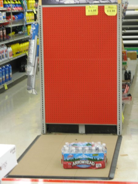
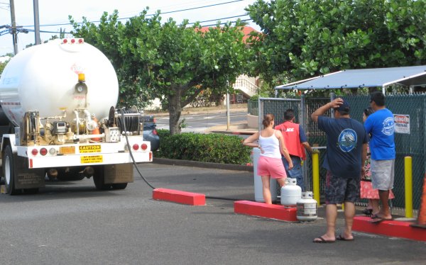
Every hurricane season, we have stocked a cupboard full of canned food, but we forgot to refill our 5-gallon (20 liter) water jugs this year. We also decided to buy boards to cover our largest windows, and we were not alone. Lots of pick-up trucks were leaving the Home Depot in Lihue with sheets of plywood, but they had not run out. They had reportedly run out of generators, so maybe the ones I saw were already sold. Plastic tarps are used for covering furniture indoors, in case windows or roof get blown out and let the rain in. I found some at Ace Hardware in Lihue, but they were almost out the useful sizes. However, Ace was out of water (the small bottles that are not environtmentally-friendly), and they needed to refill their 500 gallon (2 m3) tank of propane:

One case of water left on the shelf

People wait to refill propane bottles while the Gas Company truck resupplies the store

Like everyone else, I ended up at the Costco warehouse store to buy the other essentials in bulk. Looking at the shopping carts of local people who probably lived through hurricane Iniki, I estimate that the most important items are: bottled water (in those small, wasteful bottles again), bleach (to purify more water), and toilet paper. They hadn’t run out of these items, but they had already opened new pallets from their reserves. Actually, the stores seemed to be handling the supplies fairly well, perhaps they know what to stock during the hurricane season. And fortunately, I didn’t notice any price gouging.

Disaster shopping has a strange feeling. Everyone is buying a lot of stuff, everyone hopes their preparation and spending will be in vain, and yet everyone is cheerful and helpful even with the threat of a hurricane. One person was even optimistic enough to buy a new rug, though maybe it was on sale. The newspaper also has some good stories (here and here) about the preparations.

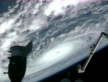
My predictions may be nothing more than amateur speculation, but something always feels like a significant phenomenon when you can see it from space:

View of the hurricane from the current shuttle mission to the space station, I have no idea which way is north

Source: NASA via Reuters via yahoo.com