Mark your calendars, there’s a complete solar eclipse happening across the United States on August 21, 2017.
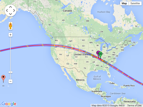
NASA has a nifty website that shows the predicted path of the eclipse right through the continental United States. The blue lines of the path show where people will see a 100% solar eclipse, and the colored markers in southern Indiana show the “center” of the eclipse where it will last the longest (about 2 minutes and 40 seconds).

Source: Nasa Eclipse Web Site
If you click through to the Nasa Eclipse Web Site, the interactive map lets you click anywhere to see the percentage of eclipse at that spot. For example, even Southern California will see 60% coverage of the sun, and northern Maine 50%.
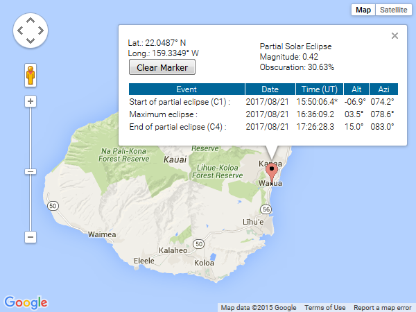
The path of the total eclipse passes right through the North Pacific, missing both Hawaii and Alaska. Here on Kauai, it will be only 30%:

Source: Nasa Eclipse Web Site
But if you look carefully at the data, we will see a really interesting phenomena: the maximum eclipse on Kaua’i occurs at 6:39am with the sun 3.5 degrees above the horizon–at sunrise! I sure hope there are no clouds so I can get a picture.
It might even be worth going to the North Shore of Kaua’i to get 31%. Again, click through to the live map to find the exact numbers for your location.