The I was driving back from the Hanapepe farmer’s market on Thursday, when I noticed the view into Hanapepe canyon was especially clear:
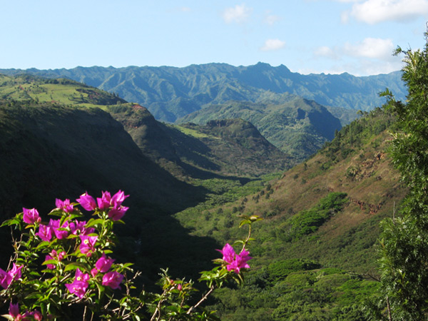
This is not the scenic viewpoint along the highway, but a spot a little further east. If you’re driving towards Hanapepe, pull off at a dirt road that starts right next to the sign that says “Scenic Viewpoint, 1000 feet,” and walk 200-300 feet west (towards the viewpoint and Hanapepe). At a break in the trees, you should see the canyon and the colorful bougainvilleas in the foreground.
Hanapepe canyon goes all the way up to the back side of the Wai’ale’ale plateau region, just below the Kawaikini summit. Hanapepe canyon drains the back side of the ridge south of Kawaikini, an area seldom seen from the east or west (Olokele canyon, a branch of the Waimea river watershed, drains the south-west side of Kawaikini). As a matter of fact, Kawaikini is visible from these highway viewpoints, although it is usually in the clouds, or behind the trees as in my photo above. But the whole canyon is private land, owned by the Gay and Robinson sugar plantation to provide the water for their fields—and therefore inaccessible.
To a hiker like me, views like this into a remote and inaccessible canyon are enticing. There are some great waterfalls up there that you can see on helicopter tours, including Manawaiopuna falls made famous by the movie Jurassic Park, but this is the closest you can get on land. Tantalizingly, the dirt road at the pulloff is the private road to access the canyon.