It’s so hard to start blogging again, I got in the habit of just reading other people’s blogs. The lack of posts hasn’t been for lack of hikes, sunrises, events, or news-worthy items, I have lots of drafts to publish. However, I’m going on a real vacation starting next week, so I thought I’d post today’s outing before it fades away in my mind.
The Kapa’a Stream is sometimes called the Kealia stream because it ends at the south end of Kealia Beach, just north of Kapa’a. You can see it from the road bridge, and I’ve always wanted to explore it by kayak.
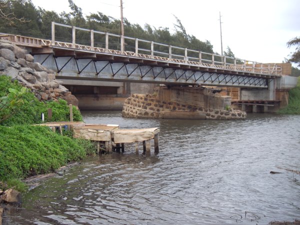
The best place to put the boat in the water is on the southern (right) bank, between the road and the stream. Down a little dirt road, you can park right next to the bridge at the stream. There’s a little makeshift ramp there for launching, even a little home-made pier. The following picture also shows the new bike path bridge being built in place of the plantation train bridge that had nearly rusted away.

It looks like that center piling was half-sunk at one point, I wonder if it was from the tsunamis of 1946 or 1957. It looks like it was reused and topped off level, but I think the new bridge does not rest on it (those are wooden spacers in the picture above).
But what about the kayaking? Well, this is one of the prettiest rivers I’ve kayaked on Kauai. It’s doesn’t have the size or waterfall hiking of the Wailua River, nor the mountain backdrop of the Hanalei River, but it’s a charming stream through Kauai’s rural landscape.
The first leg is a wide lagoon, although several patches of pretty water hyacinth are trying to reduce it. The trade winds blow straight up this part, so save some energy to paddle against them on the way back. The stream then winds back in a big S curve (so you paddle against the wind, both ways), past some cows and horses to the prettiest part inland.
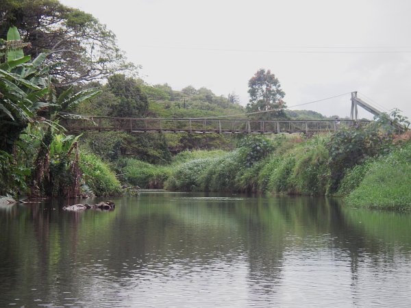
As the stream straightens out, it ducks under some large monkeypod trees for some shade. There’s a big logjam that you can fortunately get by on the right, and then you just admire the bananas and coconut trees lining the bank until you reach the swinging bridge. It’s about 100 feet long and hangs about 20 feet over the stream.

After going under the bridge, you reach shallower water, but it is possible to scrape by until you see the road crossing the stream over a small culvert. Total distance is almost exactly 2 miles each way (you can also download my Google Earth file).
Source: maps.google.com (click for larger version)
You can also reach the swinging bridge by car: take Haua’ala Rd. from the main highway up across Kawaihau Rd and back down into the stream valley. As it turns into a one-lane road, it parallels the stream and almost a mile further you’ll see the bridge.
I’m fascinated by the swinging bridges on Kauai. In my mind they’re associated with more adventurous crossings in the jungles of South America or the gorges of the Himalayas. I know of 5 on Kauai (2 in Waimea—3 actually but the uppermost one is private and in very bad shape, Hanapepe, Kapaia—between Lihue and Hanamaulu, and this one). Up until only 25 years ago, swinging bridges probably still outnumbered stop-lights on Kauai.
Most of these pedestrian bridges still serve residents in the river valleys, either as shortcuts to the fields or sometimes the main access to some houses. This one in Kapaa serves a half-dozen houses as an easier alternative to vehicle access on a long dirt road. In the photo above, there is actually one of the residents on the bridge near the right-hand cable support.