Over the years, one of my hobbies has been playing with maps. I used to map all my hikes in California with the Topo software, and now I use Garmin’s MapSource in association with their GPS. The first gift my wife got me on Kauai was the set of 11 7.5-minute series topological maps (on paper) covering the entire island. Still, I had seen posters and books with some nifty views of Kauai, which I finally found online.
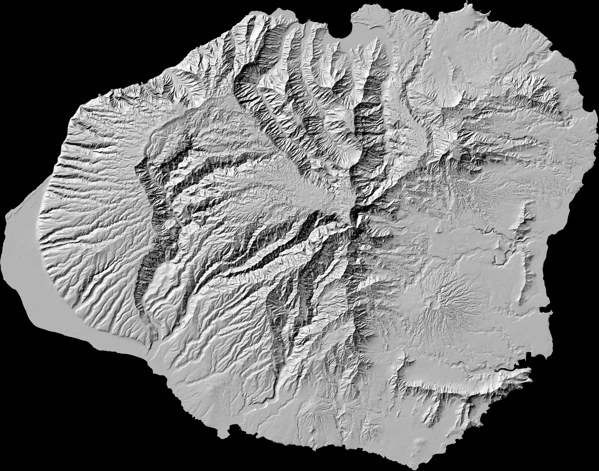
This first one is a hillshade map of Kauai. The artificial shadow is drawn by computer based on the elevation data of the topographical maps. The original is 2.4 MB and available from this link:
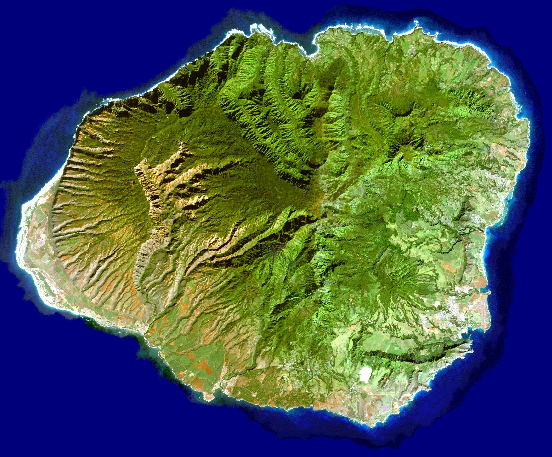
This second one is technically a Landsat photograph, but it has many map qualities. With computers and tools such as Google Maps, the distinction between map, data, and photo is getting blurry. The original is 4.9 MB and available from this link:

Aloha,
I’d like to use your map of Kauai as a graphic in a small book I’m publishing. Is this possible?
Thank You
Hi, these are not mine to give, they are produced and published by the state of Hawaii. You’d have to follow the links above each map and find their policy for use in publications (click JPG version under “Metadata” to find the email of the person who made them. I suspect they are free to use, but I really don’t know.