Share the Abundance!

There’s a new website in town with a great idea: share the abundance of fruits and vegetables from your backyard.


KauaiAbundance.com

Kauai Share the Abundance masthead

A neighbor of mine with a big yard and lots of fruit trees had the idea. He had so much fruit that he couldn’t give it all away and some inevitably went to waste. Plus I imagine he got tired of eating the same fruit day in and day out, not to mention offering the fruit to everybody again and again.

There’s always been informal sharing of produce with family, friends and neighbors on Kaua’i, but this is the age of Web 2.0, and it was time to make a website. The idea is simple and easy to use: anybody on the island can post a short message offering what they have, and anybody can search by produce type or location. Send an email, give them a call, stop by on your next errand, and soon you’ll be enjoying home-grown fruits and vegetables. It’s all free and based on goodwill, so go ahead and try it.

And it works! We already traded lilikoi for avocados and lilikoi juice for coconut water. A lot of people are looking to trade for something else, but I’m sure people are willing to give away small amounts, too. Or this can be your incentive to plant a garden and some fruit trees, so you can join in the trading.

What I really like about the concept is not just keeping all the fruits and veggies from going to waste, but also the sharing of healthy food within the community and creating new connections based on sustainability.

Disclaimer: my wife made the website, and the neighbor who owns it has given me free fruit in the past.

PS: I heard the newspaper is going to run a story about the website (sorry for the scoop), so I predict this is going to become very popular soon. [Update: here’s the article, with a really good tie-in to the whole issue of eating locally and sustainably. Keya Keita is the new features writer at the Garden Island, and she’s been writing some really insightful articles about interesting people and places several times a week–she raises the bar for local bloggers like me.]

Kapaa Stream Kayaking

It’s so hard to start blogging again, I got in the habit of just reading other people’s blogs. The lack of posts hasn’t been for lack of hikes, sunrises, events, or news-worthy items, I have lots of drafts to publish. However, I’m going on a real vacation starting next week, so I thought I’d post today’s outing before it fades away in my mind.

The Kapa’a Stream is sometimes called the Kealia stream because it ends at the south end of Kealia Beach, just north of Kapa’a. You can see it from the road bridge, and I’ve always wanted to explore it by kayak.

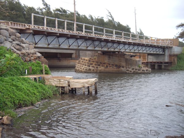
The best place to put the boat in the water is on the southern (right) bank, between the road and the stream. Down a little dirt road, you can park right next to the bridge at the stream. There’s a little makeshift ramp there for launching, even a little home-made pier. The following picture also shows the new bike path bridge being built in place of the plantation train bridge that had nearly rusted away.

KealiaBikeBridge

It looks like that center piling was half-sunk at one point, I wonder if it was from the tsunamis of 1946 or 1957. It looks like it was reused and topped off level, but I think the new bridge does not rest on it (those are wooden spacers in the picture above).

But what about the kayaking? Well, this is one of the prettiest rivers I’ve kayaked on Kauai. It’s doesn’t have the size or waterfall hiking of the Wailua River, nor the mountain backdrop of the Hanalei River, but it’s a charming stream through Kauai’s rural landscape.

The first leg is a wide lagoon, although several patches of pretty water hyacinth are trying to reduce it. The trade winds blow straight up this part, so save some energy to paddle against them on the way back. The stream then winds back in a big S curve (so you paddle against the wind, both ways), past some cows and horses to the prettiest part inland.

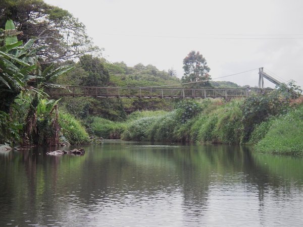
As the stream straightens out, it ducks under some large monkeypod trees for some shade. There’s a big logjam that you can fortunately get by on the right, and then you just admire the bananas and coconut trees lining the bank until you reach the swinging bridge. It’s about 100 feet long and hangs about 20 feet over the stream.

KapaaSwingingBridge

After going under the bridge, you reach shallower water, but it is possible to scrape by until you see the road crossing the stream over a small culvert. Total distance is almost exactly 2 miles each way (you can also download my Google Earth file).


Source: maps.google.com (click for larger version)

You can also reach the swinging bridge by car: take Haua’ala Rd. from the main highway up across Kawaihau Rd and back down into the stream valley. As it turns into a one-lane road, it parallels the stream and almost a mile further you’ll see the bridge.

I’m fascinated by the swinging bridges on Kauai. In my mind they’re associated with more adventurous crossings in the jungles of South America or the gorges of the Himalayas. I know of 5 on Kauai (2 in Waimea—3 actually but the uppermost one is private and in very bad shape, Hanapepe, Kapaia—between Lihue and Hanamaulu, and this one). Up until only 25 years ago, swinging bridges probably still outnumbered stop-lights on Kauai.

Most of these pedestrian bridges still serve residents in the river valleys, either as shortcuts to the fields or sometimes the main access to some houses. This one in Kapaa serves a half-dozen houses as an easier alternative to vehicle access on a long dirt road. In the photo above, there is actually one of the residents on the bridge near the right-hand cable support.

Stupid Ferry

One unique character of Hawaii is that each island has evolved in the motoring age without the benefit of vehicular passage between the islands. This makes each island so much more independent and unique due to the limited movement of people and goods. For example, there are very few RVs (camping-cars) blocking the roads on Kauai because residents don’t need them and nobody can bring them here easily. More importantly, while Oahu might have nearly one million residents, Kauai is not over-run with city-dwellers on weekends.

Now, the so-called “super” ferry wants to change all that, not to mention harm our fragile ocean and island eco-systems in the process. After several years of lobbying, the ferry project has been granted a license to operate by the governor’s administration, without any preliminary study about how it will impact the people or environment of Hawaii. As details about the size (350 feet / 105 m long and 11 feet/ 3.5 m draft) and high speed (35 knots / 40 mph / 65 kmh) of the ferry were made available and people realized what it really means to have a ferry, much opposition has developed on Kauai and Maui (the Big Island is spared until 2009). Concerned citizens have created the website superferryimpact.com to raise awareness about the many ways in which a ferry would negatively impact Kauai.

With service scheduled to begin in July of this year, the state legislature finally looked into the matter and drafted bills to require the studies. This is my letter in support of those laws, with some links added.

TO: Chair, Hermina Morita, Energy & Environmental Committee
  Vice-Chair, Mele Carroll, Energy & Environmental Committee

RE: In favor of HB702, requiring Environmental Impact Statement on Hawaii Superferry

ENVIRONMENTAL IMPACT STATEMENT ON HAWAII SUPEREFERRY, being heard 2-1-2007, 0800, Room 312, House side, State Capitol.

Testimony:

Aloha,

The so-called “super” ferry represents such a change in how people and
goods will move between the islands that no state harbor improvements
should be made for the ferry before an environmental impact study (EIS)
has been done.

For me, the most serious impact to consider is the danger to the
whales. The ferry will travel at over 40 miles per hour, and whales are
often near the surface. The newspaper today contained an article about
a “speeding” cruise ship in Alaska killing a whale, and the ferry
vessel will travel even faster. Imagine the effect that one whale death
will have on the growing eco-tourism market in Hawaii. Even if ferry
activity were limited to the summer months when the whales are in
Alaska, what about green turtles, also an endangered species?

I am also worried about invasive species, both plants and animals,
spreading between islands. Dealing with the coqui frog on Kaua’i has
wasted thousands of hours of work and will cost the county hundreds of
thousands of dollars
. Weeds are choking our forests and their seeds can
easily hitch a ride on vehicles. The ferry spokespeople claim vehicles
will be cleaned, but an EIS will mandate how to do it thoroughly.
Finally, I’ve heard callous people claim that the only solution to
Kaua’i’s chicken “problem” is to import the mongoose so readily seen on
other islands. How does the ferry intend to protect against such a
calamity that would decimate the island’s native bird population,
including the nene?

Any type of ferry is also sure to cause economic and social impacts.
The fact of the matter is that neighbor islands have developed an
economy and society that does not rely on vehicular travel between the
islands. Given the population imbalance between the islands, the ferry
will certainly affect issues such as traffic, over-crowding, and crime
much more on the neighbor islands than on Oahu.

An Oahu resident might not mind sitting in Kapa’a rush hour traffic
instead of that on the H-1, but local residents are sure to feel the
additional surge of traffic. Even though vehicles will come and go on
the ferry, there will undeniably be more passenger-miles driven on
Kaua’i, and most of it will be concentrated on weekends, the only time
many residents have to enjoy their parks and beaches.

Overcrowding at said parks and beaches is therefore also an issue.
Neighbor island counties already have limited resources to maintain
their parks and hire lifeguards. An influx of users, in addition to the
crowds of tourists, will degrade the experience for everyone. I also
think that Oahu’s homelessness problem will be exported to Kaua’i and
Maui, creating a further burden on those counties.

The ferry website does not address how drugs and criminals will be
prevented from traveling between islands. Unless an impact statement
can identify solutions such as photo identification checks and video
surveillance, what will keep fugitives, criminals and illegal drugs
such as “ice” from spreading to the neighbor islands on the ferry? What
if such measures are unconstitutional?

One last impact that I find galling is the unfairness of the advertised
ferry schedules towards neighbor island residents. With late departures
and overnight stop-overs, it is obvious that the schedules all favor
Oahu residents and happen to inconvenience neighbor island residents.
An impact study might suggest how all residents could benefit equally
from the ferry.

Perhaps an economic impact study is necessary as well, in order to see
if the inevitable cost of all the environmental mitigation measures is
even justified. What are the benefits to private individuals and groups
when compared to flying and renting a car or bus? What are be benefits
to businesses given the advertised rates, and are those benefits equal
for neighbor island businesses given the disadvantageous schedules?
What are the potential revenues, direct or indirect, to the state that
justify the outlay for the harbor improvements? What if the ferry
business is not successful, can the state be reimbursed for the harbor
improvements that directly benefited the ferry?

All the environmental and economic risks also need to be weighed along
with the potential disruption of current island lifestyles, existing
businesses, and current harbor users. That’s why I ask you to please
enact this legislation to require impact studies before any harbor
construction or ferry service can begin.

Mahalo.

Poisonous Plants of Paradise

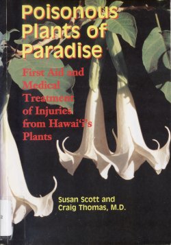
PoisonousPlantsPoisonous Plants of Paradise: First Aid and Medical Treatment of Injuries from Hawaii’s Plants by Susan Scott and Craig Thomas, MD. Available at the Kapaa library (and possibly others), H 615.952 Sc under Hawaiiana.

This is a fascinating book if you’re interested in the outdoors and/or the specificities of flora in our isolated islands. Written as a medical reference, it thoroughly explains the toxicity and injury vectors of every (?) plant known to harm humans in Hawaii. Each plant is photographed and explained, including how it arrived in Hawaii and where it is usually found, then its toxins and method of injury are explained. Some readers may be interested in the description of traditional uses for each plant, though the authors always add that using these plants “as a remedy is scientifically unproven and may be harmful.”

I would put the dangerous plants in three categories:

  • Decorative plants that you are unlikely to see outside someone’s yard
  • Landscaping plants that you are likely to encounter in public places
  • Native and naturalized plants that hikers are more likely to find on the trails

Here are some of the landscaping plants whose toxicity you should be aware of:

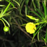
Oleander, Be-Still: Both of these colorful ornamentals are deadly if any part is ingested even in small quantities. Oleander leaves and be-still seeds are the most poisonous, but even dust from leaf litter can irritate the airways. Parents should definitely know these plants, never bring them in the house or yard, and keep children away from them outside. I’ll mention that be-still also grows wild in Kalalau, mauka of the trail between the river and the campsites at the beach. The book says that even using a stick from it to roast marshmallows or hot-dogs over a fire, or inhaling smoke from burning the wood can kill an adult. DeadlyBeStill
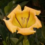
CupOfGold Angel’s Trumpet (on the cover above), Cup of Gold: These two plants aren’t related, but they both have large, pretty and sweet-smelling flowers with similar toxins. The smell of the flowers is pleasing, but some people report mild symptoms such as headaches and dizziness just from inhaling the scent. Also, rubbing the eyes after touching the cup of gold flower or any part of the Angel’s Trumpet plant can cause pupil dilation and blurred vision for up to a week.
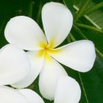
Plumeria: This widespread plant is mildly poisonous, ingesting leaves or flowers can irritate the digestive tract. It’s the sap that’s irritating and a few people develop rashes when they get it on their hands from breaking a branch or leaves. Children sometimes put the fragrant flowers in their mouths, but will not have any symptoms unless they ingest whole flowers. PlumeriaWhite
Mango: The sap of this tree contains toxins related to poison ivy and poison oak of North America, so people who are sensitive to those might react to the leaves and skin of the fruit. Because repeated exposure increases the reaction, sensitive people should avoid contact. The fruit is safe to eat even for sensitized people once it is peeled by someone else.

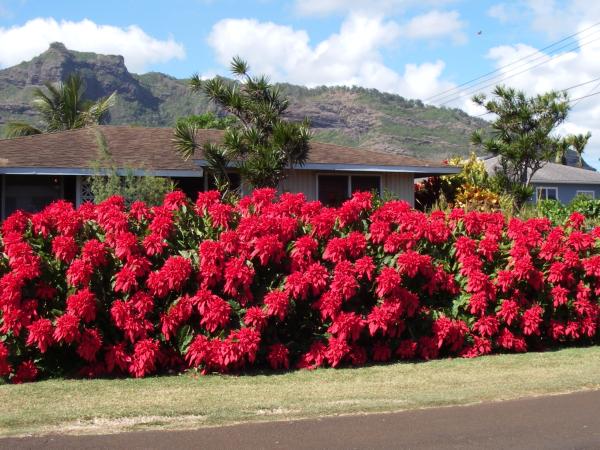
Poinsetta: A professor in Hawaii in the 1940’s erroneously claimed that even one leaf was toxic, but this book claims it was a mistake. While ingesting the leaves may cause vomiting, and repeated handling may cause a mild skin rash, the authors are confident there is no toxic substance that may cause further harm.

PoinsettaHedge

Here is a short list of poisonous plants that hikers should be aware of, especially when taking children along:

Castor Beans: This plant grows along roadsides and disturbed areas all over the island, but the whole plant and especially the beans are deadly. The beans are very pretty and contain both castor oil and the poison ricin, known to have been used by spies for assassinations. I’ve never seen a seed lei made with these, but pricking your finger with the needle for stringing them is enough to cause severe symptoms.
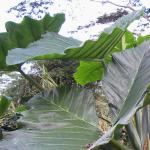
ElephantEar Elephant Ear: These plants with leaves up to 4 feet (1+ meter) are related to taro and grow in wet, muddy conditions near streams and rivers. Like the taro plant, they contain invisible calcium oxalate crystals, tiny sharp needles inside the plant cells that irritate the skin. What I did not know is that these plants have a cell mechanism to project the crystals whenever a leaf or stalk is broken. Crushing or chewing the leaves or stems will cause a burning rash where the crystals embed in the skin or mouth. Differernt species had varying amounts of calcium oxalate. Taro leaves must be thoroughly cooked, and elephant ears were only cooked in times of famine.
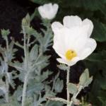
Hawaiian Poppy: It’s one of the few native poisonous plants and the only prickly one. Like most poppies, the sap can irritate the skin and causes vomiting if ingested. The toxin affects the heart muscles and is deadly if enough is ingested. The only place I’ve seen this plant outside of botanical gardens is near the heiau in Kalalau Valley. PuaKalaNativePoppy
Kukui Nut: All parts of the tree contain a mild toxin that is only dangerous to small children. The sap can cause a skin rash, but most poisonings are from the nuts. Raw nuts allegedly taste good, but a single nut can cause nausea, more cause vomiting, severe cramps, and diarrhea. Hawaiians cooked the nuts and ate them as a relish, and the authors say “cooking alters the toxins and makes the nuts safe to eat in small amounts”.
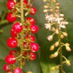
CoralBerryRed Pokeberry/Coral Berry: Pokeberry is a native plant with small black berry clusters, coral berry has tiny red or orange berries. Both types of berries were used as dyes, and the plants are eaten as greens, despite the danger. The whole plant contains toxins: eating the root or undercooked leaves can be deadly to adults, and berries, especially unripe ones, can be deadly to children. I’ve only seen the red coral berry, but it grows as a weed in our garden and an invasive in Waimea Canyon and Kokee.
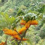
Silky (or Silver) Oak: This non-native tree from Australia is not related to oak. It was used in the 30’s and 40’s to reforest the eroded slopes of Waimea Canyon and the Pali-side of Kokee. Some people can get a rash from touching any part of this tree, though it only appears after 1-3 days, making identification difficult and often spreading to the eyes by contact. Sensitized people can get an asthma attack near these trees. It has a pretty flower, and even though my parents’ house used to have a specimen, I didn’t know it was potentially harmful. SilverOakBlooming
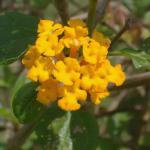
LantanaInvasive Lantana: This bush with a recognizable smell might have pretty flowers, but it is an invasive weed that grows in thickets and is taking over forests on Kauai. Hikers know it because it has small curved thorns that can scratch badly, but I didn’t know the plant was poisonous. The leaves can cause a rash and are deadly to ruminants and fish. The berries are toxic when unripe, and even though some people eat ripe berries, they are potentially dangerous as well.
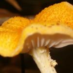
Mushrooms: If you haven’t learned to identify mushrooms in Hawaii, never pick and eat them here. Many poisonous and dangerous mushrooms in Hawaii look similar to edible ones on the mainland. They may even be the same mushroom, but different soil and weather conditions make them inedible. According to the book, the fatality rate for the hallucinogenic “magic” mushrooms is “less than 1%,” which is very high if you think about it. UnidentifiedMushroom

Unlike the book, these descriptions are not exhaustive. Other plants may also produce unpleasant symptoms if touched or ingested, especially in children. Avoid touching plants you are not familiar with, wash your hands as soon as possible especially if you get sap on them, and do not touch your eyes in the meantime.

If you suspect a plant poisoning of any kind, keep the plant for identification and call the poison hotline. If symptoms are present, take the patient and the plant to the nearest emergency room.

There are other ways in which plants can hurt people outdoors. A maintenance worker was killed recently on Kauai while cutting trees away from the highway. While I doubt many of you will be chainsawing, remember to be careful of rotten branches and stumps in the forest. I’ve been thrown off balance when pulling myself up on one of those, and there’s always the potential they they are holding up other branches than can fall on you.

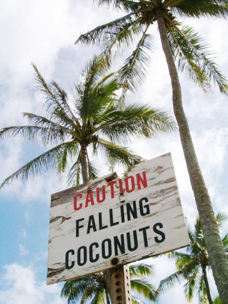
FallingCoconuts

Finally, always pay attention when you linger under coconut trees. When I was “fresh off the boat,” it hadn’t occurred to me that coconuts eventually fall off the tree, and they are most likely deadly if they hit you. Most parks and public places remove the developing coconuts, but it’s best to look up and make sure before you spread out your towel.


More Kalalau Questions

My first post about the Kalalau trail has generated the most comments of any so far. It is after all the highlight of any trip to Kauai for the physically inclined. But from the emails I keep receiving, it seems like details are scarce. The discussion in that post has turned to the “hippies” who “inhabit” Kalalau valley, so I’ll start a second post with another set of questions. Rachel asks:

Q: I am determined to make it to Honopu Beach, what is the best way to get there, some places say you can walk along the rocks, while others say to swim. We will be there the second week in June ’07. How hard is it really?

A: You must have been reading the “Ultimate” Kauai Guidebook where Honopu beach is called “the most beautiful beach in all the islands, maybe in all the Pacific.” Now I have a lot of respect for the guidebook authors, with all the places they’ve revealed and all the great photos they’ve published, but they do have a tendency to hype (and brag about) the most deserted and most difficult places to access (remind me to blog about the “tunnels” hike someday). What you should know about Honopu beach is that although it is beautiful and unique, sitting at the base of sheer cliffs and bisected by a towering arch, I don’t find it as aesthetic as Kalalau beach (see the first two photos in that other post). At Honopu, the cliffs are a bit foreboding, the arch is massive and asymetrical, the waterfall is mostly hidden and the beach itself has no trees, no shade and only a few dunes to add interest.

But the attraction of Honopu is undeniable: a deserted beach whose isolation almost guarantees you’ll be alone (though not unseen from kayakers and helicopters), and exploring it gives you a good adrenaline rush. There is only one legal way to reach Honopu beach, and that is to swim there. Landing a craft of any sort at Honopu is illegal, even a surfboard I believe. Be aware that the swim involves choppy waves, currents and unpredictable conditions, even in the summer when the ocean is relatively calmer. You should not even consider this swim outside the summer months.
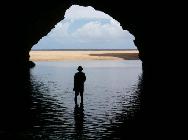
KalalauWetCave
The third sea cave from Kalalau beach, the first with water
KalalauLastCave
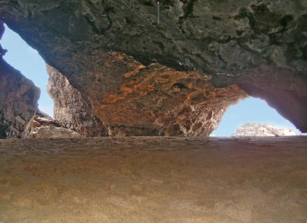
The two entrances make this cave a candidate to be a future sea arch

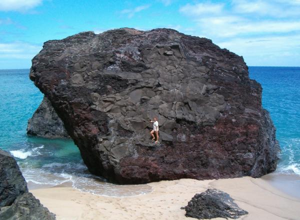
During the summer, the relatively calmer seas bring sand onto Kalalau beach, making it walkable for almost a half mile past the campground. You will go past several sea caves on the beach, some with small lagoons trapped inside by the enlarged beach. The last cave opens where the rock face blocks the beach, but you can go through the cave (usually dry) out to a small beach on the other side. There seems to have been some sort of rockslide that opened up this beach from the cave, and there are huge boulders strewn on the beach. When I went, I swam from here:
KalalauLastBeach
Start swimming just to the left of this house-sized boulder

You might be able to hike a bit further along the rock face, but I believe you will reach a point where it will be impossible to pass. Anyways, you would be battered by waves, even small ones, making it safer to be swimming in the water. So, if the seas are not rough, if you feel confident in your ability to swim in the ocean, and if you agree to not hold me liable, here is where you start swimming. From that last beach, you cannot see Honopu beach, it is around the corner of the cliff. I estimate it’s about 100 meters to the corner, and another 100 around to the beach. That’s 4 laps in an olympic pool (50 meters in length), so I recommend you be able to swim 10 laps to give yourself a large margin of safety. Also, you will be swimming against the current when you return, so you should be prepared to swim about 15 minutes continuously. Please do not attempt this if you have no experience swimming in the ocean.

Two suggestions: if you are determined to make it, bring a snorkel and mask or at least some fins. That should make the swim easier though you will curse the extra weight on the Kalalau trail. I suppose you could also bring a small inflatable device (children’s floats or camping pillow) for safety. If you collect sea shells, bring a small ziplock bag and make sure you have closable pockets to put it in, because deserted beaches are your best chance to find sunrise shells.

A friend here on Kauai has written about his adventures in Honopu, sometimes known as the Valley of the Lost Tribe. It’s the only other account I’ve found on the web about swimming to Honopu, and I do not recommend you follow his lead and climb into the valley. Remember that the main reason for going to Honopu is to explore further off the beaten path, but that involves further risk. So if conditions are not favorable or you are unsure of your ability, it is best to just stay and enjoy Kalalau Beach.

Update: I just found another account of swimming to Honopu on a new blog. It pretty much confirms what I say here.

Q: I am trying to fill out my camping permit, but am not sure what
campsites we will be staying at each night. We plan to backpack for 5
nights and really enjoy the trail, do you have a suggested itinerary
for me?

A: In the other post, I gave my ideal schedule for 4 nights and would just extend that with an extra day and night in Kalalau. But that supposes you are a strong hiker (hiking every week, backpacking every month), so if you feel you can’t hike out in one day, reserve the last night at Hanakapiai Hanakoa again. Or even if you are a strong hiker, you might want to add the side trips to Hanakapiai falls the very first day and Hanakoa falls on the way out, and thus plan to stop at Hanakapiai both ways.

Update July 2007: camping restrictions have changed, and permits are now given for Hanakoa instead of Hanakapiai. I had previously heard camping was restricted at Hanakoa to preserve the archeological sites (rock walls and terraces), but Hanakapiai was becoming so overused that the park managers decided its sites were now more at risk. Hanakoa is the more logical half-way point to camp, and people were camping there anyways, but I still find it to be too muddy, muggy, and buggy.

See the official Na Pali permit procedures webpage if you haven’t already. Hanakoa camp at the 6-mile marker is closed, and so Hanakapiai is your only legal option. In case of an emergency, and that would include getting caught by darkness, I think you would be justified in bivouacking at Hanakoa Hanakapiai. There is also a heliport near the 8-mile marker, with small terraces on the other side of the trail where you could set up an emergency bivouac. The section of trail beyond that point is the worst eroded, so you really don’t want to do it in the dark even if you have head-lamps or flashlights.

As long as you have a paid permit for a given night, you will most likely be forgiven if you camp in the wrong place and get caught by a ranger (let me know if that’s not the case). That means that if you plan to hike out in one day, but then realize after the hike in that you’d rather not, it’s better to leave a day early and spend that night in Hanakapiai rather than make an unpermitted stop there.

Personally, we don’t camp at Hanakapiai when hiking out because by then we just want to get back to our home. But those last two miles are hard after the first nine, and the throngs of day hikers returning from Hanakapiai don’t make it easy to maneuver a large pack. So you should really evaluate how you handled the hike going in and decide if you’d gain anything by pushing yourself to get out in one day.

Q: Are there any places along the way we should make it a point to stray off the trail for that the books don’t tell you about?

A: The major side trails are Hanakapiai and Hanakoa falls, which are in the guidebooks, but I’ll mention them here as part of a Kalalau trip. As nice as they are, I usually don’t recommend them for people only going for 2-4 days. However, you will have extra time, so you could fit them in. Hanakapiai falls are 4 miles roundtrip from the beach, on a muddy trail and rock-hopping a bit in the stream. That’s a good half-day hike in itself, so I recommend you do on the first day if you leave early and camp at Hanakapiai afterwards. You could always go on your last day if you camp at Hanakapiai, but like I said, you might just want to hike out and rest by then.

Hanakoa falls are only a half-mile (less than 1 km) from the main trail and well worth the detour (see photo on the right below). The problem is that you may not have time for that extra hour if you’re behind schedule going in or trying to get out in one day. My recommendation is to skip it on the way in, to make sure you reach Kalalau before dark (not only for safety but also for the views), and do it on the way out if you have time (based on your schedule going in). The trail begins near the shelter on the SW (Kalalau) side of Hanakoa stream. You can go through the shelter and out the back to the left, but I think the real trail starts one or two terraces below the shelter. The trail is unnmarked and faint, but it’s the only way to go (it crosses a side stream but stays on the left bank of the main stream). At one point near the falls, the trail is eroded on a ledge high above the stream, so step carefully.

NaPaliViewFromHanakoaRim
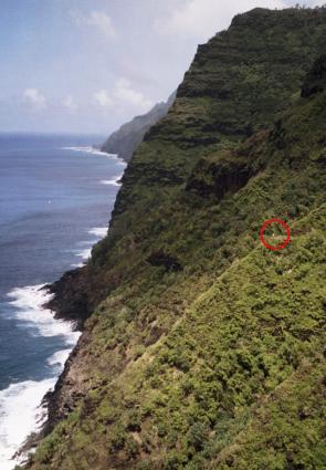
View from Hanakoa to Kee, note the hiker
HanakoaFalls
You can’t really see the top of Hanakoa falls

Hanakoa valley also has two viewpoints that reward the adventurous hiker. At both points where the trail turns to go into and out of the valley, there is a small ridge that continues toward the ocean. Leave your pack by the trail, grab your camera, and scramble through the bushes onto these rocky outcrops. You can’t go too far until it gets steep, narrow, and dangerous, but that extra perspective gives you great views up and down the Na Pali coast and into the valley. I believe the photo on the left above is from the NE ridge, and you can see my wife hiking further down the trail towards Kee, itself visible at the end of the cliffs.

In the original post, I mentioned Space Rock, which I call the Gate because that’s more what it looks like. It’s where the trail squeezes between a large boulder and the cliff face, around the 3.5 mile-mark, after leaving Hanakapiai and just before entering the first major valley of Hoolulu. This is the highest point on the trail at over 700 feet (over 200m), and if you are not subject to vertigo, you can walk around the rock and look straight down into the ocean.

In Kalalau valley, I’ve also described how to get to Big Pool. Several sources mention Davis Falls, which are the major falls on the N wall of the valley that you can see from the Kalalau lookout and from one point on the trail to Big Pool. The Boy Scouts actually built a trail to the falls but it was cut off by damage from the hurricanes, and then lack of use made it disappear. I have explored some other trails in the valley, and people have told me where to find that one, but I’ve never really looked for it. Maybe some of the “resident” hippies can tell you, and then you can share it with us here.

One place to find those “residents” and more views of the Na Pali is on the bluff between Red Hill and the stream crossing. The easiest way to find it is to walk back to the base of the eroded Red Hill you descend on into the valley and then cross the grassy bluff to the cliff edge. You can get down to a boulder beach to the right, and there is a faint trail that loops around to left on the bluff, joining the main trail just above the stream.

Finally, there are many views from the trail itself, just look up and look back often to see them. There are also some possibilities for exploring elsewhere off the trail, but I don’t know many of those and none lead to new viewpoints. If you do feel like exploring off trail, please walk carefully to avoid causing erosion and killing plants that prevent erosion, and do not disturb any ancient rock walls you might find.
FromKalalauTrail
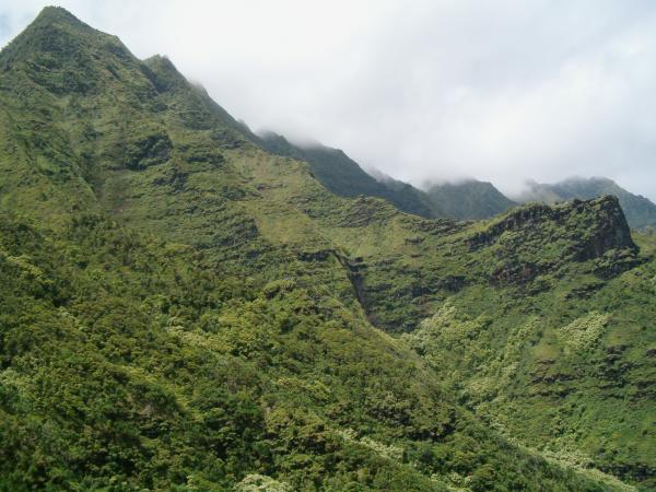
Looking up at the mist-shrouded peaks above what I think is Waiahuakua valley

Q: Is catching fish a feasible feat? We obviously don’t intend to base
our food supply on that, but something sounds cool about catching a
fish for dinner while on the trail.

A: The only places you reach the ocean are at Hanakapiai and Kalalau Beaches, so you’d most likely be fishing from your base camp in Kalalau. Shore casting is practiced widely throughout Hawaii, from both rocky shores and sandy beaches, and I suppose Kalalau would be as good a place as any. I am not a fisherman in any way, so I have no idea what fish would be worth catching, nor how you would go about it. I do see that most have long poles and weighted lines, neither of which are practical for backpacking, and to be honest, I’ve never seen a shore-caster catch anything (in Hawaii, night fishing is legal but sleeping on a beach is not, so I think that catching something is not always the goal). Come to think of it, I did see someone taking a pole into Kalalau, but I have no idea if they were successful. Another option if you snorkel is to go spear-fishing, but I don’t know anything about that either.

Food for long backpacking trips is always a problem. The two hiking stores in Hanalei, Peddle and Paddle and Kayak Kauai, both carry freeze dried meals, though it will be cheaper to bring from the mainland I imagine. Because those are usually bland and oversalted, we have moved towards other calorie-dense foods. The organic food store in Kapaa (Papaya’s, near Safeway) has powdered soups, hummus, and refried beans in bulk (be sure to pack them in stronger bags before hiking). Mix those with filtered or boiled water and some olive oil, and roll inside tortillas, for a hearty and healthy meal. We also take ramen soup packets and add garlic, peanut butter, and oil to the cooked noodles.

Q: How busy is the trail at this time of the year?

A: The trail between Hanakapiai and Kalalau is never busy. I think there are 60 permits per night in the summer, but many are kayakers. So you probably only have 10-15 people going each way beyond Hanakapiai each day. It’s enough to make you feel secure knowing that if you have a problem, someone will be along in a few hours, but not so much that you loose that sense of getting away from it all. If you stop at the places I mention above, you will most likely have them all to yourself for a while. The rest of the year, there are even fewer people on the trail, but between all the people I hear from and the “hippies” who hike it regularly, I doubt you’ll ever be all alone.

I have mentioned the throngs of day-hikers between Kee and Hanakapiai above, probably 100-200 on a sunny day. Between 10am and noon, most are hiking in, and from 2pm to sunset, they all hike out. You probably can’t avoid them, so it’s best to know you won’t be making good time on that section, either getting behind slow people or having to stop when crossing large groups. After the splendid solitude on the rest of the trail, it can be annoying, but you can see it as a preparation for getting back to “civilization” and feel a little smug knowing that those 2 miles are what 95% of the tourists consider the Kalalau trail experience.

Q: I keep seeing over and over that the beaches along the trail are
not safe and not to go in them, is there any good swimming/snorkeling
along the way?

A: Again, the trail reaches sea level only at Hanakapiai beach and Kalalau Beach. Anywhere else in between there are dangerous cliffs below the trail, and the coast inaccessible for all intents and purposes. Hanakapiai is the treacherous beach with the most drownings on Kauai, so no one will suggest you go swimming there. It is a tiny bay between large cliffs, and the offshore currents combine with the large stream to create unpredictable rip currents in the bay. People die because they get swept out to the open ocean, not back to shore, and even if they do reach the rocky shore there is no way for a weakened person to climb onto the wave-battered cliff.

Kalalau is a different story. It is a long sandy beach where you can see up and down the coast. There is still a current going left as you face the ocean, but it will take you down the beach before carrying you offshore. I’m sure rip currents are possible with any size wave, but I have swum here when the waves weren’t too big, 2-3 foot (up to 1 m) face max. I am a medium swimmer, and although i could feel some currents and some churning, I was able to handle it.

If you want to go in the water, watch the waves for a while, throw a stick in the water, see if others are swimming, go in slowly to get a feel for the currents, and stay alert at all times for drift and undertow. One rule of thumb is that a steep slope on the beach indicates a steep slope in the water, so go in the water where the beach has the gentlest slope to avoid deep water. But once you’re comfortable with the conditions, jumping and bodysurfing in the waves is a blast. Again, bringing fins could give you an added margin of safety.

As far as snorkeling, Kalalau isn’t known as a great destination. It lacks a fringing reef, so there is no shallow lagoon where fish frolic. I’ve noticed two areas with potential fish habitat: the rocky bottom of the beach towards the Kalalau stream and the boulders and cliff-face on the swim to Honopu. Of the two, the rocky bottom around the stream is shallower and has calmer waves, but it will be murky after rains due to run-off. The rest of the beach is all sandy and drops off relatively quickly, so I don’t think there is much to see (but let me know if you try it).

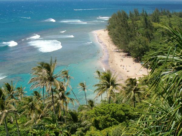
In the end, the best swimming and snorkeling along the Kalalau trail is Kee beach at the trailhead. It gets “crowded” on summer afternoons, but there’s a reason.
KeeBeachFromTrail
Kee Beach seen from the first lookouts along the Kalalau trail