Distant Island Neighbors

Update: I wrote this post without realizing it’s Geography Awareness Week.

I’ve always had a passion for geography and maps. I love to just “read” an atlas, looking at details on maps and trying to imagine what life would be like in remote places. For the longest time, I wanted a globe, and now I have two above my desk (not so I can see both sides of the earth at once, but because they were $1 each at a garage sale). Now, the Google Earth application lets me play with a virtual globe with all the benefits of placemarkers and zooming in to incredible detail (see the KML links below that work when you have Google Earth installed on your computer).

When I lived near mountains, I was interested in distant mountain ranges; now that I live on an island, I like to search for far-flung islands that stand out by their isolation and striking features. I am fascinated by small islands, and I see them as microcosms, finite enough (fractals and scuba excluded) that I can wrap my mind around them, perhaps even know “everything” about them. It helps if the island has an exotic or foreboding name, and it’s always a bonus if there is some good maritime story in the island’s history.

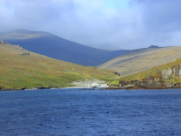
Barren green and brown slopes of Crozet Island with a flock of penguins

Source: Aceduline on flickr.com

One place that combines mountains and glaciers (and my francophilia) on a remote island is the Kerguelen group. I always wanted to blog about it, as a sort of antipode to Hawaii—and it is practically on the other side of the earth, but somebody beat me to it. Check out that link for a brief description, and links to more photos and information.

The problem is that after reading that article, I spent three hours exploring Google Earth and looking for islands. I’ve read a lot about the South Pacific islands, so I focused on the South Atlantic about which I knew almost nothing. By comparison, the Pacific seems relatively well inhabited. Just so that time is not completely wasted, here’s what I found:

  • Wikipedia calls Tristan de Cunha the most remote inhabited island, although I’d be interested in their definition of remote (closest people, closest island, closest larger island, or closest continent?) and inhabited (temporary, permanent, non-scientific?). A nearby island is called Inaccessible, and indeed it was not fully explored until recently.
  • Gough Island (once known as Diego Alvarez) should qualify as obscure, being administered by Tristan de Cunha 800 miles away, itself a 1350-mile dependency of St. Helena, an oversees territory of the UK. The photos on this site make it look very Hawaiian, though I imagine the climate is quite different. The only inhabitants are South Africans who run a permanent weather station there [KML] (that view makes me think of the game Myst).
  • The British equivalent of Kerguelen is South Georgia, over which the Falklands war was started (among others). Having skiied cross country on a mountain-top glacier in France (Glacier de la Vanoise, not a picture of me), I began to understand what these places must look like.
  • Google Earth screenshot showing the islands of the south Atlantic

    Source: Google Earth

  • Mimicking Gough administratively are the South Sandwich Islands, far removed from South Georgia, itself once dependent on the Falklands. They form a quite regular crescent in the South Atlantic, some 250 miles long. Only one pair of them, including Vindication Island, is visible in high-resolution in Google Earth [KML] (note the icebergs dotting the ocean there).

    Update: National Geographic Magazine has a full article on the South Georgia in their December 2006 issue with photos and video online.

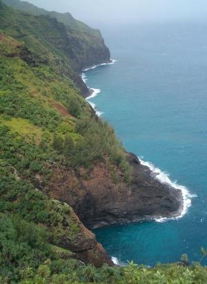
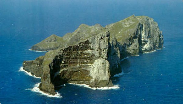
  • In the other Sandwich Islands named by Captain Cook, Nihoa Island (above) is only 150 miles from Kaua’i but lacks rain and therefore much vegetation. It was once inhabited, perhaps seasonally, but access is restricted now as part of the new Northwestern Hawaiian Islands Marine National Monument (3MB PDF, with maps).

    Nihoa is 171 acres, about 1 sq km, with 900 foot cliffs, 300 meters, to the east and steep slopes on the west

    Source: http://atsea.nmfs.hawaii.edu/islands/nihoa.htm, photo by George H. Balazs

  • Then there are all the “rocks” that stick out of the oceans in random places. While you don’t expect to see these in Google Earth, Wikipedia often has photos of these incredibly remote places. Shag Rocks are 240 km from South Georgia mentioned above. The well-named Rockall is 300 km from Scotland but has a satirical newspaper online. And Hawaii’s entry in this category, the Gardner Pinnacles, are the remains of a volcanic island perhaps once the size of the Big Island now in the process of becoming just an atoll.

Kalalau Trip Reports

After writing my description of the Kalalau trail, I’ve come across several other trip reports on the web. These provide some other details about the Na Pali coast, and I find them accurate compared to my past experiences:

  • Kayak Kauai is a local outfitter that runs kayak and hiking tours of the Na Pali coast. They just published a description of the Kalalau trail which I find accurate, including having an empty and washed campstove fuel bottle tossed out by an airline (despite the 9-11 security measures, I still believe they are over-interpreting FAA regulations, but we were lucky, I heard they now take away the stoves). One point where I’ll disagree is the warning about leaving a car at Kee beach. We have left cars parked there, mostly empty and locked without incident, but they were not shiny new rental cars. Now that there is a ranger stationed at Haena, I think leaving a rental car there is justifiable, as long as:
    • You leave nothing inside that you wouldn’t want to lose.
    • You have paid with a credit card that gives you extra rental insurance.
    • Your flight doesn’t leave the same day you plan to finish hiking.
    • Actually, maybe you should just find the ranger and ask about it.
  • GORP.com has a classic trail description that includes some of the characters you might meet along the way. It also mentions the helicopter nuisance.
  • DayHiker.com has an extreme hike report of somebody who hiked-jogged in and out in one day (8:30-4:30, which I find barely believable, though perhaps without a pack).
  • The previous writer should participate in the Kalalau Challenge: swim to Kalalau and hike-run all the way back (2003 winner’s time was 6:04:15). This video of the race has some good footage of the trail and scenery:

    Or if you prefer to watch “Kalalau Challenge” on YouTube.

  • And finally, some amateur video of people on the trail. These aren’t very good, but they give you some more first person accounts: search YouTube (Google video only seems to have stock aerial footage of Na Pali, but maybe that will change)


Update: As I find more Kalalau trip reports on the web, I’ll add them here:

  • A travel journal from 2002 that gives one experience of hiking in and out in two days (start reading at 17.03.2002; there is a photo link but they do not display). This account is notable because the authors are true traveling backpackers: they did not rent a car and hitch-hike from the airport to Kee and back, with mixed results. Also, they chose to forgo all camping permits and spent some time fearing the ranger.
  • A guy from Oahu wrote to tell me he blogged about his day-hike to Kalalau and back (that link takes a while to load). He was ready to start before sunrise, but when he saw some hunters starting out before him, he wisely decided to wait until daylight. He made it all the way to Kalalau beach and back to cell-phone reception (probably around Lumahai) before sunset, which was his friends’ appointed time to notify rescuers to go looking for him. I suggested that 9 or 10pm was a better time, especially because he did bring a flashlight. At the bottom of his page he also has an animated flyover of the trail that he made from my trail maps, so that’s worth checking out.
  • Another day-hike to the beach and back by a group from Oahu. I’m not a big fan of their writing style, but they do have some funny pictures, and the minutes-per-mile table at the end gives other hikers an idea of what to expect.
  • The ultimate solo single-day hike to the waterfall at the end of the trail and back in just under 12 hours. On top of that, the guy took the wrong trail at Hanakapi’ai and walked a mile up the valley before realizing his mistake, for a total of 24 miles. If you look around his website, you’ll see this guy is a peak bagger in California, and he did several other very impressive hikes the same week on Kauai—the guy is a hiking machine.

Update: Since this post is morphing into a list of resources for further information, it wouldn’t be complete if I didn’t mention the book and the map for going to Kalalau:

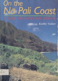
OnTheNaPaliCoastOn the Na Pali Coast: A Guide for Hikers and Boaters, by Kathy Valier. I borrowed this book from the Kapaa library a while ago (H 796.51 V, in the Hawaiiana section), and I remember it being very thorough. It does favor kayaking over hiking in the amount of details, but that just made me want to kayak the Na Pali coast someday.

NWRecreationMap

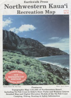
Northwestern Kauai Recreation Map, by Earthwalk Press, available in a weather-proof plastic edition. You don’t need a topo map to hike to Kalalau, but if you’re like me and you love maps , this is the one to take. It’s a topo map printed on a plastic sheet that covers Na Pali, Kokee and upper Waimea Canyon. It also has an enlarged map and accurate description of the Kalalau trail on the back.

You can buy the books through Amazon with the links above (or on my bookstore page) and support my blog. If you’re on Kaua’i, you can buy both from Kayak Kauai in Hanalei and support an island business (I’m not affiliated with them).


Blogroll Finally

A blogroll is a list of links from one blog to other blogs. It usually represents the blogs that inspire or inform the writer of the blog in question. It is usuall presented as a list of links and sometimes images to the side of the main content, as you can see in the right column on this blog.

Ever since I’ve started blogging, I’ve been on the lookout for other blogs about Kaua’i, and while I have mentioned them sometimes, I never had time to set up my blogroll. This evening, my wife who designed the layout of this website created the little image and got my blogroll … ahem, rolling.


IslandBreath.org masthead

I’m happy to reserve the inaugural top spot on my blogroll for IslandBreath.org edited by Juan Wilson. Juan is an architect who lives in Hanapepe on the west side, and who is concerned about the future of Kauai. He covers environmental and political issues that threaten this island, this country, and the world in general. He knows a lot of insiders from whom he publishes information, added to his own knowledgeable observations and recommendations for saving the character and beauty of Kauai. In addition, he has a knack for illustrating each article with a thought-provoking graphic.

IslandBreath.org is the local website that I read most frequently, at least once a week. It is actually not a blog in the sense that articles are gouped primarily by topic instead of by time, and there is no comment mechanism. I acutally like the grouping by topic because it gives you more depth to each article. If you like reading about Kauai, you should definitely check it out.

Accident Scene

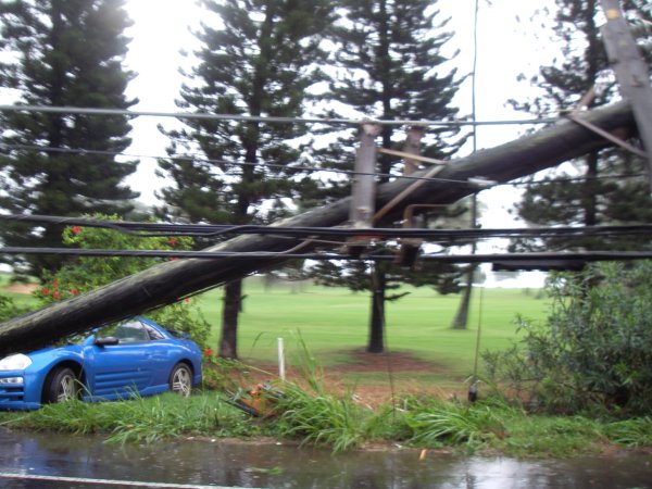
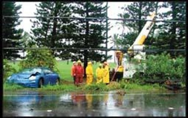
I happened to drive by this accident scene yesterday soon after it happened. Since I had my camera, I slowed down and got a lucky shot (apologies to the drivers behind me). You can see the base of the pole in front of the white stick, and you can just feel the tension on the hanging wires:

A car rests under the telephone pole it completely sheared off, still hanging from the wires

I resisted blogging about it because I don’t feel the need be a local reporter, nor do I have the time. Accidents are mostly of interest to locals, and while I’d love to reach out to them, the newspaper does it better. Except when it doesn’t:

A utility truck and workers stand beside a wrecked car, it is unclear what happened

Source: kauaiworld.com on Nov 2, 2006, photo by Adam Harju. Poor quality is due to enlargement.

Next time I’ll call them up and ask if they take submissions.

Kalalau Questions

A writer for the SmarterTravel.com website emailed me asking for info about hiking the Kalalau trail. While I’m a bit put off by their attitude that hiking is just a cheap way to see Hawaii (“[the hikes] were as amazing as they were inexpensive“), I’m always glad to give out hiking information on this blog. Hopefully they will see the appeal of hiking to their readers and change their attitude–after all, hiking (and walking around) is the only way to see the real Hawaii.

Update 1: I forgot to give the “official website” for the Kalalau trail from Hawaii State Parks.

Update 2: The SmarterTravel.com website does have a more eco-friendly page that lists several hiking and kayaking resources.

Update 3: Several people have asked for more details about the trail, and I have responded at length in the comment section, so be sure to read all the comments.

Update 4: The article about Kalalau has just been published on SmarterTravel.com. It says “Hiking is the best way to get to the heart of Kauai, both in geography and spirit,” and I couldn’t agree more.

Update 5: camping restrictions have changed, and single-night stop-over permits are now given for Hanakoa instead of Hanakapiai–see below.

Q: What is the best time of year to do this hike?

A: Usually in the late spring, (May and early June), after the rains mostly stop but before the ocean is calm enough to allow kayaking. During late-June and July, the weather is driest, but Kalalau is “crowded” with kayakers who overtake the beach and campground. August is still crowded and much more humid, making the hiking very uncomfortable. The rest of the year is hit-or-miss, with perfect weather separated by rainy periods.
ArrivingInKalalau
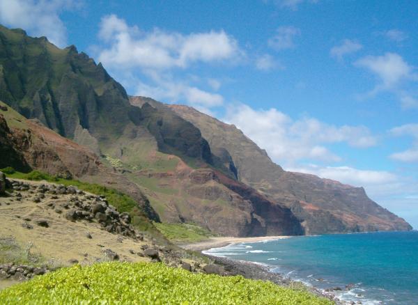
View of Kalalau Beach and the cliffs above as you arrive

Q: Do most fit hikers planning to do the full 22 mile out and back hike take two days, camping one night at Kalalau Beach ?

A: No, I think that is unrealistic. Only extremely fit people can go in and out in 2 days and still enjoy themselves (but they won’t enjoy Kalalau). I know a tourist on a 2-day schedule who had to camp in the dark on the trail, and the next day sprinted to the top of the descent into Kalalau, saw the view, and turned around to hike out. Don’t let this happen to you. My ideal “short” schedule is 4 and a half days:

  • Start in the afternoon and camp the first night at Hanakapiai.
  • Start hiking around dawn and reach Kalalau by early afternoon.
  • Stay 3 nights in Kalalau, giving you time to relax and explore.
  • Get up before dawn again and hike all the way out in one day.

Q: Are there designated camping spots at Kalalau Beach ?

A: There is a designated camping area right next to the beach with fairly clear tent sites. Some tent sites overlooking the beach or waterfall are idyllic, but they are all available first-come, first served. There are many more campsites in the forest, 50-100 yards from the beach. There are a few secret spots too.
KalalauCampground
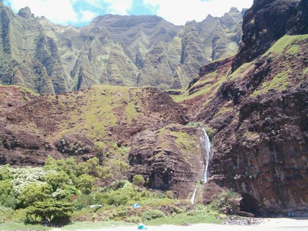
Nakeikionaiwi cliffs and Hoolea waterfall above the camping area

Q: How many camping areas are there along the trail (I heard the one at Hanankapi’ai is closed)?


A: There used to be permitted camping at Hanakapiai and Hanakoa. I’m fairly sure Hanakoa is closed indefinitely, and you wouldn’t want to camp there anyways because of the trash, pigs, mud and mosquitoes. I have not heard that Hanakapiai is closed, but it is very possible. They have to close the campsites if the composting toilet is out of order, and that happens often with vandalism/retaliation. Again, there are some secret spots too, obviously non-permitted.

Update July 2007: camping restrictions have changed, and permits are now given for Hanakoa instead of Hanakapiai. I had previously heard camping was restricted at Hanakoa to preserve the archeological sites (rock walls and terraces), but Hanakapiai was becoming so overused that the park managers decided its sites were now more at risk. Hanakoa is the more logical half-way point to camp, and people were camping there anyways, but I still find it to be too muddy, muggy, and buggy.
HanakapiaiBeach
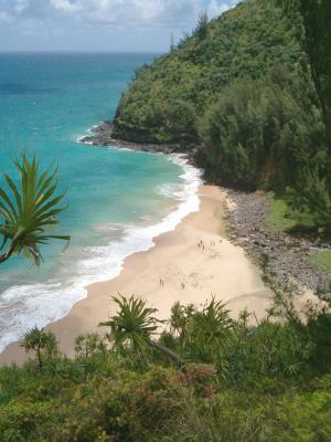
Hanakapiai Beach from the south
HanakapiaiOuthouse
Composting toilet in disrepair at Hanakapiai

Q: Can you briefly describe the physical landscape you’ll experience on this trail?

A: The trail skirts the NW and W facing cliffs and valleys between the wet north shore and drier west-side of Kauai. The 11 mile (18km) trail was established by the Hawaiians centuries ago and follows ledges on the cliffs and dips down into 5 major valleys (including Kalalau) and numerous little gullies.
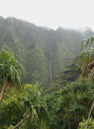
WaiahuakuaValley
Lush and misty Waiahakua Valley
SouthOfHooluluValley
Na Pali coast south of Hoolulu Valley

The ledges are usually plenty wide and vegetated, offering views up and down the coast as well as cooling sea breezes. During winter and early spring, it is common to spot whales in the ocean. The valleys are lush and humid, offering views of waterfalls and green mountains. You can often find edible fruit such as wild guava, lilikoi (passion fruit) and mountain apples (a tropical fruit not related to apples). The large valleys involve stream crossings, and most gullies have water for drinking after treatment. Near the end, you reach a crest, turn a corner and Kalalau Valley opens up before you, with near-vertical walls curving inland and around to the beach on the opposite side.

Q: What would you say are the highlights of a Kalalau hike?

A: If you mean highlights of the trail, it would be the views up and down the Na Pali coast (the cliffs) , the view 700 feet straight down from Space Rock, the views into some of the valleys including Kalalau itself, and the exhilaration of going down the last slope to the golden beach and waterfall.
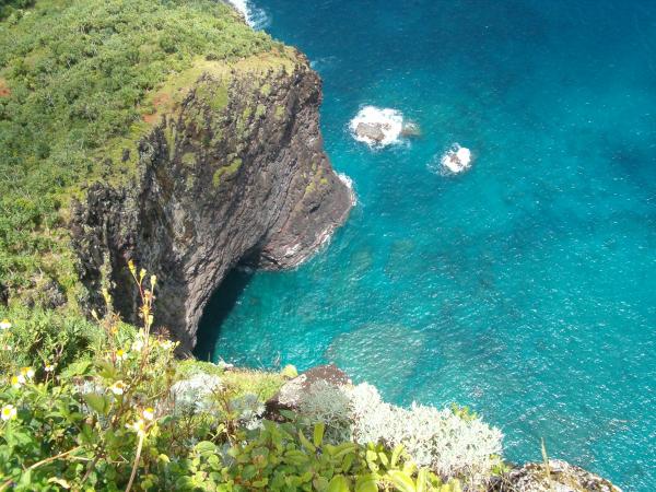
Looking700FeetDown
Looking straight down from Space Rock (the Gate as I prefer to call it)

If you mean highlights of the whole trip, it’s definitely being on a remote beach, surrounded by incredible beauty, exploring a semi-deserted valley, feeling like a hippie and skinny-dipping (technically illegal as well), and of course, the views. Beyond the phyiscal impression, there is a certain sacred awe at being in such a magnificent natural setting. I sometimes call it a Hawaiian cathedral, not just because of the towering cliffs on all sides, but because Kalalau epitomizes the natural balance between the Hawaiian culture and the physical world.

Q: What fitness level and safety precautions would you recommend?

A: I would recommend the Kalalau trail only to very fit and experienced backpackers, which I consider the ability to pack 40+ lbs 15 miles and 3000 feet uphill on the mainland. Note that the elevation gain for the Kalalau hike has been quoted anywhere from 2000 to 5000 feet each way, but I actually think it’s somewhere between 2200 and 2600. Regardless, the heat and humidity make it seem like much more.

You will need the usual equipment: hiking boots, hat, sunscreen, water treatment, etc. An internal frame pack is better because it won’t get caught on low branches and rocks. You should have a screened tent against the mosquitoes and a rain fly against the inevitable shower. You don’t need a sleeping bag, a fleece blanket or bedroll is enough. Hiking poles are useful for crossing streams and balancing heavy packs, but can be an inconvenience in the overgrown sections.
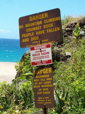
WarningSigns
Warning signs from the state at Hoolea falls
SteepDropoffMile7
Scariest part of the trail

Safety Precautions:

The trail itself can be treacherous. One cliff-face around 7 miles has a very steep and impressive dropoff, one eroded section at 8 miles requires careful footing, and in some places the overgrown vegetation pushes you off the narrow trail or hides a dropoff.

Only the first valley of Hanakapiai has a sandy beach in the summer, but swimming there is NEVER recommended. Swimming at Kalalau beach is possible but dangerous due to strong waves and rip currents. As the safety slogan says: “When in doubt, don’t go out.”

Some people pitch tents or sleep directly on the beach in the summer. While technically illegal if you’re not actively shore-casting, it is also very dangerous if the beach is not wide enough to stop the occasional rogue wave.

All water from streams and waterfalls must be treated due to the Leptospirosis hazard. Boiling for several minitues is still the most effective; the bacteria can theoretically go through a 1 micron filter, so you should add cholrine drops to filtered water.

Heavy rains are possible any time of year, making the trail muddy and slippery, making streams impassible, and sometimes causing erosion that physically cuts the trail. Never cross a flooded stream, people have been swept downstream and over waterfalls to their death. When the trail is impassible due to severe weather, you will be stuck overnight or longer in Kalalau or one of the wetter valleys. State agencies will perform helicopter evacuations after several days only if the trail is predicted to remain impassible.

Q: Any other comments you’d like to share?

A: Kalalau is definitely a world-class hiking trail, though you wouldn’t know it from the way local agencies fail to maintain it. However, they still collect fees and enforce permits. There are permit quotas year-round, and the best summer weeks must sometimes be reserved a year ahead of time. For permit information and availabililty, call the State Parks at 808-274-3444 (8am-12 and 1-4pm locally). Recently, due to a crackdown on illegal camping, mostly by hippies who live off and on in the valley, rangers have been helicoptered in to check all permits. So do not assume you can get by without a permit because it is so remote. Finally, if you go, please preserve and protect the area as much as you can, avoiding erosion and keeping it clean for future hikers and future generations.

If you’ve read this far, I’ll share another tip with you: if you’re looking for specific trail information, you can email me, Andy {AT} great-hikes.com, and I’ll try to answer your questions here. I originally wanted to give full hike descriptions for all our trails, so you wouldn’t have any questions left to ask, but I haven’t had time for writing that much. If I know people want and need the information, I’m more likely to write about it.