Floods are thought of as acts of nature and many of the people affected by this tragedy want it to be known that its origin is man made, so it is now being called a “dam break” or “dam breach.” However you look at it, the effects are impressive. Wailapa Road just east of the stream is reopened, and I was finally able to go back in the area for some more photos. This is the Wailapa stream bed further downstream of my previous photos, next to the dirt road to Rock Quarry Beach (Kahili Beach). Here, the stream leaves the flat agricultural (now residential) land and cascades down 200 feet (60 meters) to Kilauea Stream near sea level.
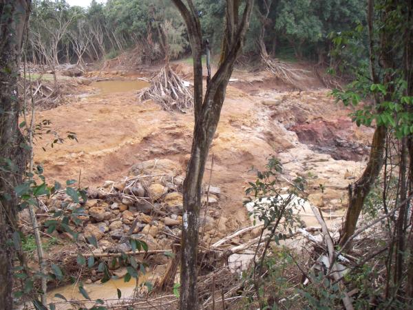
The picture above is the stream seen from the road. It arrives from the upper-left through a wide area that I believe is a man-made pond, curves around out of sight to the lower left, and then crosses right to some falls in the next pictures. During the flood, much water went straight over at the top of the picture, washing away a driveway that used to be behind the trunk in the center. You can see branches piled up in front a tree that withstood the flow and some building material washed up in the trees in the foreground.
There were some homemade signs and some printed Dam Mad signs posted in this area asking for an independant investigation of the disaster.
Source: Matt Reifslager via Julian Miller
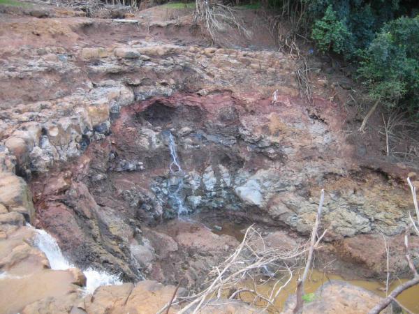
These photos show the waterfall, from the road-side above, and after crossing where the driveway used to be below. I never knew this waterfall was here, or even the stream for that matter. It was a small stream before the dam broke, and the vegetation hid the terrain. A friend refers to it as Bette Midler’s falls, so maybe she owns the property around here. In additions to all the erosion, there is a lot of re-bar in the middle of the falls and you can see a cement and stone wall below. I wonder if there was some sort of construction here that was totally destroyed. I’d be interested in seeing photos of this area before.
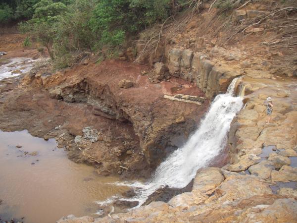

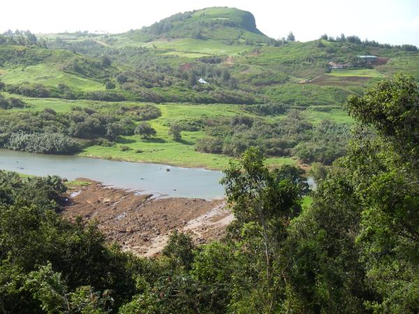
These photos show the extent of the erosion all down the stream bed. Above is looking down from the falls. Below is from another place on the bluff looking at where Wailapa stream meets Kilauea stream. It’s hard to get a sense of scale on this last one, the current stream is the brown flow at the right of the alluvial deposits, and those are tree trunks on the opposite bank.
There are more photos of the devastation on The Garden Island website: page 1, page 2. They have some pictures of the reservoirs from helicopters, which I will probably never get to fly in.