Hawaiians historically had footpaths for getting about on land. On Maui and the Big Island, some of those paths that traverse ancient lava flows have been preserved, but on Kauai, vegetation and erosion have erased all the paths that fell out of use. So, several years ago, I was excited to hear that one of these historical trails was preserved near Moloa’a Bay.
To understand why there is a trail along Moloa’a Bay that still exists and why it is still important to local people, you have to look at the geographical history of the area. I am just an amateur geographer who has read some history books, so this is no more than my speculative history of the area.
Historically, pre-contact Hawaiians lived in ocean-side communities, farming the low river valleys, gathering seafood inside the reefs, and fishing out beyond them. Thus it is likely that Anahola valley, Papa’a valley, and Moloa’a were all farmed and inhabited. Of those, I believe that only Anahola has a shallow reef area, but it is rather small. Much larger is the reef area at Larsen’s beach, further to the north. The calm, shallow waters inside reefs were important sources smaller fish, shellfish, and limu, the edible seaweed.
In order to reach the resources at Larsen’s, the coastal residents would likely walk the easiest and most direct route to get there along the coast. Thus the coastal trail they established probably followed inland of the beaches and up over bluffs on the easiest route. I am not sure if this path was the main passage for travelers going around the island, but seeing as how it connected populated areas, it likely was. Since Moloaa stream forms a wide valley over 200 feet deep further inland, the coast would probably be the easiest route.
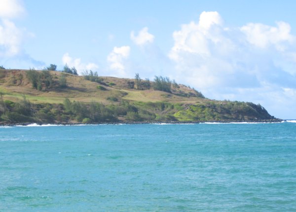
This photo shows the bluffs on the west side of Molaa Bay. The coastal trail stays near sea-level until the middle of the picture, then it climbs up to the middle “bench” on the right:

After western contact, land ownership became established in favor of agricultural ventures. Initially, only the flat land at the tops of the sea-bluffs was useful for sugar cane or ranching, and that’s were the land parcels were sold. As transportation developed, new roads were needed to connect the new towns, and the shortest way was no longer along the coast. For example, I believe that Koolau Road which switchbacks down into Moloaa valley from the main highway was part of the original road between Anahola and Kilauea.
However, these new roads cut through the flat agricultural land. To compensate the owners, the government gave them the marginal coastal land in exchange. This is the sloping bluff area that extends from the original parcels down to the high-water mark along the shore, where the tail weaves up and down along the safest route. The land was unusable to the government anyways, and the ranchers could use some of it for livestock grazing.
Despite all the changes, a few people still lived in the coastal communities and found it easier to go fishing and limu gathering on the established trail. One kupuna (elder) resident of Moloaa recalls taking part of the trail to school, which used to be located on Koolau Rd, near the cemetary, as well as bringing limu back from Larsen’s with a mule. It was this continued use that preserved the trail for everyone. Fortunately, the government of the time recognized the use of the trail that existed at the time and created a public easement in the deeds of the land that was exchanged. Unfortunately, they ignored the existing trail and reserved the right to create an easement at the high water mark. When the land was just pasture, the ranchers were longtime neighbors of the limu gatherers, and so this easement was not enforced and the original trail was still used.
Fast-forward to the present, and now the land is prime ocean-view real-estate. The owners are mainland developers seeking to put what must be luxury estates on the bluff-top agricultural land, which implies keeping the public as far away as possible to ensure privacy. Although the days when local residents would gather limu and carry it back on a mule are long gone, the public is still entitled access to the original coastal trail created over generations (see my updated conclusion regarding access).
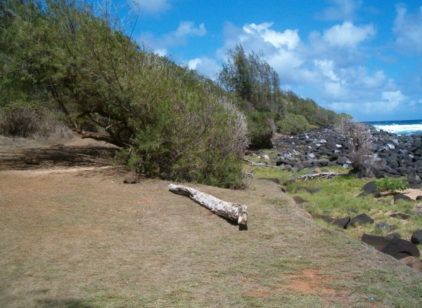
When I first became aware of the Moloaa trail in 2005, the landowner was asking for landscaping permits on the slopes. Hawaii law recognizes the sensitive nature of coastal bluffs, mostly due to the impact that erosion and runoff can have on the reef and ocean, and landowners need special permits for landscaping in the area. Evidently, the landowner’s plans did not even recognize the existence of the historical trail. When faced with the legal obligations of the deed, the landowner followed the letter of the law and proposed creating a trail at the high water mark, in other words, at the foot of the bluffs, through the rocks in the photo below:

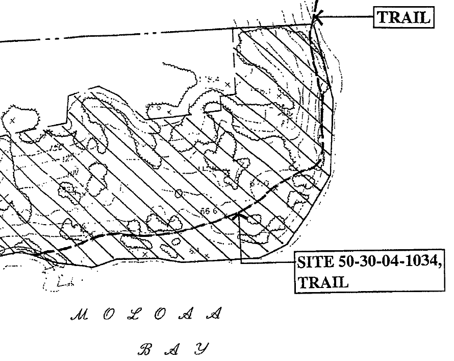
Earlier this year, with the permitting process dragging on, I heard that a new trail had been created, parallel to the original one and pushing the public to the edge of the bluff. Worse, the trail was to be landscaped uphill with a low hedge, to delineate the trail they argued, essentially overgrowing the original trail and denying the public a safe passage. What’s so galling is that the landowner has been told the original trail is a catalogued archeolgical site, as shown in the map below, and that it must be preserved. The way to preserve a trail is to keep it open, have people walk on it.

To be continued…
Additional Reading:
- Malama Moloa’a is a website that catalogues the actions of the landowner against neighboring property owners as well as citations issued for permit violations. I have focused only on the trail, but there are many contentious issues surrounding the development of this property. When you follow the link above, just click the Cancel button when prompted to enter a password—that must be for the site administrator.
- The recent article in the Garden Island newspaper (Sunday, February 10, 2008) about the trail, which I have blogged about before.
- A later article in the Garden Island newspaper (Tuesday, February 12, 2008), summarizing the mixed results of the last planning commission meeting regarding the permits.