Read the beginning in part 1.
Most people have heard there’s a second tunnel, but its wherabouts are not very clear. The Ultimate Guide barely mentions it, and some think that the curvy parts of the first tunnel count as the second. Others correctly conclude it lies on the other side of the Hanalei river, but don’t know where to look. The first time I did this tunnel hike, I started too late to even go looking for it. This time, my friend Adam and I were determined to find it.
So let me repeat my disclaimer warning, and then follow me:
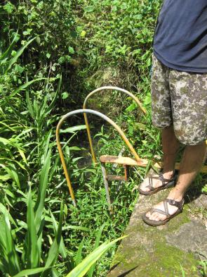
WARNING: hiking off-trail, crossing rivers, and entering abandoned tunnels are dangerous activities. Unmaintained use-trails have many hazards including eye-level sticks, slippery mud, drop-offs concealed by vegetation, and more. Rivers can flood quickly to trap you on the other side. Waterfalls sometimes carry rocks with fatal consequences. Never free-climb volcanic rock because it is unstable. Take plenty of water (or a water filter), don’t forget your flashlight, and turn around to return before dark. Exercise caution and proceed at your own risk.
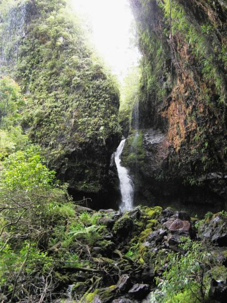
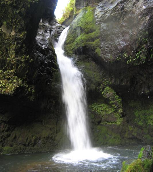
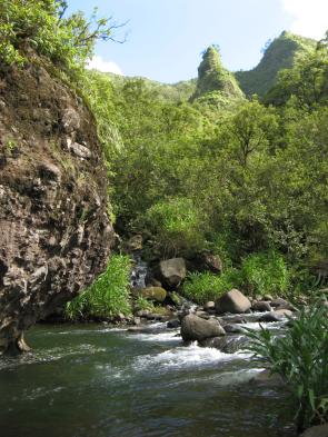
 Across from the house-sized boulder on the Hanalei River, look for a use trail up onto the river bank. Walk past two distinctive clumps of bamboo (I’m starting to think that hunters plant it for sticks), and on up into some really dense grasses (Job’s Tears, actually). The trail really gets lost in here. If you bear left towards the sound of the river, you’ll come out near this waterfall. It is in fact the weir that used to catch some river water and channel it into the first tunnel. |
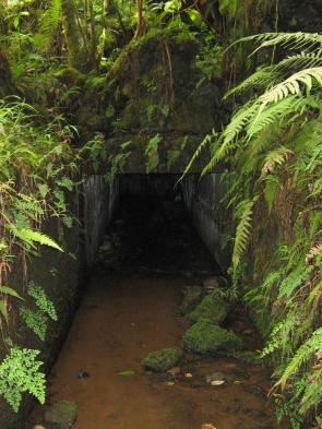
 Again, find a use trail that heads away from the river and up the bank. At one point, you’ll be on a ledge over a big drop-off to your left, half-hidden by vegetation–I think that is the ditch or channel coming out of the second tunnel. Alternatively, if you bear right in the Job’s Tears, you should find a use trail that will also lead to this cement wall without the danger of the drop-off. The ladder is on top of the wall and takes you down into a water and grass-filled ditch. |
|
||
|
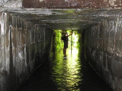
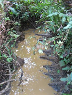
 The rockfall, however, raised the floor of the tunnel so the water in the middle third of this tunnel is deeper and muckier. You have to walk a long ways in 2-foot ( 65cm) deep water, and it’s cold, which almost gave me cramps. The deepest is around 3 feet (1m) deep, almost waist-deep for me, when you have to climb over the first series of wooden braces. They seem sturdy, but they are obviously holding back more crumbly rocks. The second set of braces are in shallower water already (photo above), and they are easier to step over. |
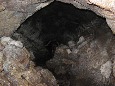
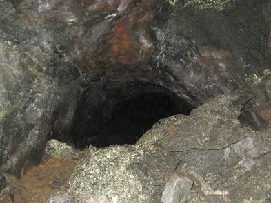
 This tunnel is also perfectly straight, so you can see a light the whole way. The tunnel is actually shorter than the first, but the light is fainter because the opening is smaller. I don’t actually remember if there was waterfall at this exit, but I think not. Again, turn left before the exit and the tunnel continues, then it goes up a short slope before really ending. If the TV show “Lost” could get to a place like this, I’m sure they’d be tempted to use it in some strange plot twist. In any case, take note of the exit so you can find it again. |
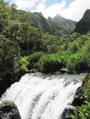
Go straight ahead from the tunnel exit over some rocks to the stream—this is the waterfall you’ve been waiting all day to see. The Ka’apoko stream bounces through a moss-covered cleft in the rock, with water raining down from the overhang.
|
||
|
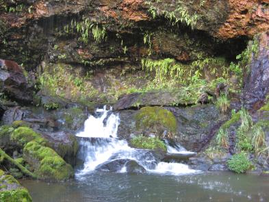
Climbing up the stream, you can easily reach the waterfall and small pool. The pool looks nice and refreshing, but after walking for so long in the cold water, I didn’t feel like swimming.
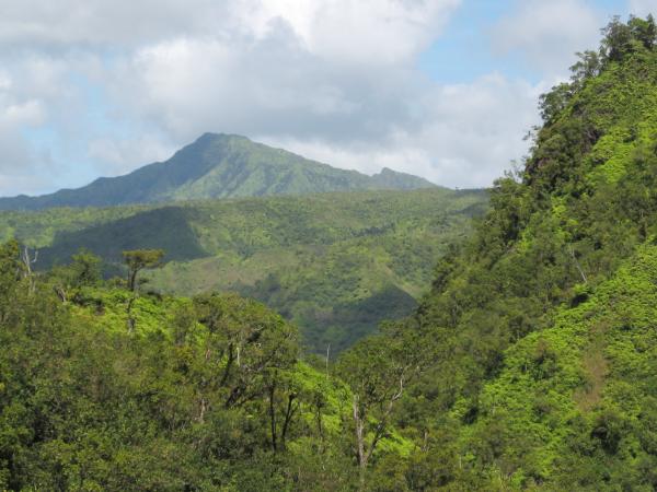
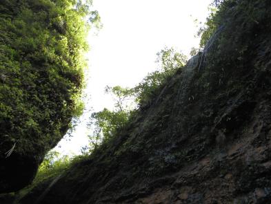
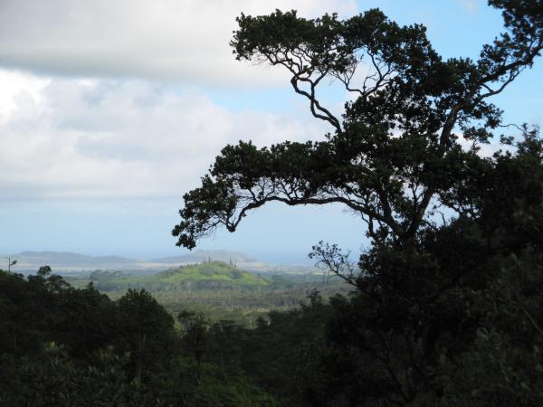
We then climbed up a little until we could get a view out of the valley. Here you can see a peak called Kekoiki (2874 ft, 876m) that is part of Mount Namahana, an inaccessible mountain above Kalihiwai (between Kilauea and Princeville). The ridge in between is the one with the Powerline trail, we could barely see the huge powerline pylons.
|
||
|
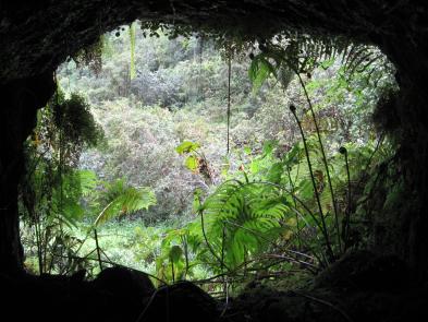

On the way out of the third tunnel, the opening framed the waterfall beautifully.
 By then it was 2 pm and time to head back. From the clock on my camera, the second tunnel takes about 30 minutes to walk through. Back at the Hanalei River, we found the trail that takes us straight through the Job’s Tears back to the house-sized boulder. This photo is looking across the river at the side-stream with the pink flags that lead back up to the first tunnel. |
 The first tunnel is longer but easier and took us just under 30 minutes. Then we put back on our wet pants and wet socks, laced up our muddy boots and faced the mud again. The mud was actually worse than before because we met at least 9 people who had churned it up and trampled the small footholds. |
The hike out took us over 2-and-a-half hours (1 mile/hour), so be sure to save time, energy, water, and snacks for this difficult section. Soon after exiting the tunnel, on the slope down to the big stream, there are some nice views across the eastern lowlands. The closer knob is Hanahanapuni, a small volcanic cone that you drive past on the dirt road. In the distance is Kalepa Ridge above Hanamaulu. This area does have cell phone reception because it’s a direct line of sight to a cell tower.
Other Hike Reports
- There are two short YouTube movies (1 and 2) of the Ka’apoko waterfall after the second tunnel.
- Tripadvisor.com has some threads of people asking for information, only this one had useful information. Another one has more details, but the author was confused by the pink trail markers. I found the markers very helpful and, as mentioned above, only lost them in the dense Job’s Tears grass—but don’t rely on them because sometimes the hunters remove them.
- This hike report has some nice photos from the first tunnel, but this photo has me believing they exited early, took the little trail, reentered, and counted that as the second tunnel.
- This review also criticizes the Ultimate Guide for its inadequate description of this trail and its recommendation to wear Tevas.
- Here’s another trip report that also does not recommend open sandals (Tevas) for the mud. He has some photos and an anecdote about a helicopter rescue on this trail.
- This guy was even worse informed: he went with flip-flops and ended up hiking barefoot. To his credit he tried again (twice) and finally made it through. However, he seems to be the source of the misinformation about exiting and reentering the first tunnel instead of following it to the left—do not follow his advice.
- This one has some good pictures, and he obviously found the 3 tunnels, though he counts them differently. However, many of his estimated measurements are inaccurate.
- And finally, just because I love ditch, tunnel, and waterfall hikes, here is another one (and somebody else’s photos) that I found on Madeira, the Portuguese island off the coast of Africa. Most of Hawaii’s Portuguese immigrants came from Madeira because the sugar industry that sponsored them realized they would already be familiar with living on a tropical island. It also seems like they were adept at creating irrigation works, which may explain the genesis of the Kaua’i tunnels in the first place. In any case, Madeira is definitely another beautiful island.
Hi there. I’m the guy who you mention above as being misinformed, and hiked this hike barefoot the first time, and came back to do it two more times. I was a little shocked to find myself mentioned here. I’m actually going back next weekend to hike this for the 4th time, as I’ve made it far, but not all the way yet. I’d LOVE to talk with you before I go and get things strait in my head so that I can finally complete this hike. I’m bringing a tent and food with me this time so I plan on staying until I get it done right. Email me back if you have time please. Thanks!
Who built the tunnels and why?
Peter
Hi Peter, sorry for the late reply. The tunnels were built by the sugar companies to bring more water to their plantations. In this case, the water came from the upper Hanalei river watershed (the main stream and the Kaapoko tributary), and it went to the reservoirs and then cane fields inland of Hanamaulu. I’m not sure which plantation ran them, that would be some interesting research. They had an extensive network of dams, tunnels, ditches, siphons, and trestles to bring the water from the mountains to the sunnier fields.
Ancient crumbling tunnels through which water flows are like some kind of nightmare come to life.