I know I’ve seriously neglected this blog, but I still like to help people who are going hiking on Kaua’i. I just got a question by email, and the answer is worth sharing here:
I’ll be hiking the Kalalau in the near future. I was wondering if there is a topo map available that you would recommend.
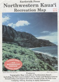
Yes, there is a topo that is great for the Kalalau trail, it’s called the Northwestern Kaua’i Recreation Map by Earthwalk Press. I have a short review of it on my blog, but it is kinda buried in another post. I might as well reproduce it here:

Northwestern Kauai Recreation Map, by Earthwalk Press, available in a weather-proof plastic edition. You don’t need a topo map to hike to Kalalau, but if you’re like me and you love maps , this is the one to take. It’s a topo map printed on a plastic sheet that covers Na Pali, Kokee and upper Waimea Canyon. It also has an enlarged map and accurate description of the Kalalau trail on the back.
Unfortunately, if you click that link to the map for sale on Amazon, some resellers are trying to get $999 (!?!?!) for it. Forget that.
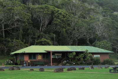
| The Koke’e Museum shop on Kaua’i is selling it online and will of course ship it to you on the mainland. Here are some links to: |  Source: kokee.org |
A quick search also found these online map stores that hopefully still have it in stock:
- Metskers Maps (Seattle, Washington)
- Latitudes Map and Travel Store (Minnesota)
- eMapStore (online only)
- Boulder Map Gallery (Boulder, Colorado)
- The Find, an aggregator that shows some other places as well
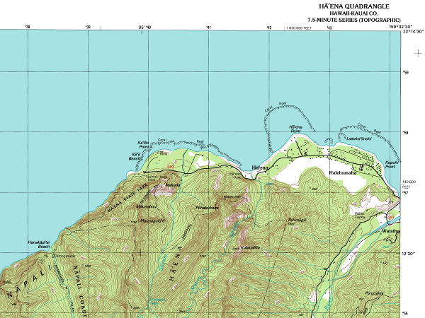
If the map is really out of stock and out of print, your next option is the USGS topographic Haena “quad” (7.5-minute series) that covers the Kalalau trail on one map:

Click map for larger version
The USGS topos for Kaua’i are usually available on-island at the Kaua’i Museum store (808-246-2470) and the Koke’e Museum store (808-335-9975). Give them a call to see if they have the Haena quad in stock, or order it if you want to get it before leaving home.
Related: I’ve also updated my GPS track of the Kalalau trail with an embedded Google Maps/Google Earth version.
Update April 28, 2011: I don’t think the Northwester Kaua’i Recreation Map is out of print. I have seen it on sale by the check-out stands at the Longs Drugs (and so much more) in Kapa’a. So if you can wait until you arrive, that is an easy way to get it. Of course, if you read this much later, they might not carry it anymore, so call and ask them: (808) 822-4915.
The NW Kauai Rec. Map is still available at Kokee as of May 2012. I just purchased it. The map stops at the Powerline Trail. I would like to find a topo map that shows the center area of Kauai incl. the Powerline and Waialeale areas. Do you know of such a map and where I can get one?
Hi Dwight, the alternatives are the regular paper topo maps, the 7.5-minute series from USGS (1:24,000). It takes 11 of them to cover Kaua’i, and the center one is the Wai’ale’ale quadrangle. The University of Hawaii has digital copies online that you can download, here is an overview of the coverage on Kaua’i. Unfortunately, the whole Powerline trail is covered by 2 quadrangle maps, Wai’ale’ale in the center and Hanalei above it. But if you only want to do the southern portion of the Powerline trail, from the Keahua arboratum to the dividing ridge, you only need the Wai’ale’ale map.
Both the Koke’e museum and the Kaua’i Musueum (on Rice street, in Lihu’e) used to stock the USGS paper maps–though I’m not sure if they still have them all.
thanx for the info