Open Reply to Bill

Bill just wrote to me:

My wife and I have been envious of your ability to make the transition from mainlander to islander. […] But we have to ask, how were you able to do it?! We have looked from afar at the property listings and they are outrageous even for modest properties. And yes, we’ve read that the islanders are just fine with that as more people would like to have that dream existence.

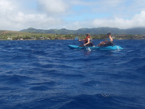
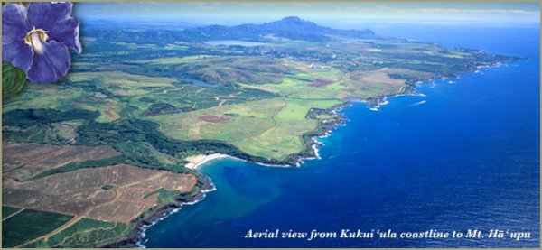
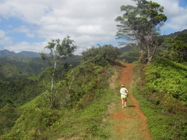
But anyway, just wanted to say hello and thanks for your blog postings. Its very interesting reading and great to see the vivid pictures. […]

I’ve been asked similar questions before, and I think my answer will interest other readers, so I hope you don’t mind if I answer publically.

Hi Bill,

Thanks for reading A Kaua‘i Blog, glad you like it.

There are at least three transitions to make if and when you move here: financial, social, and psychological. Many people leave again in less than two years if they can’t successfully make all three. There is a book called “So You Want to Live in Hawaii” that you should read if you’re considering moving here. It doesn’t encourage or discourage you to move, it just helps you be clear about the realities and your own motivations.

The financial transition is the most obvious, you need to be independently wealthy, have a job lined up ahead of time, or enough savings to last until you find a job. Personally, I took a sabbatical from a computer job to move here and begin the adventure hiking business, and my wife quit her job to make and sell crafts here. We are frugal people and we made the move with our savings. However, we found we didn’t want to live in a shack and we could not afford rent for a decent house with our start-up ideas.

Fortunately, I was able to go back to my California job through tele-commuting and stay on the island. That allowed us to buy a house, barely. I still do guided hikes, but it just can’t pay the mortgage in a place like this. Like my hiking business, I think there is a market for successful entrepreneurs on Kauai, but not much funding. You either need a background in business so you can do a real business plan and get a loan, or scale back your living needs drastically to whatever you can make from your cottage industry.

Any decent (but still small) living space for a couple is at least $1000 per month, mortgage on a small house is around $3000 monthly. The cost of living is roughly the same as the San Francisco Bay Area, just without all the job opportunities. In my estimate, you would need at least one professional salary (architect, engineer, nursing, etc.), or two skilled jobs (contsruction, trade, teaching, government, etc.) for a couple or small family to be comfortable. Long-time residents and local families who own their house can live on two or more service jobs (sales clerk, cleaning, tour guide, entertainer, etc.) because their mortgages are much much lower. For everyone else, the overlap between available salaries and obtainable mortgages or affordable rents on this island is very small.

For career-minded manager-types, the only real opportunities are with the international luxury resort franchises on the island, but they do exist. The good news is that nurses can always find work here, skilled jobs are available for those with experience, and service jobs abound at $10/hr. So people willing to work can usually get started here, long enough to see if they can make the other transitions. The bad news is, the weather is often perfect, the beaches are beautiful, the locals are taking it easy, and you won’t have time to enjoy it. When you move here expecting every day to be a vacation and instead you have to work more than you did on the mainland, you will feel how hard the financial transition can be.

Real-estate is a thorny issue here. Many realtors are just flipping homes to investors, which prices out the locals, and sometimes literally drives them out of their affordable rental. Locals have no mobility because they’re selling older homes and can’t afford the new ones, unless they leave for the mainland. There is also resentment against developers who are taking the green agriculture land that gives Kauai much of its character and turning it into investment/vacation housing. You can guess what happens when there is more housing than open land: no more character and charm.

The social and psychological transitions are harder to see and plan for. If you have a large circle of friends and live close to family, you may find you won’t stand the move. But that may be true even if you move somewhere else on the mainland. Locals and earlier transplants avoid the fresh-off-the-boat mainlanders because so many of them leave even if you take the time to cultivate a new friendship. We’ve had that happen to us. We’ve tried being open to the local culture, both the Hawaiian heritage and the current rural character, and we’ve found people to be friendly, but there is still a limited number of like-minded people on the island who share our professional and recreational interests.

And finally, island fever is real. Activities are more monotonous, and potentials are more limited here than on the mainland, especially if you come from a city. We love the outdoors and are still finding things to discover, but we also miss skiing—fortunately that can be fixed with a winter vacation to California. No such thing as a road-trip in Hawaii, if you’re used to a change of scenery every now and then. Again, it is a question of openness. Kauai has a lot to offer if you’re not busy complaining about how it’s not like the mainland.

And once you feel you’re established here, you may still feel like you’re not treated as a local. It takes much more time for those who were raised here to see you as one of them. You need to get connected to the social fabric and think of the island as home, not someplace you can leave if things go bad. And don’t try to speak pidgin until it feels natural to you. Our friend Gabriela, who has lived here for 30 years, built two houses, ran a B&B, and wrote a book about it, says it took at least 20 years to be accepted into the local community.

To be honest, we feel well established here after 2.5 years, but we can tell that none of our transitions are complete. Buying a house and raising a child on a single income from a remote job makes us financially vulnerable, we’ve met lots of people but have really established only a few friendships, and we do get homesick for the high Sierra or the Alps. So be prepared, but don’t be afraid to make the move. And once you get here, slow down, be open to the local culture, the local activities, and the opportunities that are here. And give it some time.

Aloha!

Ocean Kayaking

This past weekend, we finally had the chance to take our kayak out in the ocean, although we didn’t go very far.

A two-person kayak is dwarfed by the green island and the immense deep blue ocean

The ocean is much rougher in the winter, although the south shore only had 0-2′ (0-60cm) waves predicted, which our kayak can handle. But we weren’t counting on the wind blowing 10-20 knots with stronger gusts. This made the water choppy and paddling even harder.

We launched from the beach next to Kukui’ula harbor near the Spouting Horn, paddled around a small wave-break and then headed back towards Poipu about half a mile (1 km). I don’t think we were ever more than a quarter-mile (400 m) from shore. The goal was to see some whales from a bit closer, but we were too busy negociating the weather to see any. We didn’t see any from shore either, so I don’t think they were around that area.

In the picture you can see our friends Becky and Julian riding on our old blue Cobra Tandem. I was paddling Julian’ one-person kayak to take the picture, while Sonja waited her turn on shore with the baby. It’s fun to see the island from off-shore and get a new perspective on the mountains. I think that is Haupu Mountain in the clouds above Julian. The Kauaian saying goes “The mists of Haupu foretell the rain,” but we only had wind and sunshine.

As a side note, the empty green fields behind the ocean-front houses is going to be developed soon as part of the 1500+ units of the new Kukuiula subdivision. Looking at their site plan, it is even larger than I thought. It goes beyond the Spouting Horn, all the way to the edge of the McBryde and Allerton National Tropical Botanical Gardens that are inland of Lawai beach in the foreground of this photo from their website:

The canefields of the south shore before being paved over by the Kukuilua development
Source: kukuiula.com

Mahalo

As you may have noticed, this blog got a makeover and now looks all neat and pretty. Nothing fancy or outlandish, just enough green to match the content. Mahalo nui loa (thank you very much) to my wife Sonja for figuring out how to change things in WordPress and for creating a good layout that hopefully displays the photos well in all browsers.

If you do see any layout quirks, just leave a comment on this post. Thank you.

For those of you who want to know more, the power behind a blog is that writing a post is as simple as visiting a website and typing in a box. The blog software or the blog service turns your text into a dated and categorized blog entry and presents it nicely to the world. As Sonja did for me, you can then change the masthead and the page layout to suit your needs or your fancy. Readers then access a single URL to see your latest entries or to navigate and find older entries. RSS (Really Simple Syndication) is another feature of most blogs, but I’ll cover that in another post.

You have the choice of installing blogging software on your own website or using a blog service to manage your blog for you. A blog service is the simplest and quickest way to blog if you don’t want or need your own personal website. There are many easy-to-use blog services such as LiveJournal, Blogger, and WordPress.com. It’s as simple as creating an account on their website and then just start blogging on the personal page they give you.

For my Kaua‘i Blog, I preferred the flexibility and control of managing my blog configuration on my own website. After registering a domain name with Network Solutions and paying to have it hosted at 1&1 *, I download the free WordPress.org software, easily modified some files, and uploaded them to my hosting provider. To run WordPress, you need access to a MySQL database, which most hosting providers include. After that, you can blog with the default layout until you have time to personalize your page, or until your wife takes pity on you and does it for you.

(*) Note that most domain name services provide hosting and vice versa, I have separate ones as a result of promotions. It might be easier and not much more expensive nowadays to go with only one for both services.

Pure Speculation

On the Kuilau Ridge hike last Sunday, I caught a few glimpses of Mt Waialeale through the clouds. You often hear about how the Hawaiians used to climb up from Wailua once a year to the heiau atop Mt Waialeale, and I realized I was now looking at the possible routes.

Conventional wisdom says they climbed up to the col that the Powerline trail crosses between two points labeled Maheo and Kualapa on the topo map, and then followed that dividing ridge steeply up and over the prominent Pohakupele (Pele’s Rock), a false summit to the upper plateau of Waialeale. This seems plausible, because the Powerline trail demonstrates that it is easy to reach that ridge, and it seems to slope fairly gradually up to the inevitable steepness of Pohakupele.

The rest of the modern story is that this path was last climbed in the 1800’s, once even by a haole (white person), but that a rock slide has since made the treacherous path impassible. Though I’ve heard somebody wonder if the trail was just simply lost to the vegetation. Nevertheless, some people are still intrigued by the idea of climbing to Waialeale from the east side, some are even trying to find that way, and some are also failing and getting rescued.

For those trying to find a way without getting stuck up there (no guarantees), here’s my purely specualtive contribution. Last Sunday, the way the clouds and sun were shining made it apparent that there is a large cleft, 200-300 feet (60-100 m) deep, in the ridge of the assumed path.

A hazy view towards Mt Waialeale showing the ridges that lead up to Pohakupele, a false summit
Click for unlabled photo.

The height and steepness of the cleft are not readily apparent on the topo map (just above the 3000′ contour label), and I hadn’t noticed the cleft at all other times I’ve had good views of that area. Of course, if ancient Hawaiians or a modern adventure-seeker did manage to reach the cleft, they may have the wherewithal to climb over it or around it. But having hiked in similar places on hunters’ trails, I think it is either impossible or suicidal to attempt without any kind of trail. The cleft looks too steep to climb down and back up, and the cliff face too vertical to allow getting off the ridge.

However, the same view offered me a plausible alternative route that I’ve labeled on the photo. A second ridge also leads up to the false summit that is Pohakupele, generally steeper, but smoother and without any large gaps. It is very steep near the top, but the photo shows the other ridge is just as steep in that area. This alternative ridge begins down near the Wailua river, near the beginning of the Tunnel hike, and is much more direct than following the Powerline ridge to the col. Given the fact that the cleft in the assumed ridge is probably too large to be the landslide that supposedly closed the other route, I speculate this steeper ridge is the old Hawaiian route.

Now all I need is for somebody to tell me if this new route can be climbed.

WARNING: climbing off-trail in the wilds of Kauai is a dangerous idea. What looks like a smooth ridge from a distance is a jagged ridge of crumbly rock covered in dense vegetation that you cannot simply push through, but you can easily fall through with fatal consequences. Exercise extreme caution and proceed at your own risk.

Kuilau Ridge Trail

We went hiking this past Sunday on the Kuilau Ridge trail, perhaps the most underrated trail on Kauai. Big hikers rarely go there because it’s an easy out-and-back trail, less than two miles each way, with 600 feet of elevation gain in all. It starts at the Arboratum at the end of Highway 580 in Wailua, or at least the end of the pavement.

Trailhead sign that also forbids commercial activity and warns hikers about hunters

This is the furthest road inland on the East side, though only 5.5 miles inland and still 5.0 miles from Mt Waialeale. The trail goes north-east, towards the Makaleha mountains in the photo above. It’s the combination of mountain views and lush tropical forest on the ridges that makes this hike so worthwhile, rain or shine. You even see some of the native vegetation, such as the carpet of uluhe, false staghorn fern, and the large ohia lehua tree at the top of this picture:

Rolling red dirt trail on a gentle ridge overlooking lush green valleys

Here’s a view of the picnic shelter at the high point of a very gradual climb. The tallest tree in this photo is a non-native Moluccan Albezia, whose green canopies and light trunks give that jungle look to all the wet areas of the island. The Makaleha mountains are close behind.

A typical State of Hawaii picnic table under a flat corrugated roof shelter and the Makaleha mountains beyond

The trail is an easy road to here and then turns into a easy single track winding up and down to a bridged stream crossing. The topo map says this is the Opaekaa stream, the one that flows spectacularly over Opaekaa falls 3 miles downstream.

A large and sturdy bridge across a tiny stream not even visible through the vegetation.

I recommend going all the way to the bridge before turning around, and even further for some more views if you have the time. The trail is then known as the Moalepe trail that connects to the apex of Olohena road 2.5 miles further–contrary to what the sign says, there is no closer parking area. So you can make it a much longer hike if you want, but it is not as lush and open as the Kuilau Ridge Trail, and the last mile is an unshaded rocky road.