At least I’m trying to publish one every week, and Monday was cooperating:
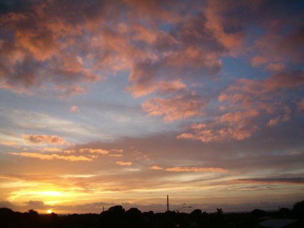


At least I’m trying to publish one every week, and Monday was cooperating:
I usually don’t talk about computers, but I can’t pass up this little tidbit of computational history.
To be more accurate, the ALOHA protocol for packet switching was invented at the University of Hawaii and successfully applied in the ALOHAnet, a precursor to Ethernet on which the Internet runs. It’s actually a simple packet protocol with a high collision rate, which is therefore rather inefficient (18% throughput max), but still close to the best you can do in certain cases such as Wi-Fi. From the Wikipedia article:
Norm Abramson was a professor of engineering at Stanford, but was also an avid surfer. After visiting Hawaii in 1969, he inquired at the University of Hawaii if they were interested in hiring a professor of engineering. He joined the staff in 1970 and started working on a radio-based data communications system to connect the Hawaiian islands together, with funding from Larry Roberts.
By late 1970 the system was already in use, the world’s first wireless packet-switched network. Abramson then managed to get an IMP from Roberts and connected ALOHAnet to the ARPANET on the mainland in 1972. It was the first time another network was connected to the ARPAnet, although others would soon follow.
And since I assume from the rest of the article that Kauai was connected to that first network, I can talk about it here. I wonder if they called it surfing back then…
And no, I don’t think Al Gore had anything to do with it.
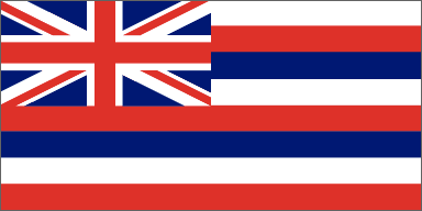
Local Kauaians are usually proud to be Hawaiian, even when they are not ethnically Polynesian. The usual way to show pride in the place you live, regardless of ethnicity, would be to show your flag, However, the Hawaiian flag is really old fashioned and not very Hawaiian looking with it’s horizontal bars and Union Jack:
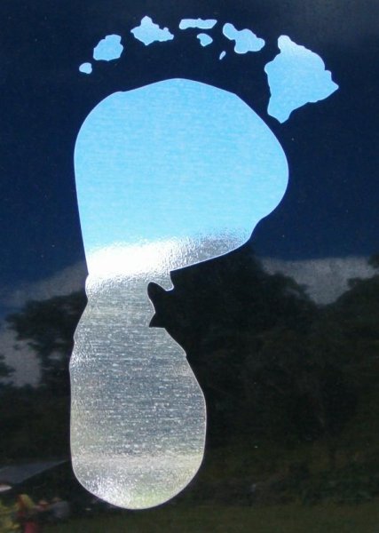
While the flag is used, you often see a geographical representation of the state instead, in other words, a map. Stylized as it may be, the outline of the islands is still recognizable, especially in Hawaii. I’ve even seen Hawaiian map tatoos. Of course, each island also uses its own outline to further show their local pride. The other day, I saw this window decal on a pickup truck, using a very distorted outline in a clever way:
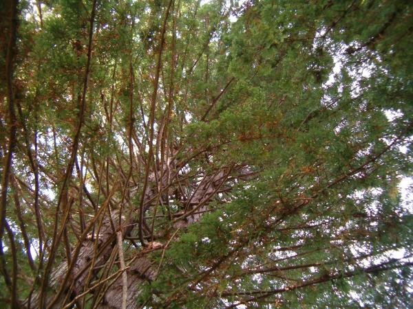
One more post about last Saturday’s trip. Of course we saw trees up in Kokee, the forest with many native trees is one of the main attractions there. However, we ran across two interesting non-native trees.
In the early 1900’s wild cattle roamed the uplands and destroyed much of the native forest, causing erosion. The lack of forest and heavy erosion was threatening the water supply for the profitable sugar cane down below. In the 1930’s, one of the jobs of the CCC (Civilian Conservation Corps) camp established in Kokee was to replant the forest. They experimented with different trees that now grow around the meadow, mostly cedar, cypress, and redwood.
One of the redwood trees between the meadow and the road is perfect for climbing, so we climbed it, nearly 150 feet (50m) to the top. If you look closely, you can see me in this photo, just to the left of center:
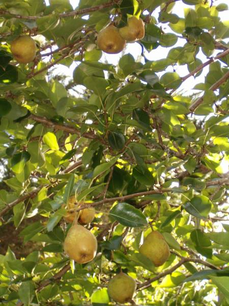
They also planted an orchard of mainland fruit around the old camp, taking advantage of the cool weather at 4000 feet (1300 m) altitude to grow apples, pear, and plums in the tropics. Some of the plums have spread to the nearby forest and they are so sought after that you need a permit to pick them in season. But we found one of the old pear trees, still producing small hard pears. I tried one small one and it was edible but crunchy and not very sweet. We picked a few good ones off the ground and one or two off the tree hoping they’ll ripen at home.
I keep mentioning that we went to Kokee last Saturday, I just haven’t gotten around to writing about it until now. We went to see the annual Eo e Emalani i Alaka’i festival, commemorating Queen Emma’s trip to the Alaka’i swamp. That doesn’t sound like something to celebrate, but here’s the story:
In early 1871, when Queen Emma took a fancy to journey from her Lawa’i beach house up to the isolated reaches of Waimea Canyon and the misted bogs of the Alaka’i Swamp, she set off in a flurry of activity. An experienced guide was sought, provisions and horses were procured, and a path of fern logs was hastily laid through the wettest part of the swamp for the convenience of the Queen and her almost 100 traveling friends. Led by Kaluahi, the guide recommended by Eric Knudsen of Waimea, her party trekked all the way to the Kilohana viewpoint, with a vista stretching to Hanalei and Wainiha. She wanted to see for herself the spectacular views she had only heard about. […] When Queen Emma trekked up the mountain, members of her entourage paused at scenic vistas to compose new chants and songs.
Kauai’s mountain forest echoes with the sounds of Hawaiian music and traditional chants at this free annual festival, held the second Saturday in October, mist or shine. […] Queen Emma and her entourage enter the lovely Kanaloahuluhulu Meadow on horseback, accompanied by as many as thirteen hula halau from around the state who perform ancient chants and dances as gifts for their Queen.
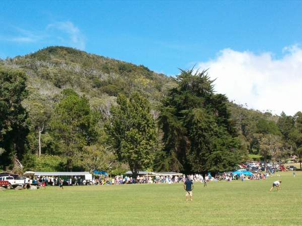
This year there was perfect weather, and the meadow came alive with mele (songs, music) and hula. Usually, the meadow feels big, empty and often chilly, but we took advantage of the break in the hula to have our picnic in the shade on the other side, and it seemed like one big lawn party:
The hula itself was very good, this is the setting that I imagine it used to be performed in. The halau (troupes) chant as they walk in and out facing the dignitaries and all the commoners sit around to watch the performance. This year, there were a lot of children performing, so it felt less formal and more like a recital, with the people eager to show off their dances:
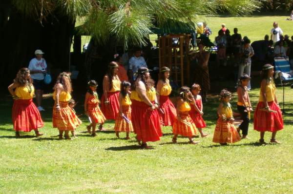
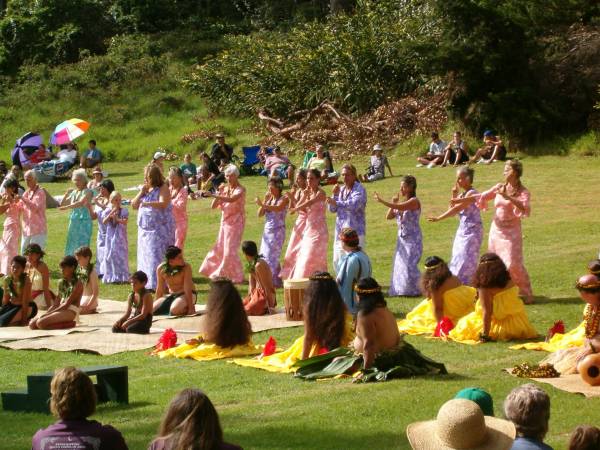
Our friends Katharina and C are dancing in the second picture.