Storm Aftermath

Monday’s storm was really intense, but as the previous week, the normal weather came back fairly quickly. By Tuesday, there was hardly any rain on the coast, Wednesday and Thursday being almost sunny. It did rain more inland, and this created more run-off, but nothing like Monday’s fury.

First, some YouTube videos that are finally getting uploaded after the storm, starting with Opaeka’a falls and some other very temporary waterfalls:

You know, I did go looking for the waterfalls I had once seen on Nounou, but there were always too many clouds in the way.

Then there are the kids that found a wet hill to surf on. East-side residents can probably guess where this is:

And finally, what it was like to drive in the rain. I’ve seen more than one video where the driver is filming, but we’ll assume they were driving slowly to begin with.

That last one is rather telling, because the main damage from the storm was the closure of the Kapa’a Bypass due to a large culvert being eroded and undermining the roadway (photo at The Garden Island)–I wonder how many people drove over it in that condition. The state is working quickly to repair the culvert (HDOT has a release with photos) and reopen the road by next week.
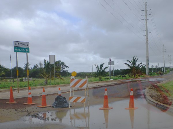
KapaaBypassClosed

In the meantime, the closure is causing bad traffic on the main road, because inland Kapa’a traffic to the Kawaihau and Kapahi neighborhoods (half the Kapa’a population) is stuck on the main road. Count on at least an extra 20-30 minutes to get through Kapa’a, both northbound and southbound at rush hour. At least in Hawaii, you get rainbows with your traffic jams:
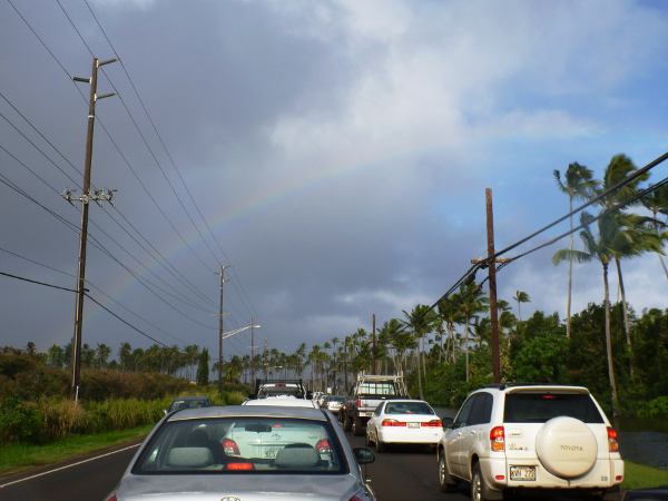
KapaaTrafficRainbow

There is another road closure on the main highway in Kilauea, again caused by a culvert eroding. That one took out half of the roadway, but they have a small detour in place and less traffic.

I did get out for the farmer’s market, and took Kamalu road behind the Sleeping Giant to avoid the traffic. I could tell I wasn’t the only person on the back roads. Do watch out for muddy spots where water washed some dirt over the road.

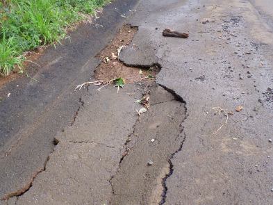
OlohenaRoadPotholes Another effect of the storm were all the pot holes in the roads from the extensive runoff. Once the water gets in a crack in the pavement, it washes away the dirt and digs a hole underneath.

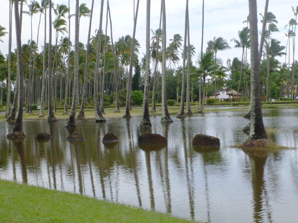
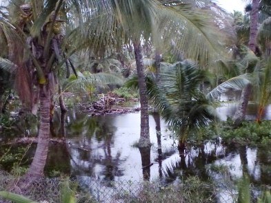
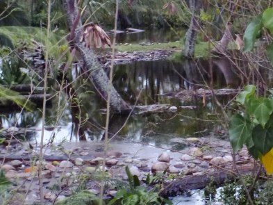
Since I was out and about, I got some photos of the storm aftermath. Water was still flooding the side-streets down by the Coconut marketplace on Wednesday, but by today, there were only little lakes in the low-lying grass:
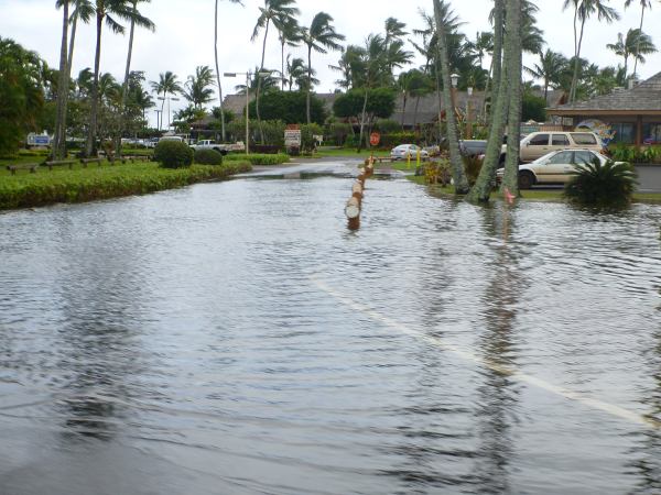
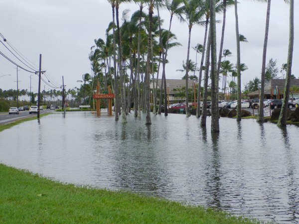
AlekaLoopFlooded

MarketPlacePond1

MarketPlacePond2

On the road to Lihue, the low lying areas around the county jail were flooded, including their vegetable gardens and outside exercise yard. You can see the drainage ditch in the forground overflowing.
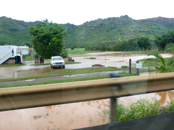
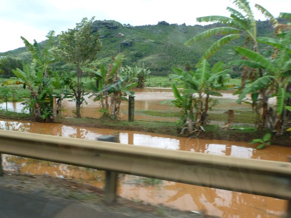
CountyJailFlooding1
CountyJailFlooding2

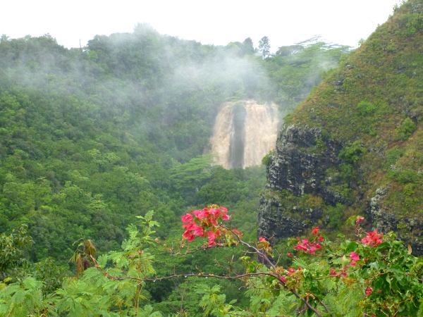
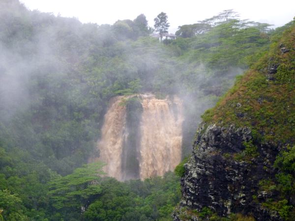
On Kuamo’o Road, I stopped to see Opaeka’a falls again. The flow was somewhat diminshed, and the water no longer so brown, but the things to notice in this picture are the trees in between the two flows that were washed over and hanging on by their roots.
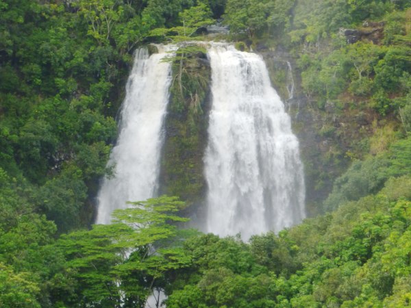
OpaekaaFallsAgain

Driving up Olohena Road, we were treated to this nice waterfall. Most of the water from this little stream is diverted into an irrigation ditch, so it’s usually just a trickle. And this area wasn’t even visible until they cleared out all the hau bush a few years ago.
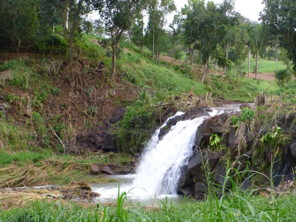
OlohenaRoadWaterfall

And here’s the irrigation ditch diversion just upstream. Like all the little streams in the area, the vegetation got scoured and the mud banks were eroded one or two feet higher than the normal flow.
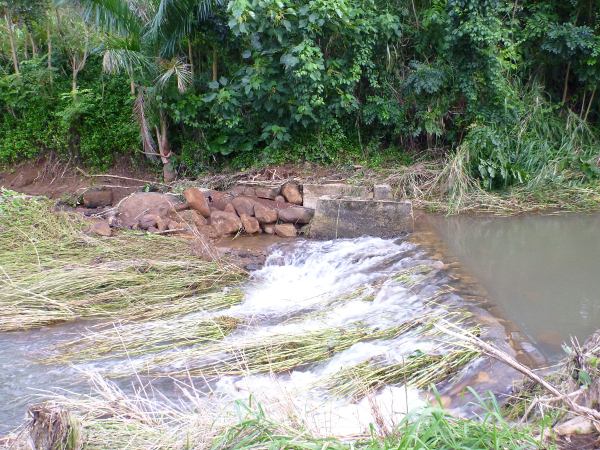
OlohenaRoadIrrigation

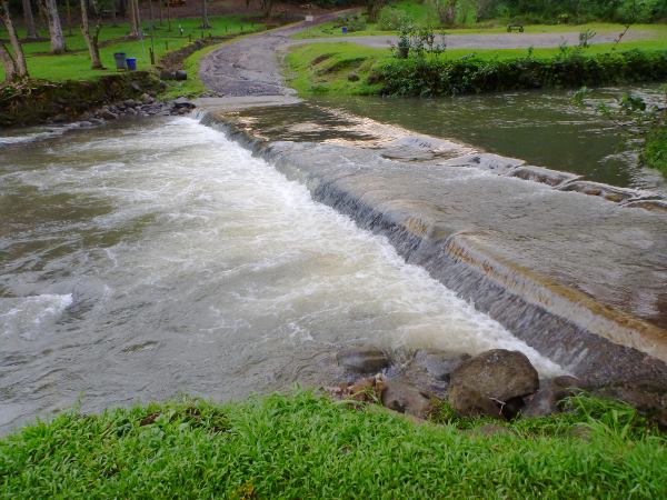
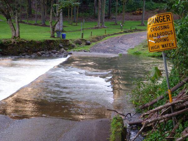
I went all the way up to the arboratum, but of course the truck in the water had already been removed. Flow was still high, almost as deep as a tire, which is still probably enough to push a car off the crossing. Heed the signs, people:
ArboratumCrossing1
ArboratumCrossing2

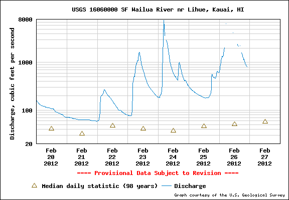
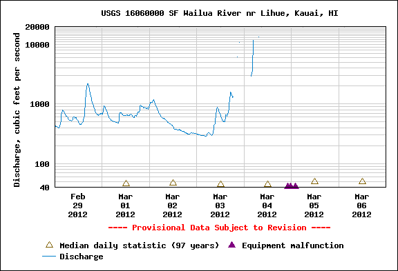
Another consequence of the flood seems to be the stream gauge further inland on the other branch of the Wailua river. It stopped recording even before Monday’s huge peak, and the graph shows a malfunction indicator. I guess we’ll never really know the actual height of the water, unless somebody goes to read it off the markings on the trees.
WailuaGaugeBroken
Source: USGS stream gauge data

On my way back down, it was getting dark, but I noticed that the Coco Palms lagoons were overflowing and flooding the entire grounds. They do have a sluice gate to let out more water, but I suppose that would then flood the other buildings by the river, ones that are actually being used (thrift store, kayak rentals, and canoe club). Better to let the unoccupied buildings be flooded. CocoPalmsFlooded1
CocoPalmsFlooded2 I think you can see the canoe docks under water at the top of this image.

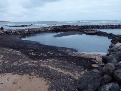
Finally, I wanted to check on the rock pools at Lydgate. They were not as full of large debris as I imagined, because it looks like the storm swell overflowed the pools on the south side by the beach and carried away some of the branches.

However, both large and small pools were full of dark silt and the beaches partly covered in black mulch. LydgatePools1
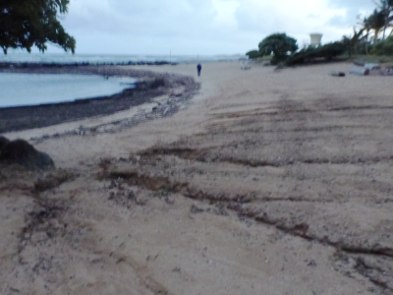
LydgatePools2 Another effect of the storm was that the beach itself was eroded from the runoff. I think some of the sand at the Lydgate pools is man-made, or at least replenished by truck, and a lot of it washed down into the water, leaving gullies in the underlying dirt.

Overall, the damage in the aftermath of the storm was minor. Some roads are being repaired, some people in Hanalei have real flood damage, and I do have some leaks in my roof to deal with. But for the size of the storm and amount of water that flowed, it seems like it could’ve been much worse. I expected to hear people talking about how they made it through, but instead most of the people I overheard were talking about the next storm already, due on Friday. We shall see.

Rainy Day Redux

After a wet, wet, wet weekend, Monday was not all sunny like last week. In fact, it was quite the opposite. The rain came down by the bucketful today, barely letting up between torrential downpours. In the afternoon, the wind picked up and whipped the rain sideways across the lanai and into any open window on that side.

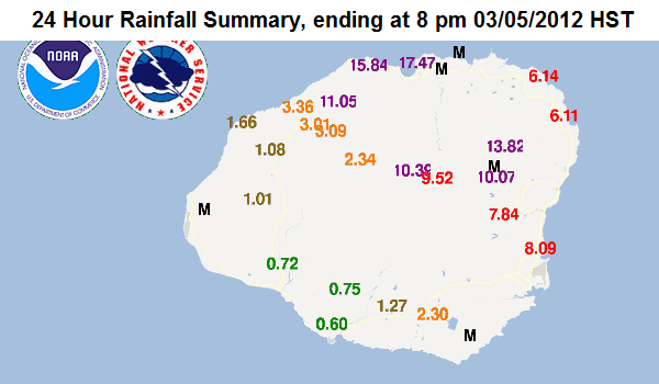
The rain totals for the day were impressive, with Hanalei getting 17.5 inches, and 6 gauges on Kaua’i over 10 inches within 24 hours:

RainyDayRedux
Source: NOAA/National Weather Service

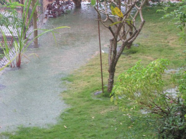
I estimate we got between 8 and 10 inches in the Wailua Houselots. The yard was full of puddles again:

RainyDay2Yard

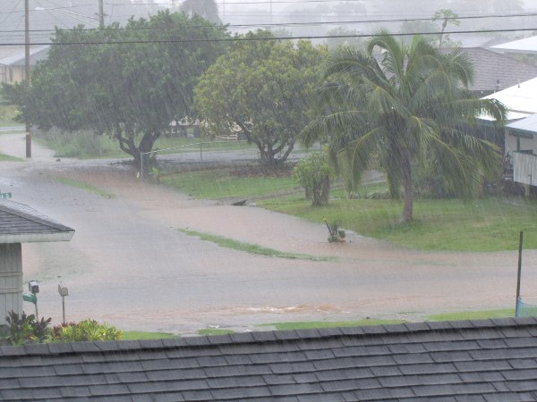
And now the roads in the neiborhood were starting to form pools:

RainyDay2Roads

And then around noon today, I heard the sound that every homeowner dreads: drip, drip, drip. I quickly climbed up in the attic and found 4 small leaks in the roof. I think the wind was lifting the shingles and blowing the rain underneath. I managed to crawl around the ceiling joists and put buckets under the leaks, before they soaked through the ceiling. The worst leak was at one of the holes for the solar hot water pipes going through the roof to the panels.

But as upsetting as that was, many people on Kaua’i have it worse. Koloa and Hanalei were flooded already yesterday, as shown on these news reports from last night:

And here is the Hanalei valley from today:

As you can see in that last one, the Hanalei river valley was flooded again as it was in November 2009. There are some houses and businesses along the river that probably have several feet of water inside. Since the road runs near the river, the water covered the road as well. I read they took people who needed to get out in heavy trucks. There were other road closures in places where streams and runoff covered the road. There was one lane closed at Kalihiwai Bridge which probably means it was flooded like November 2009 as well:

Update: it turns out it was a landslide that closed a lane at Kalihiwai Bridge (from an article in The Garden Island). There were also several road closures due to flooding and fallen trees, and the Kaua’i Beach Resort (formerly Hilton and Radisson) was without power and sent guests to the Lihue neighborhood center. The latest article from the Garden Island has a long list of incidents and closures, including a sewage spill at Lydgate.

I do have to say that we had electricity and internet connection all day, not even a flicker. We took advantage of that by snuggling in bed and watching a streaming movie tonight. So a big thanks to the utilities who built a tough network, and were probably out in this weather dealing with incidents.

The most impressive accident I saw reported so far was a pickup truck swept off of the river crossing at the Keahua Arboratum inland of Wailua. I wonder if the guy was stuck on the other side and desperate to get out, or show-boating (to use a nautical term):

That comes from an article titled “Flood warning extended for Kauai until 2:30 a.m.” and it is still raining off and on tonight, so stay safe out there. I’m just glad I used big buckets up in the attic.


Just for comparison, many towns on Kaua’i easily beat New York City’s record of 7.7 inches (set just last summer). But the rainiest day ever recorded on Kaua’i was back in 1956, according to the Western Regional Climate Center:

… during the storm of January 24-25, 1956, over 38 inches of rain fell at the Plantation Office, Kilauea Sugar Plantation, Kauai, within a 24-hour period, out of a storm total of 43.5 inches. During the same storm six inches of rain fell during a single 30-minute period and about 12 inches fell in one hour. The 38-inch value for 24 hours is conservatively low, because the gage was already overflowing when it was emptied for the first time. The six-inch value is correct within one or two tenths of an inch; the 12-inch value for one hour is an estimate only – again because of overflow – and may be in error by as much as an inch.

And records for the US are hard to find, but apparently, the record for 24-hour precipiation is Alvin, Texas with over 43 inches in 24 hours on July 25-26, 1979, due to tropical storm Claudette. For shorter periods, “a world record rainfall occurred at Holt, Missouri on June 22, 1947 when it rained 12 inches in just 42 minutes. This averages to over 1/4 of an inch of rainfall per minute. On July 4th, 1956 In Unionville, Maryland 1.23 inches of rain fell in 1 minute.”


Update: Someone caught the funnel cloud on video the other day and uploaded it to YouTube—the internet is a wonderful tool. The video shows it was over the water and actually tounched the ocean, creating a waterspout:

Funnel Cloud on Kaua’i

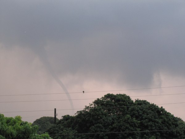
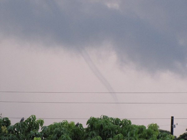
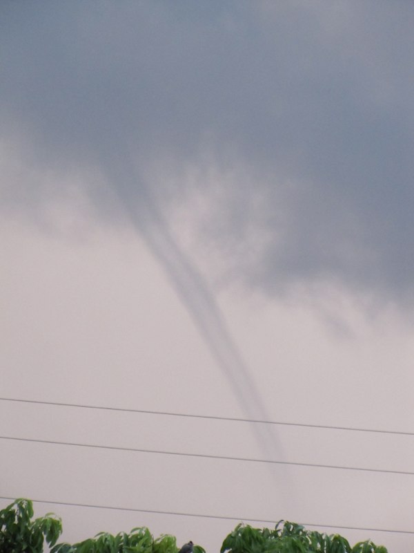
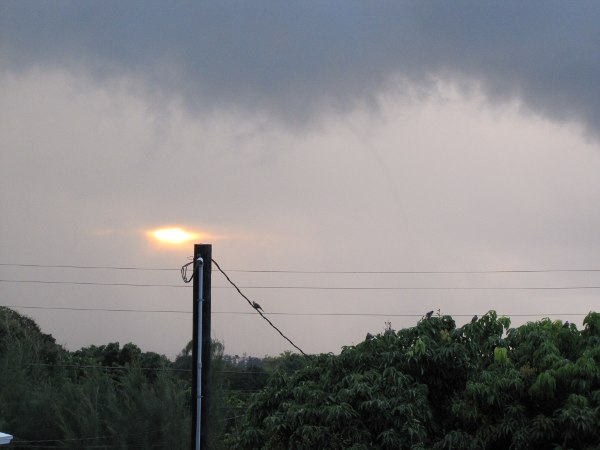
The strange weather continues: after a week of rain off and on, my wife spotted this small funnel cloud over Wailua on Saturday morning (March 3) around sunrise (7am):

FunnelCloud20120303_070233

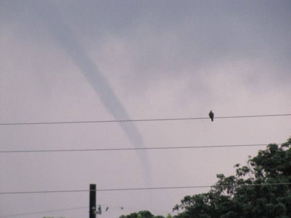
She didn’t even bother to wake me up, so these are all her photos.

FunnelCloud20120303_070250

After about 30 seconds, it seemed to dissipate (hover over the photos to see the timestamps in each filename):

FunnelCloud20120303_070305

About a minute and a half later, it was strong enough to be visible again:

FunnelCloud20120303_070442

With the backlight from the sunrise, you could see the hollow tube shape:

FunnelCloud20120303_070509

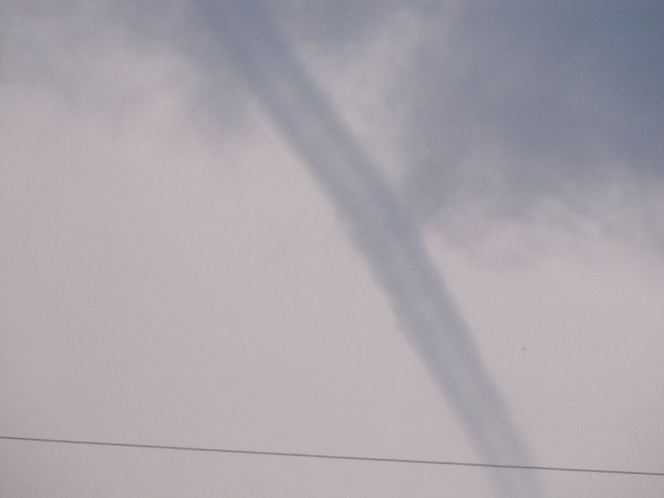
Here is a closeup of the funnel cloud, at its thickest:

FunnelCloud20120303_070531

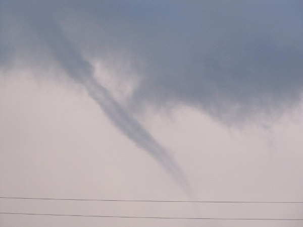
As it weakened again, it lost its shape:

FunnelCloud20120303_070613

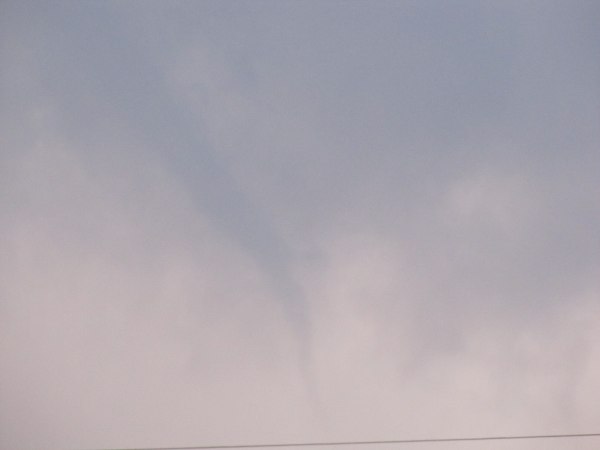
About 3 minutes later, it finally dissipated, just as the rising sun found a hole in the clouds. You can still see the very thin and faint shape of it to the center-right of the image:

FunnelCloud20120303_070744

I did some searching on the internet, and funnel clouds are fairly unusual in Hawaii. I remember reading about one on Oahu during the storms in May last year–here are some photos of a double waterspout and a video. And there was another one in September that was nicely lit at sunset. However, funnel clouds, waterspouts, and tornadoes are not rare or unheard of: this research paper (PDF) reports 31 sightings between 1949 and 1960. And they do touch down and cause damage and injuries, the worst being 4 injuries and several million dollars of damage in Kailua-Kona (Big Island) in 1971.

The odd thing is that this happened the day after deadly tornadoes and storms hit the midwest United States, so we had storms and tornadoes on our minds. While we were fortunate to be spared such extreme weather, it was another rainy weekend with over 13 inches (330 mm) in one day at Hanalei (the bridge was closed again), and 17 inches (430 mm) at the summit of Wai’ale’ale. Here on the east side, we got over 9 inches (230 mm), and it’s again raining hard tonight.

Update: At least one person had a worse day. Jack Thompson’s house on the Big Island was flooded with several feet … of molten lava. He had the last house in the Royal Gardens subdivision.

Rainy Day

The sound of the pouring rain woke me up this morning. It was barely light, but instead of lulling me back to sleep, the rain had me worried. This was the kind of rain that overflowed the gutters, saturated the ground, flowed around the house, and sometimes into the garage. I tried to go back to sleep, thinking the house was fine, it weathers these storms 2 or 3 times each year, but then I saw it was almost 8 am—the rainclouds were so thick they blotted out the light.

So I got out of bed, got out the umbrella and checked around the house. Sure enough, the gutters were overflowing, the back yard was saturated and covered deep puddles, and the garage was wet. There was also a mini waterfall down the neighbor’s hillside stairs. But other than some potted plants getting too much water and some erosion in the bare dirt of the garden, everything was fine.

It was also cold, so I put on socks and sweater and settled into a warm oatmeal breakfast with hot tea. The rain came and went, and came again. The heavy rain turned into a thunderstorm, with lightning and thunder off and on. The closest was a 3-one-thousand (3000 feet or 1km). The poor birds outside looked miserable:

WetBirdZebraDove
Zebra Dove
WetBirdJavaSparrow
Java Sparrow

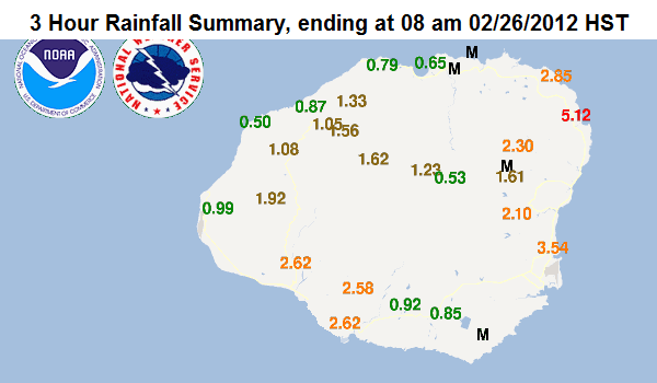
I checked the NOAA website with rain gauge information, thinking it would be worse on Wai’ale’ale:

RainyDayMorning
Source: NOAA/National Weather Service

But no, the east side where I live was the rainiest, with Anahola getting over 5 inches (125mm) in just 3 hours. We couldn’t be too far behind, maybe 3.5-4 inches (88-100mm). Then I thought to check the stream gauge data for the Wailua river. This is tonight’s graph, with today’s peak data oddly missing (gauge overflow?). But what I saw in the morning was the continuous rise that could easily dwarf Friday’s peak.

RainyDayWailuaGauge
Source: USGS realtime stream gauge data

So I talked the family into going to see the east-side waterfalls, so we went for a Sunday drive in the country. And we were not disappointed. First was Opaeka’a falls:

OpaekaaFallsBooming1
OpaekaaFallsBooming2

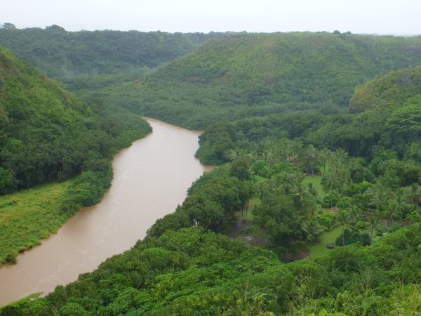
Across the road, the Wailua river was running brown and looking like it was going to overflow its banks. The Kamokila village down there was closed (but maybe it’s not open on Sunday):

WailuaRiverRunningBrown

Then we drove to Wailua falls. Everthing along the road was soaked, and the ditches by the golf course were full. But there didn’t seem to be any flooding, so the county’s work on clearing the vegetation out of the drainage ditches has paid off. Even the Kaua’i roosters were soaked, their feathers dull and their tails drooping.

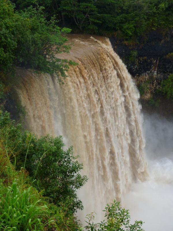
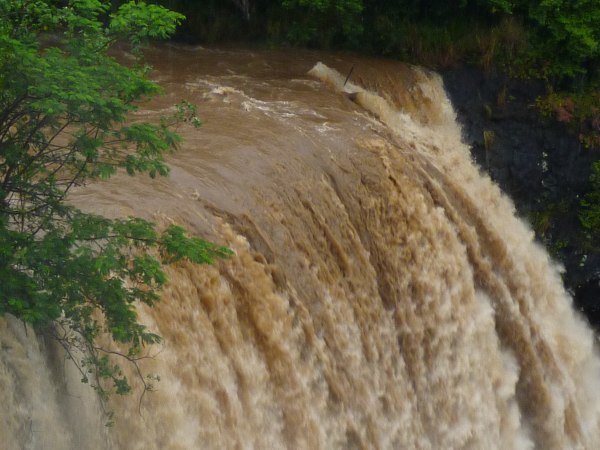
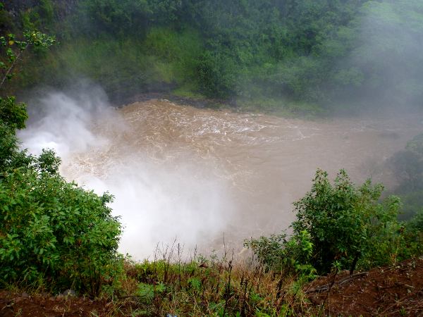
Wailua falls was even more impressive, with the full flow of the South Fork plunging over. I estimate there was 2-3 feet of water going over the full width of the waterfall—except the one place on the left where a tree was still clinging to the edge:

WailuaFallsBooming1

We stood there for over 15 minutes with our umbrellas, fascinated at the wall of water tumbling down. The brown water flowed over in a solid sheet, then it separated into streams and finally separated into white water drops in very intricate and ever-changing patterns. I tried to get a photo of the effect, but my camera is not good enough, so this is just an enlargement of the previous photo:

WailuaFallsBooming2

Almost as impressive was the massive cloud of spray that was blowing the trees like a strong wind. We did see two tropic birds flying around, wondering why they were flying in the mist and what the view was like from there. And with all that water, the round pool at the bottom was gone, all the rocks and vegetation covered by the outflow.

WailuaFallsPoolOverflow

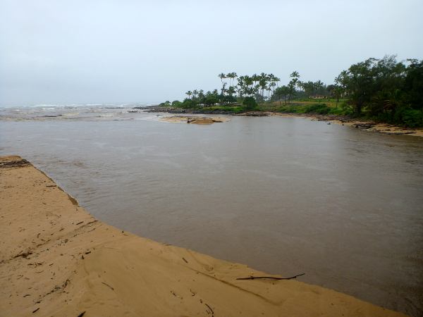
On the way home, I pulled over at Wailua beach and walked on the bike path back across the new bridge. The river mouth was spread out wider than the length of the bridge:

WailuaRiverMouth

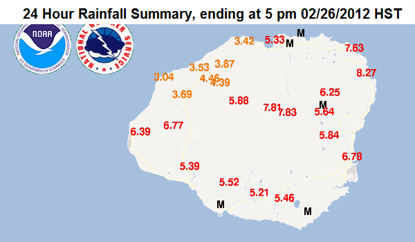
The rains finally stopped in the afternoon, and there were even some nice sunset colors. Tonight, I looked up the total rain for the past 24 hours. Different parts of the island received rain at different times last night and today, but the overall totals are all above 3 inches (75 mm), with an average of 5.6 inches (142mm) across the entire island.

RainyDayTotals
Source: NOAA/National Weather Service

More news the following day:

  • The Hanalei river gauge had a similar graph, and the Hanalei bridge was closed. Reports are that water was flowing over the bridge. The difference was that in Hanalei, you could also see the waterfalls coming down the mountains.
  • While the rainfall was impressive, this was pretty much a normal winter storm. Kaua’i usually gets 3 or 4 of these per year between November and March. The Garden Island newspaper has a similar photo of Opaeka’a falls with even more water from December 2010.
  • Some storms have been much worse, for example when the Hanalei river valley flooded in November 2009 or the Kaloko dam broke in March 2006 after 30 days of rain.
  • There was indeed a beautiful sunset after all the rain, if you were on the south or west side.
  • Today was mostly sunny with only one rain-shower so far.

Paragliding on Kaua’i

I’ve always been interested in paragliding, where you soar on wind currents or thermals under a special parachute wing. I’ve done two tandem flights in Europe, where it’s much more popular, and seen a few near San Jose, in California. The exhilirating feeling I got from those flights can best be summed up as “Man can fly!”

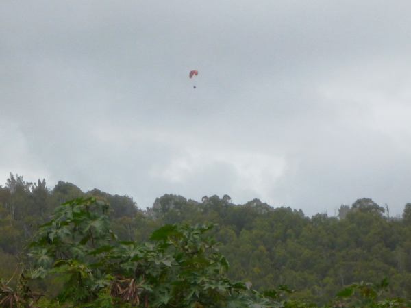
So I’ve always wondered if there were any paragliders on Kaua’i, and whether they found the right conditions to fly. Now I have my answer:

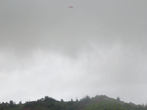
ParagliderKalepa

I was driving by the Wailua golf course on Thursday (Feb 16) and saw this paraglider over Kalepa Ridge. I pulled over right away to snap a picture, but he (or she) was staying aloft on the lift generated from the ridge (slope soaring). I drove on to the golf course parking lot and watched him for a while, looking at the ridge over the county jail. The weather was overcast, and then a rain shower blew by, so it couldn’t have been that much fun up there–and probably a little scary too.

ParagliderRain

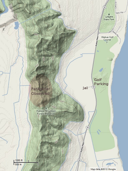
The ridge is only 500-700 feet high here (150-210 m), but I suppose that even with the light trade winds we were having, that it creates enough lift to keep the paraglider aloft. It takes a lot of skill to find the updrafts, stay in them as long as possible, and then fly back down to do it again. Maybe the bowl shape of the ridge in this area helps–now that I look at a topo map, I doubt that is a coincidence.

ParagliderAreaMap
Click map to enlarge. View source at maps.google.com.

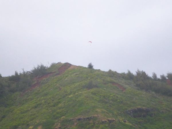
What I really wanted to know, however, was where and how did this paraglider take off. There are no roads here, so he had to hike to the top of the ridge (or ride a trail bike). Then you need a large enough area to lay out the wing and clear of trees to run downhill–unless there’s enough wind to do a standing reverse launch. I’m not sure there’s such a place on Kalepa ridge, but maybe he found one. Sometimes, you can launch from a higher place, but the only one nearby is the Sleeping Giant summit at 1240′ (380m), but it’s too far away and across the Wailua river (no updrafts there).

I also wondered where the pilot was going to land, since there is no place on the windward side with the detention center, road, and tall powerlines between the ridge and the golf course and beach. In end, he drifted out of the updraft and flew down behind the ridge on the inland side, so I lost sight of him. There is the road to Wailua falls back there, as well as pastures and dirt roads, so that seemed like the safest place to land. Perhaps he had even parked back there and hiked up to the ridge on some of the dirt bike trails.

ParagliderDropping

Mystery pilot, if you’re reading this, do you have any answers for me?

More About Paragliding in Hawaii

There are tandem and solo instruction flights by Gravity Hawaii on O’ahu and Proflyght on Maui. O’ahu must have more than a few pilots, because the Hawaii Paragliding Association seems to be based there, and their Wind Lines blog is full of beautiful pictures of O’ahu from the air. Maybe one of those pilots was visiting Kaua’i with his equipment–I’ll have to ask them.

I’ve always confused the words paragliding and parasailing, but Wikipedia says the latter is for towed rides, like you find behind boats on Maui. I believe parasailing is actually forbidden commercially on Kaua’i, and I don’t think anyone bothers with the equipment for their own use–plus the waters are too choppy. I don’t know of any restrictions to commercial paragliding on Kaua’i, but maybe the regulations are so vague as to make it illegal too. More likely is that there just aren’t enough visitors to sustain an expensive extreme sport activity.