Happy Holidays

I know this is a bit late. I wanted to write this on Christmas day, but my daughter got an iPad, and I picked it up and started playing with it, and nothing else got done that evening.

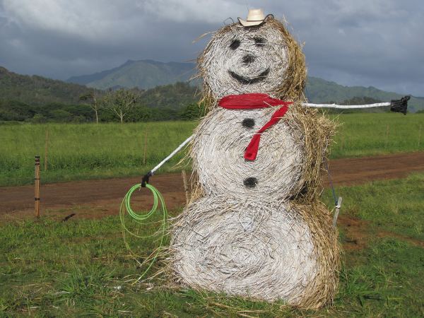
Last week on the Kapa’a bypass, there appeared the most incredible sight: a snowman on Kaua’i!
Snowman1

Of course, since we don’t have snow, it’s just hay and white spray-paint—but nobody’s complaining (or griping about how Frosty songs are discriminating to Hawaii). I’m assuming it was made by the employees of the Farias Cattle Company who manage the ranch on the land around the bypass.

FariasCattleCompany

If you look closely, it’s a real lasso, and I do believe the other hand is a shaka. Because Kaua’i (and much of Hawai’i) recieves plenty of rain and sun, the pastures are rich, and cattle are outside the whole year. And because they are not enclosed in feedlots, there is still a need for real cowboys to round up the cattle from the pastures. At least that’s my theory for why a real cowboy culture, complete with lassos and rodeos, still exists in Hawai’i.

The photo above has Makaleha mountain in the background, with some waterfalls. Here’s another view with Nonou, the Sleeping Giant, behind. Maybe all the Sleeping Giant needs to wake up is an old hat with some magic still in it:
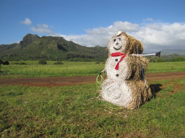
Snowman2

And the question about snow on Kaua’i is still open. I have heard some winter temperatures up in Koke’e have been cold enough for frost (not this year that I know of), which means cold enough to snow under the right conditions. But I still don’t have eye-witness accounts or photographic proof of actual snowflakes falling on Kaua’i, let alone sticking and not melting.

This is the best I can do for now:
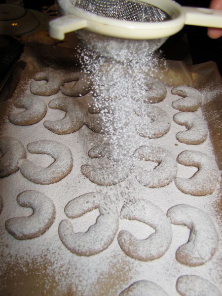
SnowNotReally

Occupy Kuhio Hwy

Update: Videos and future gatherings posted at occupyingkauai.blogspot.com.

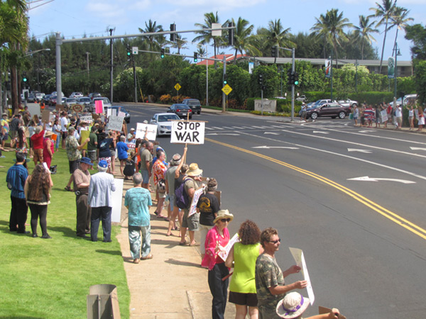
The 99% on Kaua’i held a couple of demonstrations today in support of the Occupy Wall Street movement that is spreading across the country.

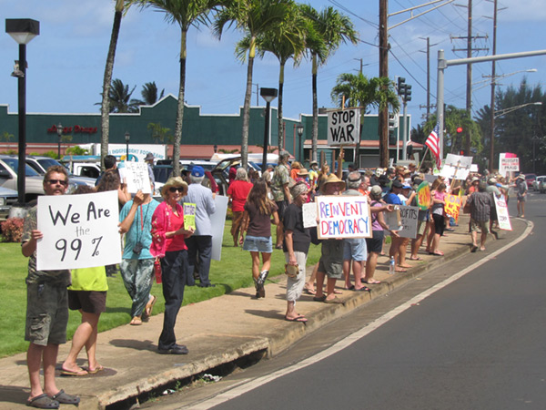
My family went to the one on Kuhio Hwy, in front of Safeway in Kapa’a (there was another one later in Puhi, by the community college). I would say there were over 100 people spread along the sidewalk on both sides of the road.

OWS_Crowd2

The idea wasn’t to occupy anything here, just show our support for the causes and protesters in New York City. There were some local causes that were added to the mix as well: the sovereignty movement of course (upside down flag across the street), anti-smart meters (coming to KIUC), and I saw something about not killing wild horses.

Come to think of it, we were probably the most distant Occupy demonstration still in a US state (some people were protesting the occupation of Kaua’i too). Just for fun, I checked the distance, and it is 5010.6 miles.

OWS_Crowd1

So no tents, just a lot of signs. My wife and I made signs, and my daughter made one too, even came up with her own slogans. In fact, I reused my sign from the No-Ferry protest and just added another layer of cardboard:

NoFerryProtestSign OWS_Signs

My daughter is getting good at demonstrating on Kaua’i, she even made her own sign this time. After I explained the Occupy Wall Street protest to her in kids’ terms, she came up with “NO More Tricks, Occupy Wall $t” and painted the sign herself (hence the pink and turquoise, with a heart over the i).

The back of my sign says “Make Wall $t Pay for Toxic Greed,” in reference to the toxic derivatives and mortgage-backed securities that Wall Street cooked up and burned the economy with. But in the end, I like the “Green Not Greed” message much better.

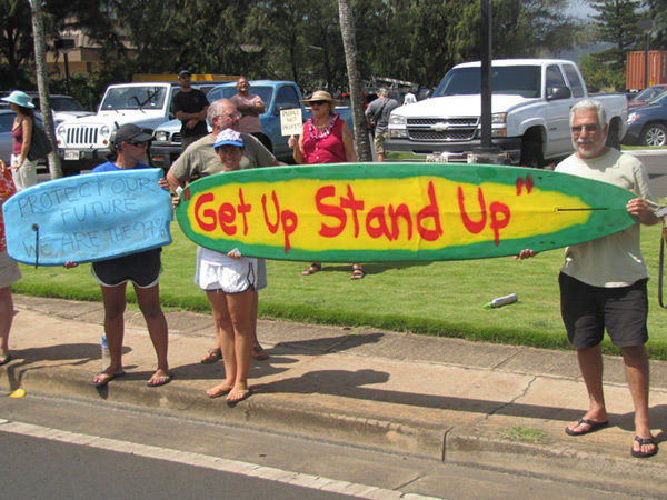
But my favorite signs were the following two, because they are Kaua’i-themed and very clever:

OWS_StandUp

“Get Up, Stand Up” refers to both the Bob Marley song (next verse is “Stand up for your rights”), and stand-up paddleboarding which has taken over the surfing world, at least here in Hawai’i.

OWS_Awakening

The Sleeping Giant is the mountain near Kapa’a, but also a reference to the 99% in America. Hopefully, the Occupy Wall Street movement will lead to some real changes on Wall Street, because together we can move mountains.

For people on Kaua’i who want to participate, the website of the organizers is occupyingkauai.blogspot.com. They will give info about any future meetings there.

Even though the organizer is a young man, my wife noted how most of the demonstrators were older, from the Baby Boom generation. From the images in New York and elsewhere, there seem to be a lot more students and young adults. I’m not sure what that says about the involvement and awareness of that demographic on Kaua’i.

A New Day

Well, I’m back on Kaua’i and accumulating sights and events that I want to share, so I’d better get blogging again.

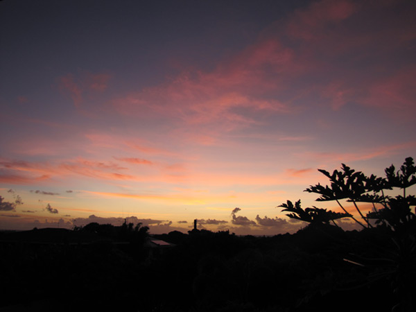
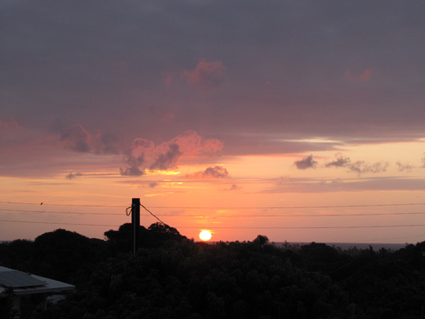
But this is just a quick post with two sunrise pictures.

Sunrise20111003_0614

The papaya in the back yard is starting to get tall and block our views. But the leaves have a pretty silhouette.

Sunrise20111005_0629

Notice the solar panel on the neighbor’s house in the bottom-left corner, just waiting for that sun to rise.

Northwestern Kaua’i Recreation Map

I know I’ve seriously neglected this blog, but I still like to help people who are going hiking on Kaua’i. I just got a question by email, and the answer is worth sharing here:

I’ll be hiking the Kalalau in the near future. I was wondering if there is a topo map available that you would recommend.

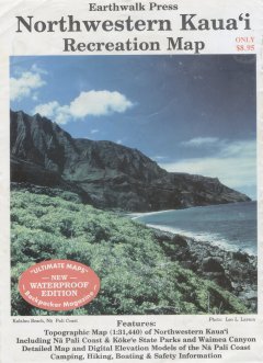
Yes, there is a topo that is great for the Kalalau trail, it’s called the Northwestern Kaua’i Recreation Map by Earthwalk Press. I have a short review of it on my blog, but it is kinda buried in another post. I might as well reproduce it here:

NWRecreationMap

Northwestern Kauai Recreation Map, by Earthwalk Press, available in a weather-proof plastic edition. You don’t need a topo map to hike to Kalalau, but if you’re like me and you love maps , this is the one to take. It’s a topo map printed on a plastic sheet that covers Na Pali, Kokee and upper Waimea Canyon. It also has an enlarged map and accurate description of the Kalalau trail on the back.

Unfortunately, if you click that link to the map for sale on Amazon, some resellers are trying to get $999 (!?!?!) for it. Forget that.

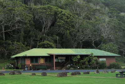
The Koke’e Museum shop on Kaua’i is selling it online and will of course ship it to you on the mainland. Here are some links to:

KokeeMuseum
Source: kokee.org

A quick search also found these online map stores that hopefully still have it in stock:

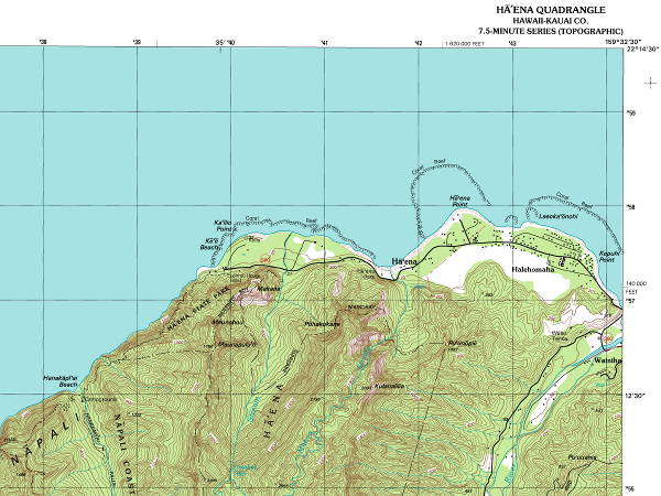
If the map is really out of stock and out of print, your next option is the USGS topographic Haena “quad” (7.5-minute series) that covers the Kalalau trail on one map:

HaenaQuad
Click map for larger version

The USGS topos for Kaua’i are usually available on-island at the Kaua’i Museum store (808-246-2470) and the Koke’e Museum store (808-335-9975). Give them a call to see if they have the Haena quad in stock, or order it if you want to get it before leaving home.

Related: I’ve also updated my GPS track of the Kalalau trail with an embedded Google Maps/Google Earth version.

Update April 28, 2011: I don’t think the Northwester Kaua’i Recreation Map is out of print. I have seen it on sale by the check-out stands at the Longs Drugs (and so much more) in Kapa’a. So if you can wait until you arrive, that is an easy way to get it. Of course, if you read this much later, they might not carry it anymore, so call and ask them: (808) 822-4915.

Tremor Near Oahu

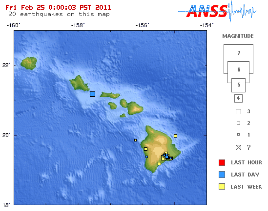
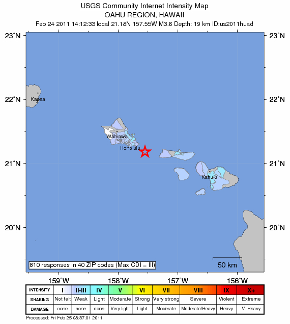
And now for a change, some breaking news: minor earthquake just off the SE tip of Oahu, magnitude 3.6, at 02:12:33 pm local time on Thursday. Here is the USGS data.

OahuTremorLocation
Source: USGS

This was just a small earthquake, the kind that happen all the time, all over the world. It was nothing like the October 2006 Earthquake! on the Big Island that shook Kaua’i. And of course, it is overshadowed by the deadly earthquake in Christchurch, New Zealand 2 days ago.

I’m not even on Kaua’i, so I can’t report on what I felt, but I don’t see anybody reporting on it. The “did you feel it” website of the USGS only shows responses from Oahu and Maui Nei:

OahuTremorDidYouFeelIt
Source: USGS

What’s particular about it, is that it is one of the closest epicenters I have seen to Kaua’i. And since seismic activity is linked to volcanism in Hawai’i, I have to wonder if there is any chance to see another volcano–I don’t think Oahu is ready for that. Kaua’i has small eruption cones near Poipu that are dated to 10,000 years ago. Nothing recent, but certainly the age of Kaua’i island when it occurred was older than Oahu island is now—so it may be possible.

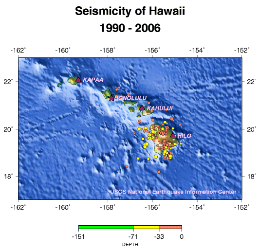
I tried to find a historical map of earthquakes in Hawaii, looking for the closest to Kaua’i. This is the best I could find, only going back to 1990 and only showing larger quakes. Smaller quakes such as aftershocks of Oct 2006 that happened on Lana’i (magnitude 3’s) are not shown—from other maps on the USGS website, I think the cutoff is magnitude 5.

OahuTremorHistorical
Source: USGS

So what this is showing is that, while not unheard of, there have only been 4 significant earthquakes near Oahu over 15 years, but this recent one doesn’t count as significant.

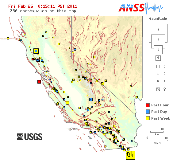
Just because I love these USGS maps, I looked at their current California map, which is always impressive for the constant amount of activity:

OahuTremorCalifornia
Source: USGS

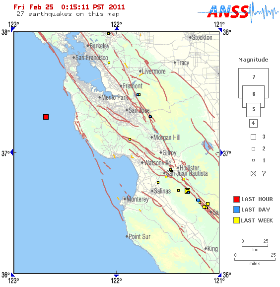
Whoa, a magnitude 5 in Mexico we didn’t hear about (hopefully because damage was minimal), and what’s this? An earthquake just a few miles away from me less than an hour ago (I’m temporarily living in the Bay Area):

OahuTremorBayArea
Source: USGS

Magnitude 3.4, but I can tell you for sure that we didn’t feel anything from that one.