The last storm was Friday almost exactly a week ago, but this time I think everyone was prepared. We had our buckets in the attic under the leaks, all the potted plants were safely inside and the windows shut against the wind and rain. After the storm, with no further rain in the forecast, everybody was ready to move on and forget it all. But curious about the cumulative rainfall, I did want to give a recap of the storms and their effects.
Last Friday’s storm felt like the worst. It was the 4th in a row, and as I mentioned, everyone was talking about it and preparing for it. Once we were ready, I went to bed thinking the rain wasn’t so bad. But even though I slept through the night, my wife said the rain came down in solid sheets, waking her up and drawing her outside to watch. This last storm was the most intense, with huge amounts of rain in a short time, creating lots of runoff. In the morning, I found my thick, heavy rubber doormat swept down the walkway from my door—so the runoff from the street must’ve been deep and strong.
There were again reports of some serious weather:
- A friend in Kapahi reported macademia-nut sized hail, which was later confirmed by a photo in the newspaper.
- The Kealia stream rose so much, it covered Haua’ala Road in the Keapana valley area just north of Kapa’a. Because it’s the only road into the valley, residents were trapped until the river went down.
- The newspaper also reported another funnel cloud that apparently touched down near Lihu’e. It did rip some shingles off a roof, and led to the best quote in a long time:
- There was a report of water flowing over the main Wailua bridge, leading the police to close the bridge, just as in Hanalei.

At first I thought this meant the river rose so much it covered the bridge. But then I had a look at the bridge, and I won’t say it’s impossible, but for the river to go that high, it would have to flood the marina and Kuamo’o road nearby, not to mention a few houses and businesses by the river. Since I saw no evidence of this, I think what happened is that runoff from the hill and road nearby washed onto the bridge and couldn’t drain fast enough, creating water on the bridge. - Finally, someone heard from someone that there was snow in Koke’e.

Given the hail, it seems plausible at least. I asked for more information (pics, or it didn’t happen), but I haven’t heard any further details. What seems more likely is that it hailed in Koke’e as well. So I’m still looking for first-hand witnesses and/or photographic evidence of snow on Kaua’i.
The small twister left the Steins’ children’s toys strewn about the neighborhood “much more than they normally are,” her husband chided.
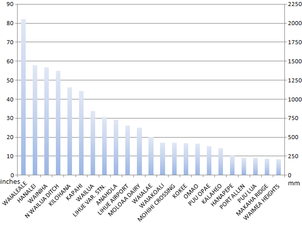
Everyone was saying how this last storm was the worst of the 4, and even worse than the “30 days of rain” back in 2006. It certainly seemed like there was more rain and more runoff in a shorter period this time. But looking at the rain gauge totals for the past 21 days, the 2nd and 3rd storms (March 4th and 5th-6th), were generally the wettest in most areas. I think the difference was the general saturation of the ground, meaning that the 4th storm created more impressive runoff everywhere.
In order to add up the rain gauge totals, I downloaded all the data from the National Weather Service and created a spreadsheet (click to download) and some graphs. This first graph (click to see the full frame) shows the cumulative rain every 12 hours for each gauge that had data the whole period:
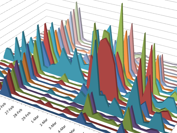
What still impresses me about the first storm is how it was so uniformly significant over the entire island. In my experience observing the rain gauge maps, that is very unusual. Typically, some areas receive more and others less, such as how the Westside stayed dry through the rest of these storms. You can see other trends, such as how Hanalei and Wainiha (the North Shore) dwarfed Wai’ale’ale at times, but how a minor rain on Feb 29 really affected the summit. However, this second graph shows the 21-day cumulative total for each of the gauges, and Wai’ale’ale still dominates:
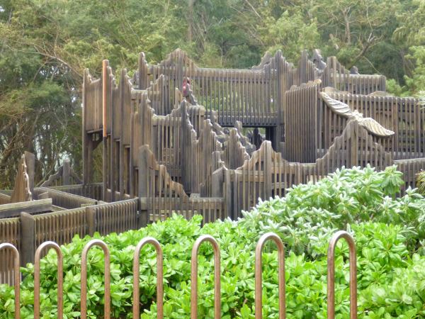
After all the rain, my daughter was anxious to get outside and play. Unfortunately, the main part of Lydgate Park is still closed. The roads are open, but the beach is washed out and pools are full of silt (as I reported earlier). On top of that, there was a sewage spill around the Kamalani playground, so it is closed and roped off. The good news is that the play-bridge structure at the south end of the park is open:
The dirt road that goes under the bridge and out to the beach has turned back into a stream. This was a natural channel I believe, and with all the runoff from the golf course nearby, it connects to the ocean again for now.
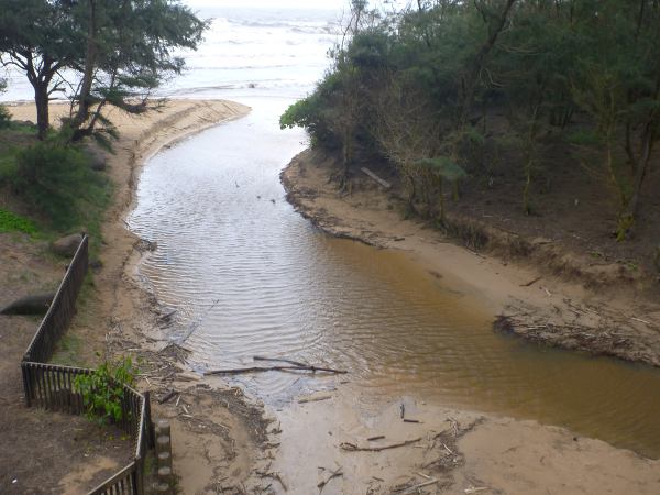
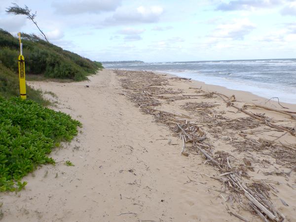
The water in the ocean is still brown, so there is no swimming on the east side for another week or so. The beach is covered in drift wood as well:
The newspaper had a photo of runoff damange at Ke’e beach that caused a deep gully in the sand. The same thing happened at the picnic area at the south end of Lydgate park as well. This channel is 4-6 feet deep and the flow washed sand from under the boulder, causing it to sink about 4 feet:
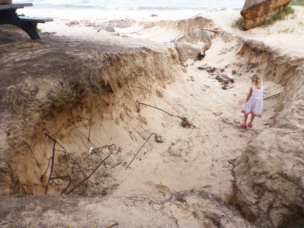
This is what happens when you build roads and parking lots without proper drainage near the beach. In heavy rain, they turn into an artificial stream that takes the shortest path to the beach (the human path), and it carries all the sand along with it.
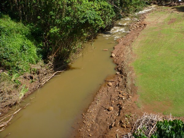
But the worst damage from this last storm is in Kapa’ia, the little valley between Hanamaulu and Lihu’e. You can see how the stream banks were scoured by the high flow, and a week after the storm the stream is still about twice as wide as usual:
The flash flood in this valley carried lots of branches and uprooted trees, and unfortunately, smashed them into the Kapa’ia swinging bridge:
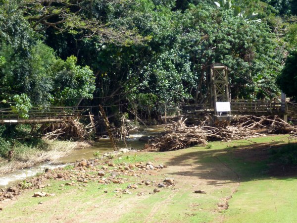
This is sad because the local community was trying to raise awareness and money to get this bridge restored. The wood was rotting, and they had to close the bridge because it was unsafe. I don’t know exactly what it needed, but now I wonder if it can be saved at all. It is one of the 4 swinging bridges on Kaua’i, a relic of an older time. If the cables are still sound, maybe this will encourage the restauration of the bridge.
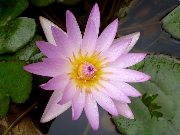
Not all is gloomy, this lotus flower (at the Coconut Marketplace) looked even nicer with some raindrops:
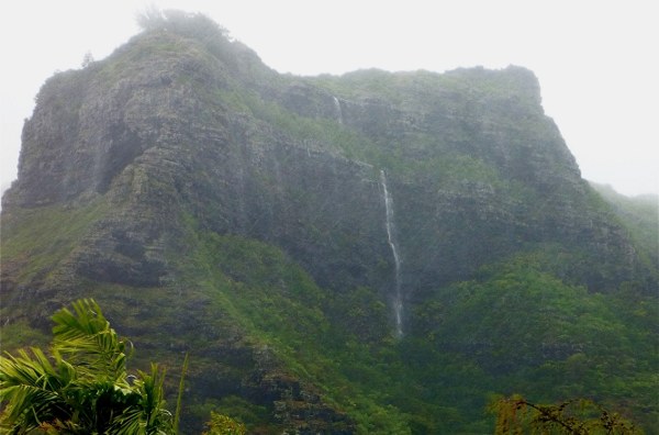
And my neighbor sent me a great photo of the waterfall on Nounou, the Sleeping Giant, although it was actually from the previous Monday’s storm. So here’s a 300 foot (100 meter) waterfall you don’t see everyday:
Because the east side still has plenty of brown water, there will be no swimming in the ocean for a few more days.
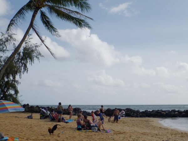
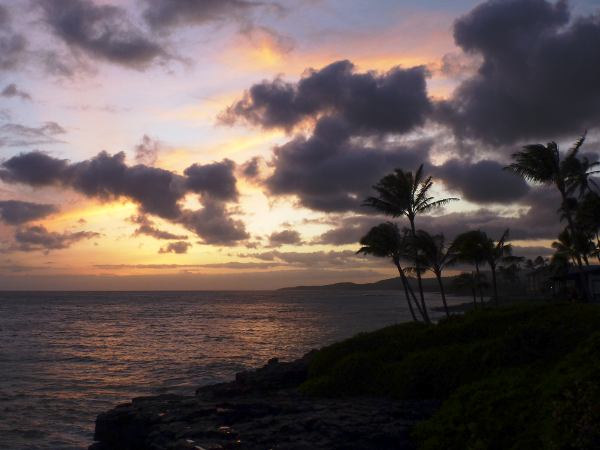
I heard Poipu was sunny early this week when the east side was still overcast, so I took my daughter down there to swim. Sure enough, it was warm and the water safe to swim, so she had a good time at Poipu Beach Park. And we got to see a sunset for the first time in a long time:
The weather island-wide is now definitely turning into spring, with warm sunshine, breezes, and clean fresh air. With all the water and now sunshine, the land is lush and green again. Not having seen the direct sun in so long, I am surprised by how far north it has moved in the sky. Following a typical pattern, these storms are now hitting California, which will soon be all green as well. Just in time for St. Patrick’s Day.