Historical Moloaa Trail

Hawaiians historically had footpaths for getting about on land. On Maui and the Big Island, some of those paths that traverse ancient lava flows have been preserved, but on Kauai, vegetation and erosion have erased all the paths that fell out of use. So, several years ago, I was excited to hear that one of these historical trails was preserved near Moloa’a Bay.

To understand why there is a trail along Moloa’a Bay that still exists and why it is still important to local people, you have to look at the geographical history of the area. I am just an amateur geographer who has read some history books, so this is no more than my speculative history of the area.

Historically, pre-contact Hawaiians lived in ocean-side communities, farming the low river valleys, gathering seafood inside the reefs, and fishing out beyond them. Thus it is likely that Anahola valley, Papa’a valley, and Moloa’a were all farmed and inhabited. Of those, I believe that only Anahola has a shallow reef area, but it is rather small. Much larger is the reef area at Larsen’s beach, further to the north. The calm, shallow waters inside reefs were important sources smaller fish, shellfish, and limu, the edible seaweed.

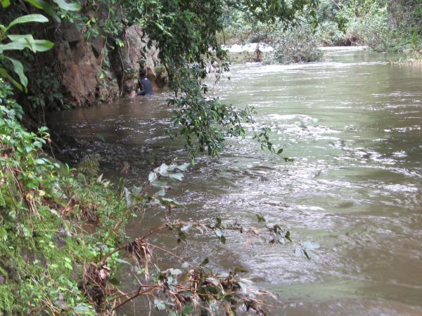
In order to reach the resources at Larsen’s, the coastal residents would likely walk the easiest and most direct route to get there along the coast. Thus the coastal trail they established probably followed inland of the beaches and up over bluffs on the easiest route. I am not sure if this path was the main passage for travelers going around the island, but seeing as how it connected populated areas, it likely was. Since Moloaa stream forms a wide valley over 200 feet deep further inland, the coast would probably be the easiest route.

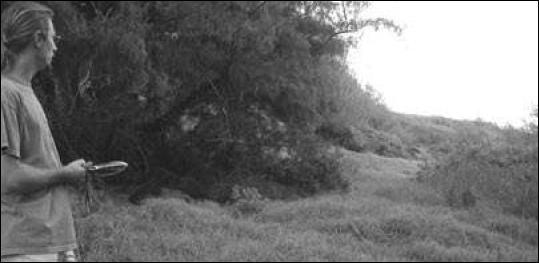
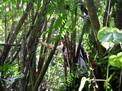
This photo shows the bluffs on the west side of Molaa Bay. The coastal trail stays near sea-level until the middle of the picture, then it climbs up to the middle “bench” on the right:

MoloaaBluffs

After western contact, land ownership became established in favor of agricultural ventures. Initially, only the flat land at the tops of the sea-bluffs was useful for sugar cane or ranching, and that’s were the land parcels were sold. As transportation developed, new roads were needed to connect the new towns, and the shortest way was no longer along the coast. For example, I believe that Koolau Road which switchbacks down into Moloaa valley from the main highway was part of the original road between Anahola and Kilauea.

However, these new roads cut through the flat agricultural land. To compensate the owners, the government gave them the marginal coastal land in exchange. This is the sloping bluff area that extends from the original parcels down to the high-water mark along the shore, where the tail weaves up and down along the safest route. The land was unusable to the government anyways, and the ranchers could use some of it for livestock grazing.

Despite all the changes, a few people still lived in the coastal communities and found it easier to go fishing and limu gathering on the established trail. One kupuna (elder) resident of Moloaa recalls taking part of the trail to school, which used to be located on Koolau Rd, near the cemetary, as well as bringing limu back from Larsen’s with a mule. It was this continued use that preserved the trail for everyone. Fortunately, the government of the time recognized the use of the trail that existed at the time and created a public easement in the deeds of the land that was exchanged. Unfortunately, they ignored the existing trail and reserved the right to create an easement at the high water mark. When the land was just pasture, the ranchers were longtime neighbors of the limu gatherers, and so this easement was not enforced and the original trail was still used.

Fast-forward to the present, and now the land is prime ocean-view real-estate. The owners are mainland developers seeking to put what must be luxury estates on the bluff-top agricultural land, which implies keeping the public as far away as possible to ensure privacy. Although the days when local residents would gather limu and carry it back on a mule are long gone, the public is still entitled access to the original coastal trail created over generations (see my updated conclusion regarding access).

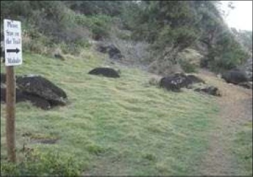
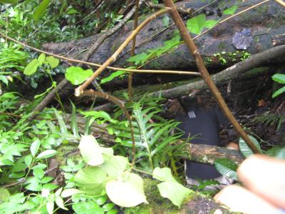
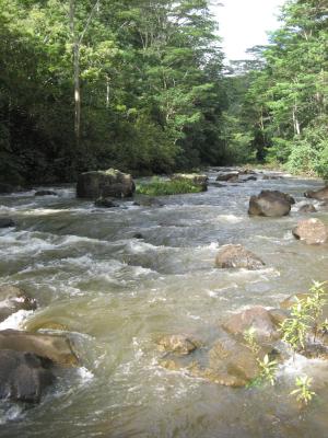
When I first became aware of the Moloaa trail in 2005, the landowner was asking for landscaping permits on the slopes. Hawaii law recognizes the sensitive nature of coastal bluffs, mostly due to the impact that erosion and runoff can have on the reef and ocean, and landowners need special permits for landscaping in the area. Evidently, the landowner’s plans did not even recognize the existence of the historical trail. When faced with the legal obligations of the deed, the landowner followed the letter of the law and proposed creating a trail at the high water mark, in other words, at the foot of the bluffs, through the rocks in the photo below:

MoloaaCoastalRocks

Earlier this year, with the permitting process dragging on, I heard that a new trail had been created, parallel to the original one and pushing the public to the edge of the bluff. Worse, the trail was to be landscaped uphill with a low hedge, to delineate the trail they argued, essentially overgrowing the original trail and denying the public a safe passage. What’s so galling is that the landowner has been told the original trail is a catalogued archeolgical site, as shown in the map below, and that it must be preserved. The way to preserve a trail is to keep it open, have people walk on it.


MoloaaArchaeologicalMap

To be continued

Additional Reading:

  • Malama Moloa’a is a website that catalogues the actions of the landowner against neighboring property owners as well as citations issued for permit violations. I have focused only on the trail, but there are many contentious issues surrounding the development of this property. When you follow the link above, just click the Cancel button when prompted to enter a password—that must be for the site administrator.
  • The recent article in the Garden Island newspaper (Sunday, February 10, 2008) about the trail, which I have blogged about before.
  • A later article in the Garden Island newspaper (Tuesday, February 12, 2008), summarizing the mixed results of the last planning commission meeting regarding the permits.

I Made the Front Page


Source: The Garden Island newspaper (I hope it’s not considered bad form to lift the newspaper’s masthead–I won’t do it again).

Sorry for the lack of posting here, I’ve been busy with other projects. One of those came to fruition in a big way yesterday, if you consider being quoted on the front page of the Garden Island newspaper “big.” Here’s a link to the story, and here are the photos and their captions as they appeared in the print edition:


Source: Nathan Eagle, the Garden Island newspaper (2008/02/10)
“Some hikers say a state-registered historic coastal trail at Moloa’a Bay, pictured here Friday, was inaccurately mapped. They claim the landowner, Moloa’a Bay Ranch, has created a new path that runs more makai—at times along a rocky slope instead of grassy meadows.”

“Andy Kass, an avid hiker from Kapa’a, uses a GPS device Friday to determine where the traditional path skirting Moloa’a Bay is located…”


Source: Nathan Eagle, the Garden Island newspaper (2008/02/10)

In another post, I’ll give some more background about the historical coastal trail and my maps.

Washed Out

A neighbor and fellow explorer of mine told me about a practically unknown waterfall that he visited recently. It turns out that I had spotted it on Google Earth already, and he confirmed that it was nearly as tall and impressive as Wailua Falls. It’s on the mighty Wailua River and because of the houses on the rim, literally in someone’s back yard.

So I had been pushing my friend to take me there, but I should know better than to push my luck with the weather. The Wednesday before Christmas was the only free day before my vacation to the mainland, so we went despite a night of moderate rain (only 1/2 an inch at my house). I did consult the online data for the Wailua North Fork stream gauge, and I saw a moderate peak starting to subside. Unfortunately, I did not take into account the fact that the early morning rain had not peaked yet, which you can see on this graph I downloaded later:


Source: USGS

And so, we didn’t really know what we were getting into. On top of the weather, we were trying out a new access (I didn’t say trail) that someone had told my friend about. Before I continue, a little reminder:

WARNING: hiking off-trail and crossing rivers are dangerous activities. Unmaintained use-trails have many hazards including but not limited to: eye-level sticks, slippery mud, drop-offs concealed by vegetation, and rotten wood that looks like a hand or foothold. Rivers can flood quickly without rain or warning. Never cross high water (above your thighs), you can be swept away and trapped underwater by rocks or logs. Fresh water, especially flood waters, can carry leptospirosis, a fatal parasite, so do not enter water with open wounds. Waterfalls sometimes carry rocks with fatal consequences. Exercise caution and proceed at your own risk.

We started at the rim of the valley and slogged through a thick forest of guava…
…then we slid down a steep muddy gully, trying to find a way through the tangle of hau trunks.
We did see trail markers (blazes) most of the way, but as usual, never rely on them.
We pushed through the dense growth on the riverbank only to find the river running high and full of brown water. With anyone else, I would’ve turned around, but these guys were half-way across the river by the time I had time to think about it.

We walked up the other river bank a ways, but in these parts, the river cuts through some vertical cliff. So we waded on some submerged rocks at the foot of the cliff. Then we needed to swim. Before taking the plunge, I took this last photo and hung my backpack on an aerial root.

We climbed back up on some rocks, around another corner and then started wading again. As it got deeper and we tried to swim again, we realized we were on the outside curve of the river, and the current was too strong against us. Progress was just getting more and more difficult as the river got narrower and stronger closer to the falls, and so we were literally turned back. We floated with the current back to my pack and managed to cross the river without falling in.

Here I am, happy to have trudged through the mud, swam up a river, and turned around with out seeing the falls. Climbing up the steep muddy hill was even more difficult than going down, and you have to watch out for the glass and other sharp trash buried in the mud of the ravine. At one point, I was almost caged in by the branches of a hau tree, but most of the time, those branches were crucial to pulling ourselves up—but do watch out for dead and rotten branches that will make you fall.

Mele Kalikimaka 2007

I’ll be traveling back to the mainland so I won’t be on Kaua’i for Christmas, but I did get to see some of the season’s local events.

First off, the Light Parade in Lihue on December 7 was cancelled due to rain. I suppose with all the preparation it takes, they couldn’t just hold it another night. You can see my pictures from last year. I think there is another, smaller light parade in Waimea town, but it’s too far to drive with a toddler in the evening, so I don’t know how it went.

Later that week, there was the Kaua’i High School Chorus’ winter concert. The high school in Lihue has two singing groups, the Singers pictured below and the Chorus. I wish I got a picture of the Chorus, because the women were wearing solid white and red mu’umu’u (aka mumu), the long flowing gowns made popular during the Victorian monarchy period.


The program included traditional pieces such as Haydn’s Gloria, and to my great delight, some in Hawaiian. Even though I’m a neophyte, I love choral music, especially at Christmas time. I also think traditional pieces in Hawaiian have a special significance. Historically, the Hawaiians only had chants, not music, and the melody of hymns with words translated by the missionaries was one factor that drew them into the first churches. So for me, religious music in Hawaiian is a look back into the past to when western and Hawaiian cultures first became meshed together.

So it was a real treat to hear a version of Handel’s Messiah in Hawaiian. The choral director, David Conrad, explained that the Messiah in Hawaiian had never been published, but he found the translation on a program from a Kapa’a school concert in the 50’s. I looked on the internet, and it seems there used to be an annual performance of the Messiah in Hawaiian (in Honolulu), so it’s not unknown. There was a performance again this year, but the article doesn’t mention whether it was sung in Hawaiian.

Anyways, I recorded the first minute of the Messiah sung in Hawaiian–that is unfortunately all my camera would record. It is titled Ka Nani O Ka Haku and translated by David Kalama, according to the program. Click here to play the music file in a new window or browser tab.

They did light the county building despite the weather, and we went to see all the decorations the following weekend. Santa was there as well, but our daughter is only 2 and is still afraid of him. If you’re on Kaua’i, the decorations inside the County Building will be open from 6pm to 8pm every Friday, Saturday, and Sunday through December 30th. The trees on the plaza in front of the building are lit up like last year as well.


Just outside the door, a Hawaiian Snowman is staying cool dancing the hula:


Inside the theme is that Santa’s “Gone Kauaian:”


Other than this display where Santa’s surfboard is being pulled by roosters, it was not particularly Kauaian:


It was however, definitely Hawaiian:


As every year, the display focuses on the homemade Christmas decorations of Auntie Josie, a Kekaha resident who filled her home with decorations every year and invited the public. When her husband died and she could no longer put on the display, it moved to the County Building for all to enjoy. Last year, some of the decorations were looking worn, but this year they were all spruced up, and volunteers contributed new ones.

I particularly like this Filipino Parol, which, as the little sign says, is a traditional Filipino Christmas decoration representing the Christmas Star. This particular one was made in 2006 by Allan Villaflor in commemoration of the centennial of the arrival of Filipinos in Hawaii:


Auntie Josie’s decorations often recycled everyday items such as bottle caps. My favorite is this wreath using six-pack rings, they look exactly the opposite of trash now:


The cane train was again the children’s favorite display, though they probably didn’t notice the Christmas tree made of Spam-brand cans:


Another new display was these nutcracker dolls, one pair dressed as old Hawaiians, the other as “new” Hawaiians:


So now I wish you all a Mele Kalikimaka e Ha’oli Makahiki Hou (Merry Christmas and Happy New Year).

The Bookstore Is Open

I’ve been thinking of ways of earning some money doing what I love: exploring Kauai and writing about it. Hiking and taking pictures is fun, writing about it is what I do here, the tricky part is getting paid for it.

Before I put advertizing on this blog, I thought I’d try some other options first. The most straightforward is to be “affiliated” with an online bookstore and provide links for people to buy the books I recommend on my blog. So I now have a bookstore page on the blog now where you can click through to Amazon.com to buy all the books I have recommended, all 3 of them (one map and two books). If you go to that page right now, you’ll see a few more books that I’m reading and will review soon.

Many of the big online merchants have these programs, which pay the website owner anywhere from 4% to 8% commission of the sales price. I hope I’m not breaching my contract when I say this, but I really wanted to be affiliated with an “independent” bookseller such as Powell’s Books. I tend to support the underdog, and I thought that a store focused only on books would serve my needs better. However, Amazon has a big network of associate booksellers, a larger group of smaller bookstores, and they were the only store that could list the relatively obscure titles about Kaua’i. On the positive side, lots of people know and trust Amazon, and I am myself a satisfied customer.

Anyways, if you’re thinking of buying the books you see on this blog, it helps me out if you buy them through my links. Hopefully, having a potential income from books will motivate me to review more of them. Don’t worry, I promise I will still recommend only the books I honestly like.